Information
Landmark: Underwater WaterfallCity: Le Morne
Country: Mauritius
Continent: Africa
Underwater Waterfall, Le Morne, Mauritius, Africa
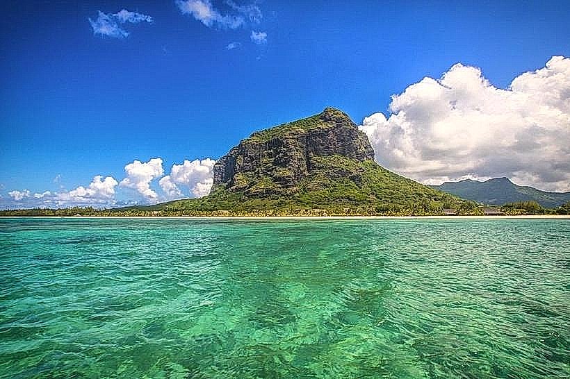
The Underwater Waterfall is a biological and geological optical illusion located off the coast of the Le Morne Peninsula at the southwestern tip of Mauritius. It is situated within the Indian Ocean, specifically at the coordinates 20.48° S, 57.32° E.
Visual Characteristics
The phenomenon appears as a vertical subaquatic cascade characterized by varying shades of turquoise, cyan, and deep indigo. This 3D visual effect is generated by the movement of white coralline sand and silt deposits over a sharp oceanic drop-off. From an aerial perspective, the lighter-colored sediments contrasting against the dark abyss create the appearance of rushing water. The surrounding lagoon is protected by a coral reef, maintaining flat, glassy surface conditions that allow for high visibility of the underlying shelf structure.
Location & Access Logistics
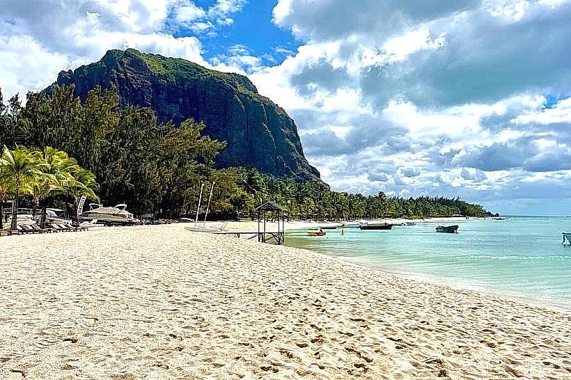
The site is approximately 60 kilometers from the capital, Port Louis, and 50 kilometers from Sir Seewoosagur Ramgoolam International Airport (MRU). Primary access to the Le Morne Peninsula is via the B9 coastal road. As the illusion is invisible from sea level or the shoreline, viewing requires aerial transport. Helicopter tours depart from the airport and various resort helipads, while seaplane excursions typically operate from the La Prairie beach area. Alternatively, the summit of Le Morne Brabant Mountain, accessible via a 3.5-kilometer hiking trail, provides a partial land-based vantage point.
Historical & Ecological Origin
Mauritius is a volcanic island formed approximately 8 million years ago. It sits on the Mascarene Plateau, a submarine shelf with depths typically under 150 meters. At the edge of the Le Morne Peninsula, this shelf terminates abruptly, plunging over 4,000 meters into the oceanic trench. The "waterfall" is an ongoing process of marine erosion where powerful south-southwest currents sweep coastal sand off the plateau and into the deep-sea abyss.
Key Highlights & Activities
Helicopter and seaplane flights are the primary methods for viewing the 3D illusion, with tours typically lasting 15 to 25 minutes. While the "waterfall" area is safe for swimming and kitesurfing due to it being a current of sand rather than a downward water flow, these activities do not provide a view of the illusion itself. Guided trekking to the 556-meter summit of Le Morne Brabant is available daily for a panoramic view of the surrounding reef system.
Infrastructure & Amenities
Public facilities, including restrooms and changing areas, are located at Le Morne Public Beach. There is 4G and 5G cellular coverage across the peninsula. Several luxury resorts surround the base of the mountain, offering private dining and equipment rentals. Official parking areas are available at the trailhead of Le Morne Brabant and near the public beach zones. No food or beverage services exist on the mountain trail itself; visitors must carry independent water supplies.
Best Time to Visit
Optimal visibility occurs between May and December during the Mauritian winter and spring, when rainfall is minimal and the air is clearest. For photography, flights between 08:00 and 10:30 provide the most favorable lighting to emphasize the color contrast between the shallow lagoon and the deep ocean. High tide periods can enhance the perceived depth of the sand flow due to increased current strength.
Facts & Legends
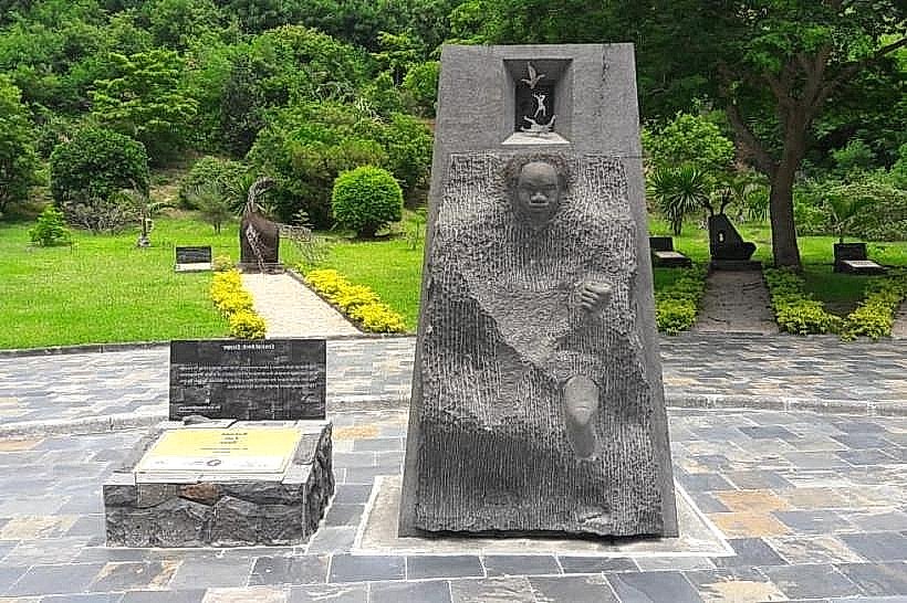
The site is adjacent to Le Morne Brabant, a UNESCO World Heritage site known as a refuge for runaway slaves (maroons) in the 18th and 19th centuries. According to local legend, when slavery was abolished in 1835, a police expedition arrived to inform the maroons of their freedom; however, misinterpreting the soldiers' intent, many chose to leap from the cliffs into the sea rather than face recaptivity.
Nearby Landmarks
Le Morne Brabant Mountain: 1.5km East
Seven Coloured Earth Geopark (Chamarel): 8.5km Northeast
Chamarel Waterfall: 9.2km Northeast
Black River Gorges National Park: 12.0km East
Piton de la Petite Rivière Noire: 14.5km Northeast