Information
Landmark: Mays Island Historic DistrictCity: Cedar Rapids
Country: USA Iowa
Continent: North America
Mays Island Historic District, Cedar Rapids, USA Iowa, North America
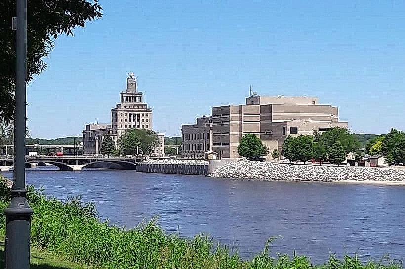
Mays Island Historic District in Cedar Rapids is a unique civic and architectural landmark, notable for being one of the few places in the United States where an entire county government operates from an island in the middle of a river. Located in the Cedar River, the district reflects the city’s early growth, its innovative civic planning, and its resilience through natural disasters.
Historical Background
The island, originally a natural feature of the Cedar River, was named after Dr. George Mays, an early settler in Cedar Rapids. Recognizing the potential of its central location, civic leaders decided in the late 19th and early 20th centuries to use the island as the heart of Linn County’s government and public life.
In 1909, construction began on the Linn County Courthouse, marking the start of the island’s transformation into a civic center. Over the next several decades, the island developed into the administrative core of Cedar Rapids and Linn County.
The district’s prominence grew as it became not just a seat of government but also a symbolic representation of Cedar Rapids’ aspirations to be a modern, organized city.
Architecture and Layout
Mays Island Historic District features a concentration of Beaux-Arts and Classical Revival architecture, popular for government buildings in the early 20th century.
The district includes three key structures:
Linn County Courthouse (1923) – A limestone Beaux-Arts building with classical details, symbolizing stability and civic pride.
Cedar Rapids City Hall – Constructed in a similar style, reinforcing the architectural unity of the island.
U.S. Post Office and Custom House (1932) – Designed in the same civic tradition, adding a federal presence to the district.
Together, these buildings form a cohesive civic ensemble, unified by their style, materials, and river setting. Bridges connect the island to both east and west banks, making it accessible while visually distinct as a government hub.
Civic and Cultural Significance
The decision to centralize government functions on Mays Island was both symbolic and practical. It represented neutrality between the east and west sides of Cedar Rapids, ensuring equal access to government services. The island became the physical and symbolic “middle ground” of the city.
The district was added to the National Register of Historic Places in 1978, recognizing its architectural significance and unusual civic planning.
Challenges and Resilience
The island’s location in the river has made it vulnerable to flooding. The most devastating event occurred in 2008, when the Cedar River rose to historic levels, submerging much of downtown Cedar Rapids and severely damaging the government buildings on the island.
Restoration and recovery efforts were extensive, requiring years of repairs. The district’s survival and continued function after the flood highlighted both its fragility and its resilience.
Modern Identity
Today, Mays Island Historic District remains a functioning government center, housing key civic institutions while standing as a symbol of Cedar Rapids’ history and adaptability. Its architectural ensemble, rare civic island setting, and long-standing role as the heart of city and county governance give it a distinctive identity.
It represents both Cedar Rapids’ early 20th-century vision of civic grandeur and its 21st-century resilience in the face of natural disaster. The district continues to be one of the city’s most iconic landmarks, embodying Cedar Rapids’ balance of history, community, and perseverance.