Information
Landmark: Mount RungweCity: Mbeya
Country: Tanzania
Continent: Africa
Mount Rungwe, Mbeya, Tanzania, Africa
Mount Rungwe is a dormant volcano located in the Mbeya Region of Tanzania. It is the highest peak in the Southern Highlands of Tanzania.
Visual Characteristics
Mount Rungwe presents a conical shape with steep slopes. Its summit is often obscured by clouds. The lower slopes are covered in dense montane forest, transitioning to grassland and rocky outcrops at higher elevations. The forest canopy is characterized by a variety of tree species, including Podocarpus and Hagenia.
Location & Access Logistics
Mount Rungwe is situated approximately 30 kilometers southwest of Mbeya city. Access is primarily via the B4 road towards Tukuyu. The turn-off for the mountain is marked and leads to a dirt track suitable for 4x4 vehicles for the initial ascent. Public transport to the base of the mountain is limited; shared taxis (daladalas) operate between Mbeya and nearby villages, from where further arrangements for transport to the trailhead may be necessary. Parking is available at designated points near the forest boundary, but is informal and unsupervised.
Historical & Ecological Origin
Mount Rungwe is a stratovolcano, part of the East African Rift system. Its last known eruption is estimated to have occurred between 10,000 and 15,000 years ago. The mountain's ecological significance lies in its role as a biodiversity hotspot, supporting a unique montane ecosystem with endemic species.
Key Highlights & Activities
Hiking to the summit is the primary activity. The ascent involves navigating marked trails through the Rungwe Forest Reserve. Specific trails include the main route to the summit and shorter paths to viewpoints. Birdwatching is also a significant activity due to the diverse avian population. Photography opportunities exist, particularly of the forest and, on clear days, the surrounding landscape from higher elevations.
Infrastructure & Amenities
Basic facilities are available at the forest reserve entrance, including a ranger station. Restrooms are present at the trailhead. Shade is abundant within the forest. Cell phone signal is intermittent and generally unavailable at higher altitudes. Food vendors are not present on the mountain itself; provisions should be carried from Mbeya or Tukuyu.
Best Time to Visit
The dry season, from June to October, offers the most favorable weather conditions for hiking, with reduced rainfall and clearer skies. The best time of day for photography is generally early morning, before cloud cover typically forms around the summit. There are no tidal considerations for this inland mountain.
Facts & Legends
Local folklore suggests that the mountain is inhabited by spirits, and certain areas are considered sacred. A specific tip for visitors is to carry sufficient water, as there are no reliable water sources on the upper slopes. The forest reserve is also known for its population of the Rungwe dwarf galago, a primate species found only in this region.
Nearby Landmarks
- Tukuyu Town (15km Southwest)
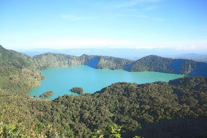
- Lake Ngozi (25km West)
- Mbeya City (30km Northeast)
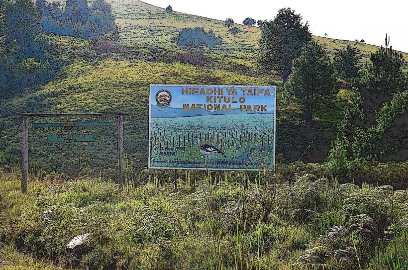
- Kitulo National Park (40km Southeast)