Information
Landmark: Ono IslandCity: Kadavu
Country: Fiji
Continent: Australia
Ono Island, Kadavu, Fiji, Australia
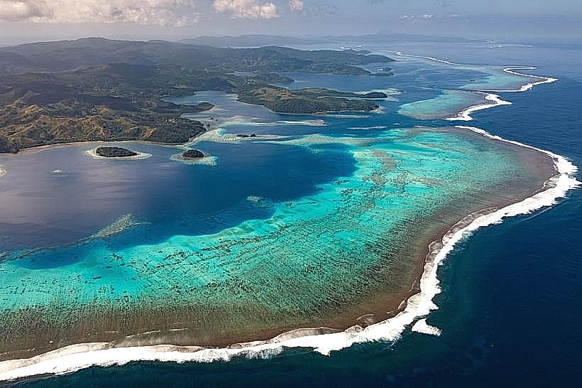
Ono Island is a volcanic landmass located within the Great Astrolabe Reef, northeast of the main island of Kadavu. It encompasses approximately 30 square kilometers and serves as the primary population center for the northern Kadavu group.
Visual Characteristics
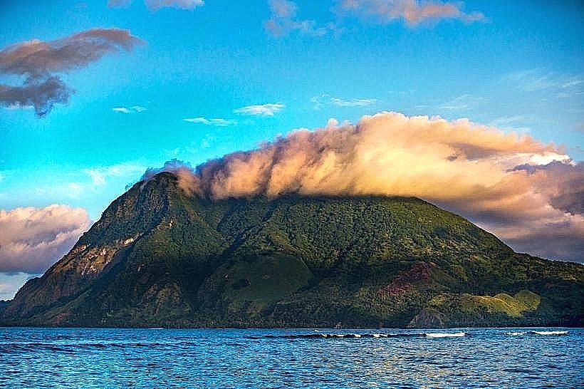
The island is defined by a central volcanic ridge with a maximum elevation of 210 meters. The topography is rugged, featuring steep slopes covered in tropical rainforest and managed coconut plantations. The coastline is deeply indented with sheltered bays and fringing mangroves, while the perimeter is buffered by the expansive turquoise lagoon of the Great Astrolabe Reef. Unlike the basaltic cliffs of western Kadavu, Ono features softer volcanic soil that supports significant subsistence agriculture.
Location & Access Logistics
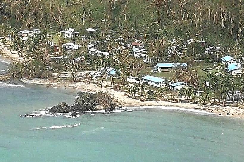
Ono is situated approximately 85 kilometers south of Suva. Access is exclusively via water. Travelers typically fly from Nadi or Suva to Vunisea Airport on Kadavu, followed by a 60- to 90-minute boat transfer across the Namalata Isthmus and the lagoon. There are no roads or motorized land vehicles on the island; transit between the seven villages-including Ono-i-Lau, Nabouwalu, and Vabea-is conducted via coastal footpaths or fiberglass longboats.
Historical & Ecological Origin
Geologically, Ono is an extinct volcanic center formed during the Pliocene. It is historically significant as a center for traditional Fijian navigation and seafaring. Ecologically, the island is a critical habitat for the endemic Kadavu Musk Parrot and the Whistling Fruit Dove.1 The surrounding waters are part of a locally managed marine area (LMMA) that protects the "Manta Reef," a globally recognized cleaning station for reef manta rays (Mobula alfredi).
Key Highlights & Activities
Manta ray snorkeling is the primary activity, concentrated in the channel between Ono and the main reef barrier. Scuba diving is available at the "Naigoro Passage," known for high-current drift dives and shark encounters.2 Cultural engagement is high, with visitors often participating in sevusevu ceremonies in Vabea or Nabouwalu villages.3 Sea kayaking between Ono and the adjacent islands of Bulia and Dravuni is a common multi-day transit for eco-tourists.
+1
Infrastructure & Amenities
Infrastructure is limited to village-level systems. There are no public utility grids, banks, or shops; basic supplies must be sourced from small village canteens. Electricity is provided by individual solar arrays and small diesel generators. Fresh water is sourced from mountain springs and piped to communal village taps. 4G cell signal is available near the western coast but is often blocked by the central ridge in eastern villages.
Best Time to Visit
The dry season from May to October provides optimal conditions for water visibility and trekking. Manta ray sightings peak between May and September when the trade winds bring nutrient-rich waters to the cleaning stations. High tide is necessary for boat access to several villages where the lagoon becomes too shallow for transit at low tide.
Facts & Legends
According to local legend, Ono was the home of the giant Tanovo, who engaged in a mythological battle with the god of Mount Washington.4 The battle resulted in the formation of the surrounding islets from soil dropped by Tanovo. A verified historical oddity is that the island maintains a distinct dialect of the Fijian language, reflecting its historical isolation and ties to southern Tongan seafaring routes.
Nearby Landmarks
Manta Reef – 4.0km North
Bulia Island – 5.5km South
Dravuni Island – 10.0km North
Vabea Village – 0.5km East
Great Astrolabe Reef (North Passage) – 8.0km North