Information
Landmark: Pirin National ParkCity: Blagoevgrad
Country: Bulgaria
Continent: Europe
Pirin National Park, Blagoevgrad, Bulgaria, Europe
Pirin National Park is a UNESCO World Heritage site encompassing the Pirin Mountains in southwestern Bulgaria. It is known for its rugged alpine scenery, glacial lakes, and the highest peak in the range, Vihren.
Visual Characteristics
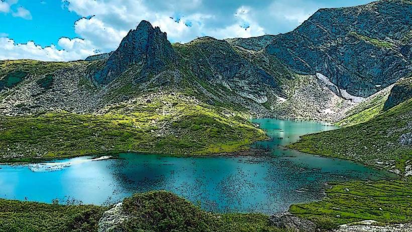
The park features a high-alpine landscape with jagged marble and granite peaks, over 180 glacial lakes, and deep cirques. It is home to the Baykuchevata Mura, the oldest coniferous tree in Bulgaria (approx. 1,300 years). The terrain is marked by steep slopes, scree fields, and dense forests of Balkan and Bosnian pine.
Location & Access Logistics
The park is centered around the towns of Bansko, Razlog, and Sandanski.
Access: The most common entry point is the town of Bansko, from which a paved road leads to the Vihren Hut (altitude 1,950m).
Public Transport: Buses and a narrow-gauge railway serve Bansko. Seasonal shuttle buses operate between Bansko and Vihren Hut.
Entry: Generally free, though fees apply for parking at huts and for specific services.
Historical & Ecological Origin
Established in 1962, the park was expanded and renamed Pirin National Park in 1974. It was designated a UNESCO World Heritage site in 1983. The ecosystem is characterized by exceptional biodiversity, including many endemic Balkan species and the endangered Edelweiss flower.
Key Highlights & Activities
Vihren Peak (2,914 m): The third highest peak in the Balkan Peninsula, accessible via several marked hiking trails.
Glacial Lakes: Notable groups include the Banderishki, Vasilashki, and Popovo Lakes.
The Marble Ridge: A dramatic limestone ridge including the "Koncheto" (The Little Horse), a narrow knife-edge ridge with a safety cable for hikers.
Winter Sports: The northern slopes near Bansko host one of the leading ski resorts in Eastern Europe.
Infrastructure & Amenities
Mountain Huts: A network of chalets (huts) like Vihren, Bezbog, and Demyanitsa provide basic lodging and food.
Connectivity: 4G/5G coverage is stable near resorts and major huts but limited in deep valleys and high-altitude remote areas.
Signage: Extensive color-coded trail markings exist throughout the park.
Best Time to Visit
Summer: July to September for high-altitude hiking.
Winter: December to April for skiing and winter mountaineering.
Safety: Weather conditions can shift rapidly; always check Mountain Rescue Service (PSS) forecasts before departure.
Nearby Landmarks
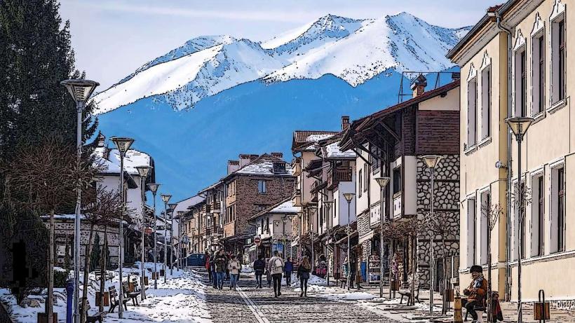
Bansko Old Town: 15 km North (from Vihren Hut)
Baykuchevata Mura: 1 km South of Vihren Hut
Popovo Lake: Central Pirin
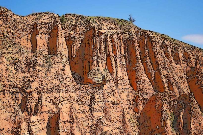
Melnik Earth Pyramids: 50 km South