Information
Landmark: Reka RiverCity: Skocjan
Country: Slovenia
Continent: Europe
Reka River, Skocjan, Slovenia, Europe
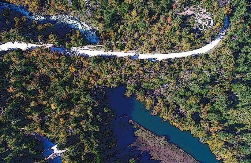
The Reka River is a 54-kilometer long karst sinking river that originates in Croatia and flows through southwestern Slovenia. It is the primary hydrological force responsible for carving the UNESCO-listed Škocjan Caves before disappearing into the subterranean karst world.
Visual Characteristics
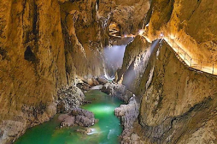
The river's surface portion is characterized by a clear, greenish-blue flow through a narrow flysch valley, which transitions into a dramatic limestone gorge as it nears the village of Škocjan. Upon reaching the Karst plateau, the river enters a deep canyon with vertical limestone walls and multiple cascades. At the entrance to the Škocjan Caves, the river plunges into a 150-meter-deep underground canyon, where it flows over massive rocky blocks and through dark, wide galleries.
Location & Access Logistics
The most accessible and visually significant section is located within the Škocjan Caves Regional Park near the village of Matavun (4km from Divača). Access is via the A1 motorway (Divača exit). The river can be viewed from the Cerkvenik Bridge inside the caves or from the Rimstone Pools trail. An outdoor viewpoint is accessible via the circular educational trail starting from the Park Visitor Center.
Historical & Ecological Origin
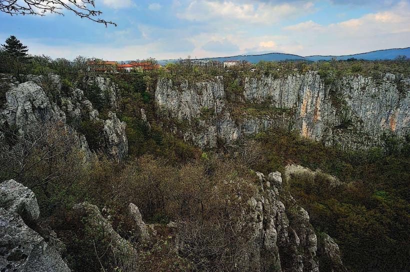
The Reka River flows over impermeable flysch rock for most of its surface course until it hits the porous limestone of the Classical Karst. Geologically, it is a "blind valley" river that has created a massive collapse doline at the point of its disappearance. Historically, its unpredictable flooding dictated the settlement patterns of the region, and its mysterious disappearance was a subject of scientific inquiry dating back to Roman times.
Key Highlights & Activities
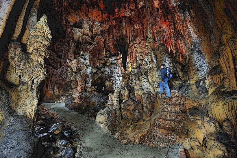
Visitors can hike the 2-kilometer "Following the Reka River Underground" trail, which traces the river's path through the first sections of the cave system. Educational boards along the Reka Education Trail explain the river's unique hydrology. Photography is permitted along the surface gorge and at the point where the river sinks into the "Velika Dolina" (Big Doline).
Infrastructure & Amenities
Infrastructure is concentrated at the Škocjan Caves Visitor Center in Matavun, which provides restrooms, 5G signal, and information. The riverbanks themselves are rugged and accessible only via managed park trails. There are no swimming facilities, as the river is a protected hydrological feature within a regional park. Sturdy hiking footwear is required for the steep canyon paths.
Best Time to Visit
The river is most impressive during the autumn and spring rainy seasons when its volume increases significantly, creating a powerful "roaring" sound within the underground canyon. For photography of the emerald surface waters, June and July provide the best light. During extreme summer droughts, the river flow may diminish to a trickle, revealing the sculpted rocky bed.
Facts & Legends
The Reka River remains one of the greatest mysteries of European hydrology; after sinking at Škocjan, it flows underground for 34 kilometers through unexplored passages, resurfacing at the Timavo Springs in Italy near the Adriatic Sea. Local legends claimed the river led directly to the gates of the underworld, a belief fueled by the mist and deafening noise produced at the sinkhole during floods.
Nearby Landmarks
Škocjan Caves: 0.1km West (at the sinkhole)
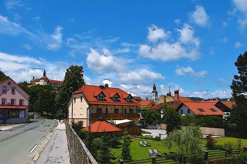
Matavun Village: 0.5km East
Školj Castle Ruins: 2.2km Southeast
Church of St. Canzian: 0.4km North
Betalov spodmol: 4.5km West