Information
Landmark: Sigatoka RiverCity: Sigatoka
Country: Fiji
Continent: Australia
Sigatoka River, Sigatoka, Fiji, Australia
The Sigatoka River is the second largest river in Fiji, originating in the central highlands of Viti Levu and flowing approximately 120 kilometers to its mouth on the Coral Coast. It serves as a vital transport artery and a primary source of irrigation for the Sigatoka Valley, often referred to as "Fiji's Salad Bowl."
Visual Characteristics
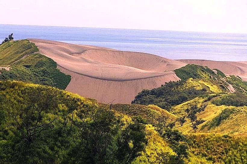
The river is characterized by its wide, winding channel and sedimentary water, which varies from silt-heavy brown during the wet season to a clearer greenish-blue in the dry season. The riverbanks are composed of fertile alluvial soil, flanked by extensive vegetable farms, patches of tropical forest, and limestone cliffs in the upper reaches. Near the mouth, the river expands into a wide estuary bordered by the Sigatoka Sand Dunes on the western bank.
Location & Access Logistics
The river runs through the town of Sigatoka, located roughly 61km south of Nadi International Airport via the Queens Road. Access to the river is primarily via the Sigatoka Bridge in the town center or various points along the Sigatoka Valley Road, which follows the eastern bank for several kilometers inland. Public buses and taxis provide access to the town, while specialized jet boat tours depart from designated terminals near the bridge for upstream travel.
Historical & Ecological Origin
Geologically, the river has carved its path through the volcanic and sedimentary landscape of Viti Levu over millions of years. Historically, the river valley has been a site of human habitation for millennia; it was a key corridor for the Lapita people and later became a stronghold for hill tribes (the Kai Colo) during the 19th-century conflicts. The river's ecosystem supports diverse freshwater fish, eels, and the endangered Fiji Petrel which nests in the surrounding highlands.
Key Highlights & Activities
The most prominent commercial activity is the Sigatoka River Safari, which utilizes custom-built jet boats to transport visitors upstream to remote inland villages. Traditional bamboo rafting (bilibili) is still practiced in the upper reaches for transporting crops. Fishing for freshwater species and swimming in the calmer upstream sections are common local activities. The river also serves as the venue for the annual Sigatoka River Festival and various traditional rowing competitions.
Infrastructure & Amenities
The main infrastructure includes the Sigatoka Bridge, which connects the town to the western suburbs and the sand dunes. Several concrete jetties and small boat ramps are positioned near the town center for commercial and private use. Cell phone signal (4G) is robust within the Sigatoka town area and along the lower valley but diminishes rapidly as the river moves into the interior highlands. Public restrooms and commercial services are concentrated in Sigatoka Town.
Best Time to Visit
The dry season (May to October) is the optimal time for river activities, as water levels are stable and the risk of flash flooding is minimal. For photography, the early morning provides soft light on the valley farms and minimizes the glare from the water. Jet boat tours typically operate in two shifts, morning and afternoon, with the morning session offering cooler temperatures.
Facts & Legends
According to local oral history, the river is protected by various deities; many villages along its banks maintain "tabu" (sacred) areas where fishing is prohibited at certain times. A unique historical oddity is the presence of the Taveuni Hill Fort, a 18th-century defensive site situated on a limestone ridge overlooking the river, which was used by local tribes to monitor river traffic and defend against invaders.
Nearby Landmarks
Sigatoka Town: 0.1km East
Sigatoka Sand Dunes National Park: 2.0km West
Taveuni Hill Fort: 4.0km North
Kula Wild Adventure Park: 8.0km East
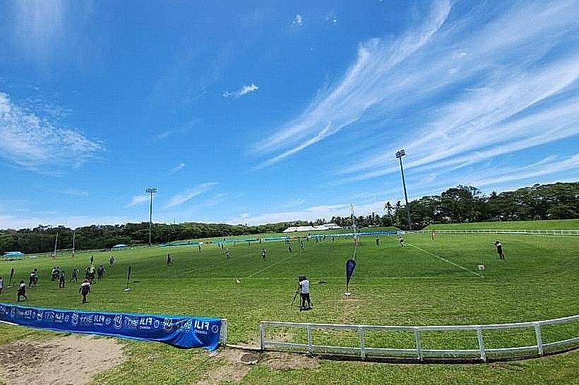
Lawaqa Park: 1.5km South