Information
Landmark: Stockhorn MountainCity: Thun
Country: Switzerland
Continent: Europe
Stockhorn Mountain, Thun, Switzerland, Europe
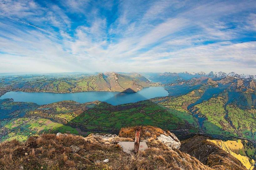
The Stockhorn is a prominent mountain peak in the Bernese Alps, standing at an elevation of 2,190 meters. It is located in the Simmental valley near Thun and is characterized by its distinctive wedge-shaped limestone summit.
Visual Characteristics
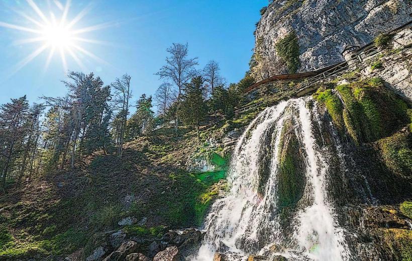
The mountain features a jagged limestone crest and a vertical north face that drops sharply toward the Stockental. The summit area includes a glass-floored viewing platform integrated into the rock. Vegetation transition consists of dense pine forests at the base, followed by alpine meadows and two mountain lakes, the Hinterstockensee and Oberstockensee, which exhibit deep blue and turquoise water colors depending on sunlight.
Location & Access Logistics
The peak is accessible via a two-stage aerial cable car departing from Erlenbach im Simmental, which is 18 kilometers southwest of Thun. To reach the base station, drivers use the A6 motorway (Spiez direction) followed by the Simmentalstrasse. Public transport involves taking the regional train from Thun to Erlenbach im Simmental station, followed by a 10-minute marked walk to the Stockhornbahn. A large, paved parking lot is situated at the cable car base station.
Historical & Ecological Origin
Geologically, the Stockhorn is part of the Helvetic nappes, composed primarily of Jurassic and Cretaceous limestone. The first aerial cable car was completed in 1968 to develop the mountain for tourism and winter sports. The summit gallery and "Stockhorn Eye" viewing platform were added in later structural renovations to enhance the panoramic experience.
Key Highlights & Activities
Hiking is possible on a network of trails, including the path between the middle station (Chrindi) and the summit. Fishing for rainbow trout occurs at the Hinterstockensee and Oberstockensee lakes. Rock climbing is established on the southern and western limestone faces. The summit platform provides a 360-degree view of the Jura Mountains, Lake Thun, and the high-alpine peaks of the Bernese Oberland.
Infrastructure & Amenities
The summit station houses a panorama restaurant and accessible restrooms. A tunnel through the mountain peak leads to the viewing gallery. 4G and 5G cellular signals are generally stable at the summit and middle stations. Shelter from weather is provided within the station buildings, and the middle station offers a children’s playground and picnic areas near the lake.
Best Time to Visit
The cable car operates seasonally, typically from May to November and during the winter season from December to March. The optimal time for photography is during the early morning or late afternoon for high-contrast lighting on the Eiger, Mönch, and Jungfrau massifs. High summer (July–August) is best for lake activities and alpine flora, while autumn offers the clearest visibility for distant viewing.
Facts & Legends
A verified feature of the mountain is the "Stockhorn Eye," a geological window on the north face where visitors can stand on a glass floor directly above a 400-meter vertical drop. Local lore identifies the mountain as a weather indicator; residents in the valley often use the cloud formations around the summit to predict approaching storms from the west.
Nearby Landmarks
Niesen Mountain - 11.5km East
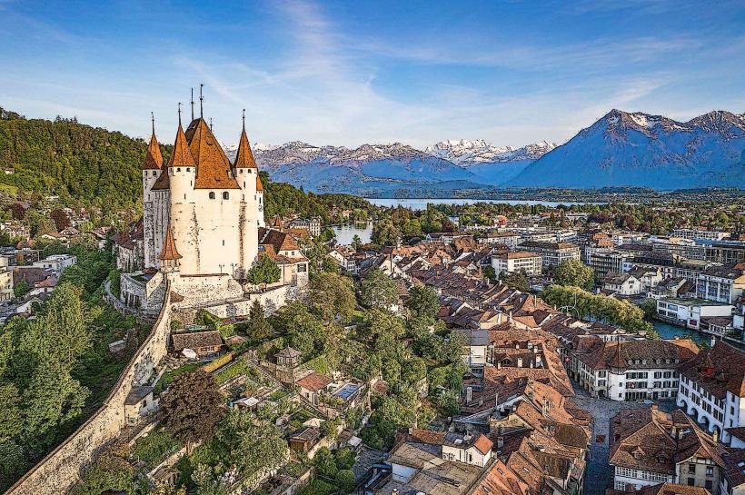
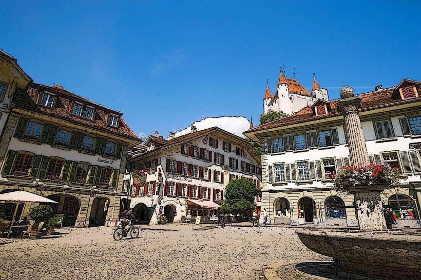
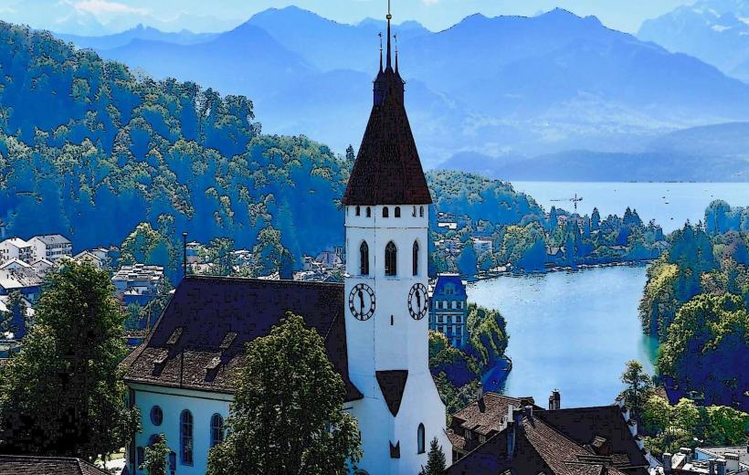
Lake Thun - 9.0km Northeast
Simmen River - 4.5km Southeast
Gantrisch Nature Park - 4.2km Northwest
Hinterstockensee - 1.1km North