Information
Landmark: Sunset Crater Volcano National MonumentCity: Flagstaff
Country: USA Arizona
Continent: North America
Sunset Crater Volcano National Monument, Flagstaff, USA Arizona, North America
Sunset Crater Volcano National Monument – In Detail
Located about 15 miles northeast of Flagstaff, Arizona, Sunset Crater Volcano National Monument preserves one of the most dramatic volcanic landscapes in the American Southwest. It protects the site of a massive volcanic eruption that occurred roughly 1,000 years ago, reshaping the land and influencing local ecosystems and human life. The monument, established in 1930, spans over 3,000 acres and is part of the larger San Francisco Volcanic Field.
🌋 Geological Background
Sunset Crater itself is a cinder cone volcano, formed during a single, explosive eruption estimated to have occurred around 1085 CE. This eruption was part of a fissure eruption event-lava and ash emerged along a long fracture in the Earth’s crust, not just a single central vent.
The explosion hurled molten lava, volcanic bombs, ash, and gas high into the sky. The accumulation of cinders (small volcanic fragments) around the main vent formed the cone, now standing at about 1,000 feet tall.
The cone’s distinctive reddish tint at the summit, created by oxidized iron in the scoria, inspired its name-Sunset Crater.
Two major lava flows emerged:
The Bonito Lava Flow, a jagged and ropey mass of dark basalt, covers a vast area and is the most visible feature of the landscape today.
The Kana’a Lava Flow, less accessible, extended southeast.
The eruption significantly altered the environment, burying local vegetation and settlements in ash, but ultimately contributed to long-term soil enrichment in surrounding regions.
🏞️ Trails and Exploration
Hiking in the monument is restricted to designated trails to preserve the fragile volcanic terrain. The summit trail to the crater’s top was closed permanently in 1973 due to excessive erosion caused by foot traffic.
Lava Flow Trail
Distance: ~1 mile loop
Description: Offers the most complete experience, circling the base of the cone through the Bonito Lava Flow. Visitors walk past jagged a‘ā lava, collapsed lava tubes, spatter cones, and fascinating volcanic textures.
Accessibility: The first quarter-mile is paved and accessible for wheelchairs and strollers.
Lenox Crater Trail
Distance: ~1.6 miles round-trip
Difficulty: Moderate to strenuous
Description: Climbs a nearby cinder cone. The summit offers sweeping views of the Sunset Crater cone, the lava fields, and the San Francisco Peaks.
Bonito Vista Trail
Distance: 0.3-mile loop
Accessibility: Paved and easy
Description: Excellent overlook providing expansive views of the Bonito lava flow and the volcanic landscape without a strenuous hike.
Lava’s Edge Trail
Distance: ~3.4 miles round-trip
Difficulty: Moderate
Description: This trail follows the transition zone between lava and forest, offering a more rugged hiking experience.
🌱 Ecology and Environmental Recovery
The eruption rendered the immediate area sterile for decades. Over time, however, plant and animal life have begun to return in a striking example of ecological succession.
Flora: Today, you’ll find pioneering species such as lichens, mosses, and rabbitbrush clinging to the lava. Further from the crater, ponderosa pines, juniper, and pinyon pine forests dominate.
Fauna: The area is home to Abert’s squirrels, mule deer, foxes, lizards, and a range of bird species, including woodpeckers, hawks, and jays. The contrast between barren lava fields and life-filled forests is dramatic.
🌌 Dark Sky & Astronomy
Sunset Crater lies within a designated International Dark Sky Park, benefiting from the nearby city of Flagstaff’s longstanding commitment to light pollution control. The area offers:
Stargazing programs in cooperation with local astronomers and the nearby Lowell Observatory.
Solar viewing and telescope nights, often held seasonally.
A pristine view of the Milky Way and frequent opportunities to witness meteor showers, especially during summer events.
🏕️ Camping and Facilities
There is no camping allowed within the monument itself, but nearby options are available:
Bonito Campground (U.S. Forest Service-operated):
Located just outside the monument’s boundary
Typically open May through October
Offers 43 sites, flush toilets, potable water, picnic tables, grills, but no hookups
First-come, first-served only
Other Amenities
Visitor Center:
Open daily (except holidays like Christmas)
Exhibits on volcanic science, native cultures, interactive models, and a short film
Rangers on-site for interpretation and trail information
Gift shop with books and souvenirs
Restrooms & Picnic Areas: Located near major trailheads.
🧭 Cultural and Historical Impact
The eruption of Sunset Crater deeply affected local Indigenous communities, especially the Sinagua people, who inhabited the area at the time.
Ash from the eruption is believed to have improved the agricultural potential of nearby lands by adding minerals and helping retain moisture in the soil.
Some archaeologists believe the Sinagua may have adapted by moving away temporarily, then returning to cultivate new lands near the ash-covered regions.
Many present-day Hopi and Zuni people trace ancestry to those who lived in this area and consider the volcano and surrounding lands sacred.
To respect Indigenous heritage, climbing the volcano and entering sensitive areas is strictly prohibited.
🎟️ Fees and Access
Entry Fee: $25 per private vehicle (valid for 7 days); interagency and annual passes accepted
Hours: Generally open year-round, from sunrise to sunset
Best Times to Visit: Spring and fall offer mild temperatures and excellent visibility. Winter can bring snow, while summer afternoon storms may limit hiking opportunities.
🧳 Travel Tips
Wear sturdy shoes-volcanic terrain is sharp and uneven.
Bring plenty of water, especially in warmer months.
Due to the high elevation (7,000–8,000 feet), visitors may experience mild altitude effects; pace yourself on hikes.
Photography is excellent early in the morning and at dusk when shadows highlight the unique textures of the landscape.
📍 Nearby Attractions
Sunset Crater is part of a scenic loop road that connects to:
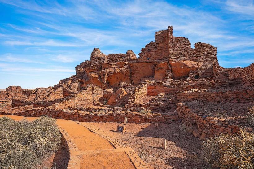
Wupatki National Monument – Home to ancient pueblos and archaeological sites.
Coconino National Forest – Offering additional hiking and camping opportunities.
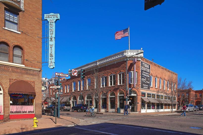
Flagstaff – With its cultural sites, restaurants, and the Lowell Observatory.
Conclusion
Sunset Crater Volcano National Monument offers an immersive journey through time-where molten earth once reshaped a civilization’s world, nature now reclaims its place in remarkable ways. Its surreal landscapes, geologic significance, cultural resonance, and star-filled skies make it one of northern Arizona’s most enriching and memorable destinations.