Information
Landmark: Vanua BalavuCity: Lau Islands
Country: Fiji
Continent: Australia
Vanua Balavu, Lau Islands, Fiji, Australia
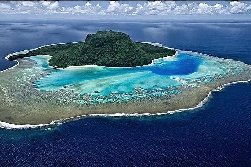
Vanua Balavu is the second-largest island in the Lau Archipelago, covering 53 square kilometers. It is characterized by its unique "anchor" shape and a diverse landscape consisting of volcanic hills in the south and jagged limestone karst formations in the north.
Geography and the Bay of Islands
The island is world-renowned for Qilaqila (the Bay of Islands), located at its northwestern tip.
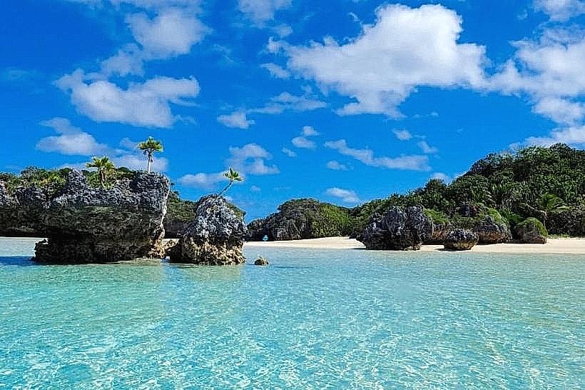
Topography: Hundreds of mushroom-shaped limestone islets with vertical cliffs and undercut bases caused by tidal erosion.
Marine Environment: Crystalline lagoons with high visibility, featuring submerged caves and diverse coral gardens.
Coastal Features: The island is enclosed within the massive Vanua Balavu Barrier Reef, which creates a safe, deep-water lagoon utilized by international yachts.
Cultural and Historical Context
Vanua Balavu has a distinct cultural identity influenced by its proximity to Tonga.
Ma'afu: The island was the 19th-century power base for the Tongan Prince Enele Ma'afu, who established the Lomaloma Confederation.
Dual Identity: The village of Lomaloma is divided into two sections: the indigenous Fijian side and the Tongan side (Savu).
Architecture: Traditional buildings often display Tongan architectural styles, specifically rounded ends and distinct lashing techniques.
Logistics and Infrastructure
Access:
Air: Vanua Balavu Airport (VBV) is located near Lomaloma. Weekly domestic flights connect to Suva.
Sea: Regular inter-island ferries service the jetty at Lomaloma. The island is a major hub for private yachting in the Lau group.
Villages: There are 17 villages on the island, with Lomaloma serving as the administrative and commercial center.
Economy: Primary industries include copra production, subsistence fishing, and niche eco-tourism.
Key Activities
Maritime: Sailing and snorkeling within the Qilaqila area.
Exploration: Visiting the Hot Springs near Lomaloma and exploring the limestone caves along the northern coast.
Trekking: Hiking the central volcanic ridges for views of the surrounding Lauan islands.
Nearby Landmarks
Susui Island: Directly south within the same reef system.
Munia Island: 10km Southeast (Private island).
Kanacea Island: 15km West.
Cikobia-i-Lau: 30km North.