Information
Landmark: Warta RiverCity: Czestochowa
Country: Poland
Continent: Europe
Warta River, Czestochowa, Poland, Europe
The Warta River is the third-longest river in Poland, flowing through the eastern and northern districts of Częstochowa. Within the city limits, it functions as a primary hydrological artery and a central element of the regional ecological corridor.
Visual Characteristics
The river exhibits a meandering course with a width ranging from 10 to 20 meters through the urban sections. The water color varies from olive-green to silt-brown depending on seasonal sediment load. The banks are characterized by natural riparian vegetation, including willow and alder trees, interspersed with stone-reinforced embankments and concrete flood defense walls in industrial areas.
Location & Access Logistics
The Warta flows through the Aniołów, Zawodzie, and Mirow districts. It is accessible via the Mirowska and Krakowska bridges. The "Warta Boulevards" (Bulwary nad Wartą) provide pedestrian and bicycle access near the city center. Public transport via tram lines 1 and 2 serves the "Plac Daszyńskiego" stop, located 0.5km west of the riverbank. Unpaved parking is available near the Mirowska street bridge for water sports access.
Historical & Ecological Origin
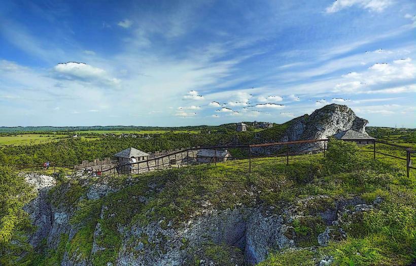
The river follows a valley formed by glacial meltwater during the Pleistocene epoch. Historically, the Warta was essential for the development of Częstochowa’s textile and iron industries in the 19th century, providing water for steam engines and waste disposal. The surrounding Mirowskie Meadows (Mirowskie Przełomy Warty) are a protected ecological area featuring limestone outcrops typical of the Kraków-Częstochowa Upland.
Key Highlights & Activities
The river is a designated kayaking route, with a popular launch point in the Mirow district for downstream trips toward Mstów. Recreational fishing is permitted with a PZW license, targeting pike, perch, and roach. The asphalt paths along the boulevards are utilized for cycling and jogging. Birdwatching is viable in the northern marshy sections of the city.
Infrastructure & Amenities
Modernized boulevards include public benches, lighting, and waste bins. Public restrooms are not located directly on the riverbanks but are available at the nearby Galeria Jurajska shopping mall (0.2km from the river). 5G cellular signal is consistent across the urban river sections. Food vendors and large-scale retail are concentrated at the intersection of the river and Aleja Wojska Polskiego (DK1).
Best Time to Visit
The Mirow section is most visually prominent during the spring thaw (March-April) when water levels are high. Early morning provides the best lighting for photography of the mist over the Mirowskie Meadows. The summer months (June-August) offer the most stable conditions for kayaking.
Facts & Legends
A verified historical oddity is that the Warta's course was artificially altered in the 19th century to facilitate the construction of the Warsaw-Vienna Railway. Local folklore in the Mirow district mentions "Topielce" (water spirits) inhabiting the deep bends of the river, a common motif in Slavic mythology intended to warn residents of dangerous currents.
Nearby Landmarks
Galeria Jurajska: 0.2km West
St. Sigismund's Church: 0.6km West
Mirowskie Przełomy Warty: 3.5km East
Old Market Square (Stary Rynek): 0.5km West
Częstochowa Cathedral: 0.7km Southwest