Information
Landmark: Welches BeachCity: Oistins
Country: Barbados
Continent: North America
Welches Beach, Oistins, Barbados, North America
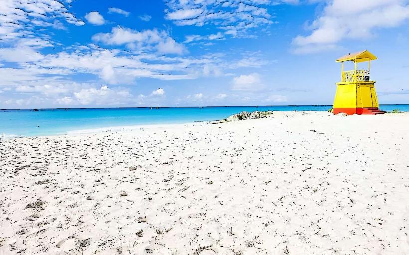
Welches Beach is a public access shoreline located on the south coast of Barbados, near the town of Oistins.
Visual Characteristics
The beach features light brown, fine-grained sand. The water exhibits a clear turquoise hue, transitioning to deeper blue further offshore. The shoreline is approximately 1.5 kilometers in length and is bordered by low-lying vegetation and scattered coconut palms.
Location & Access Logistics
Welches Beach is situated 2 kilometers west of Oistins town center. Access is directly from the ABC Highway (A2) via the turnoff for Welches Road. Ample free parking is available in a designated lot adjacent to the beach. Public transport is accessible via the Bridgetown-Oistins bus route, with a stop located approximately 200 meters from the beach entrance.
Historical & Ecological Origin
This coastal area is a natural formation, part of the wider coral reef system characteristic of Barbados's southern coastline. The sand is composed of eroded coral and shell fragments accumulated over millennia.
Key Highlights & Activities
Swimming is permitted in calm conditions. Sunbathing is a primary activity. The shallow waters are suitable for wading. Fishing from the shore is practiced by local residents.
Infrastructure & Amenities
Restrooms are available at the western end of the parking lot. Shade is provided by natural tree cover and a small pavilion. Cell phone signal (4G) is generally reliable. No food vendors are permanently stationed at the beach; however, mobile vendors may be present during peak hours.
Best Time to Visit
For photography, early morning (07:00-09:00) offers soft, direct sunlight. Midday provides the clearest water visibility. The months of December through May generally offer the driest weather and calmest seas.
Facts & Legends
Local lore suggests that the area was historically used by fishermen to dry their nets. A specific point on the western edge of the beach is locally known as "Fisherman's Rock," though its geological significance is unverified.
Nearby Landmarks
- Oistins Fish Fry (1.8km East)
- Miami Beach (2.2km East)
- South Point Lighthouse (3.5km Southwest)
- St. Lawrence Gap (4.0km East)