Information
City: Aur AtollCountry: Marshall Islands
Continent: Australia
Aur Atoll, Marshall Islands, Australia
Aur Atoll is a coral atoll of 42 islands in the Ratak (Sunrise) Chain of the Marshall Islands. Located approximately 120 km north of Majuro, it is defined by its deep lagoon, productive fisheries, and its historical role as a center for traditional Marshallese navigation training.
Historical Timeline
Inhabited for approximately 2,000 years. A critical historical event occurred in 1817 when the Russian explorer Otto von Kotzebue visited Aur; his interactions with the local navigator Kadu provided the Western world with its first detailed understanding of Marshallese geography and wave piloting. Like its neighbors, Aur was a German protectorate (1885) and a Japanese mandate (1914). During World War II, it was used as a minor lookout post by the Japanese and was largely bypassed by U.S. forces. In 2026, it remains a traditional community focused on sustainable lagoon management.
Demographics & Population
The 2026 estimated population is approximately 500. The population is almost entirely Marshallese. The economy is subsistence-based, driven by Copra production, Artisanal Fishing, and Handicraft weaving.
Urban Layout & Key Districts
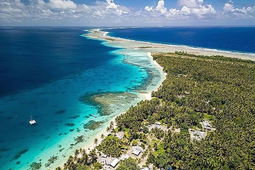
The atoll surrounds a 560-square-kilometer lagoon characterized by its great depth.
Tabal: The primary population center located on the eastern rim; it contains the main village and social infrastructure.
Aur Islet: The second major population center, located on the southern tip of the atoll.
Bigen: A smaller, northern islet used primarily for coconut harvesting and seasonal fishing camps.
Top Landmarks
Tabal Village: A traditional settlement featuring coral-sand streets and houses constructed from a mix of local timber and imported materials.
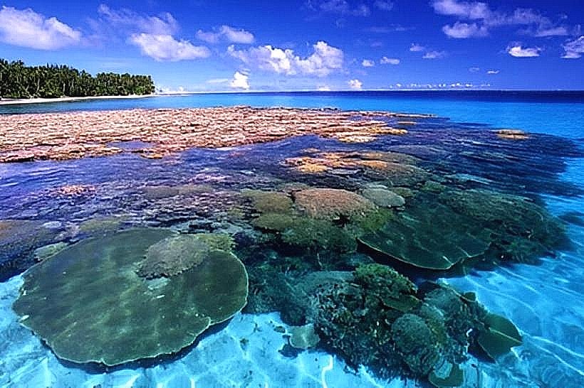
Aur Lagoon: Noted for its extreme depth and clarity, making it a premier site for observing large pelagic fish that enter through the deep-water passes.
Traditional Navigation Schools: While formal buildings are rare, specific sites on Tabal are still used by elders to teach the Manit (customary) laws of the sea.
WWII Lookout Ruins: Small concrete remnants of Japanese observation posts located on the northern periphery.
Transportation Network
Movement between the two main inhabited islets (Tabal and Aur) requires motorized boat transit or traditional sailing canoes. Aur Airport (AUL) on Aur Islet and Tabal Airport (TBL) on Tabal Islet provide irregular domestic flights via Air Marshall Islands to Majuro. There are no paved roads. Inter-island transit relies on the government "field trip" ship or private maritime charters.
Safety & "Red Zones"
General safety is absolute. The community is peaceful and highly communal. Standard awareness is advised regarding open-lagoon crossings, as the water can become very rough during the trade wind season. Environmental hazards include intense UV radiation and jellyfish in certain lagoon pockets.
Digital & Financial Infrastructure
Connectivity is negligible. No 5G or standard cellular data exists; communication is via VHF radio and limited satellite Wi-Fi in the schools. U.S. Dollars (USD) are the only currency. The atoll is a cash-only economy; there are no ATMs or credit card facilities.
Climate & Air Quality
Tropical marine climate. Air quality is pristine. In 2026, coastal erosion on the ocean-side of Tabal is a significant concern, requiring the relocation of some traditional structures further inland.
Culture & Social Norms
Tipping is not customary. The "Iokwe" greeting is mandatory. Dress codes are Strictly Modest; women must cover their knees. The culture is defined by Oral Storytelling, Navigational Heritage, and Communal Fishing (Kabbung).
Local Cost Index
1 Standard Meal: $6.00–$10.00 USD (local staples like fish and breadfruit).
Accommodation: Homestays or basic guest rooms; $40.00–$70.00 USD per night.
Nearby Day Trips
Maloelap Atoll: (Located 18 km north); a larger atoll with significant WWII ruins and close cultural ties to Aur.
Facts & Legends
Aur is historically famous for its navigators, who were considered among the most skilled in the Ratak Chain. Historically, the atoll served as a "waypoint" for travelers moving between the northern and southern Marshall Islands. A local legend tells of the Spirit of the Deep Lagoon, which is said to protect the fish populations of Aur from over-harvesting by creating sudden squalls when the balance is disturbed. Another fact: the atoll's name, "Aur," translates to "shackle" or "enclosure," referring to the protective nature of its reef system.