Information
City: BanforaCountry: Burkina Faso
Continent: Africa
Banfora, Burkina Faso, Africa
Banfora is a city in southwestern Burkina Faso and the capital of the Comoé Province. It serves as the country’s primary hub for the sugar industry and is the sixth-most populous city, positioned as a final transit point before the border with Côte d'Ivoire.
Historical Timeline
Banfora was originally settled by the Karaboro people, followed by the Gouin and Turka ethnic groups. It transitioned from a cluster of indigenous villages to a formal administrative post under French colonial rule in 1903. The primary event shaping its current urban form was the 1931 construction of the Abidjan–Ouagadougou Railway, which shifted the economy toward industrial-scale sugar production and regional trade.
Demographics & Population
The total population is approximately 172,796 (2025/2026 estimate). The primary ethnic groups are the Gouin, Karaboro, and Turka. The most common languages are Dioula (the regional trade language) and French (official). The median age is approximately 18 years.
Urban Layout & Key Districts
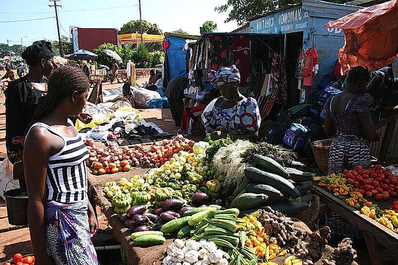
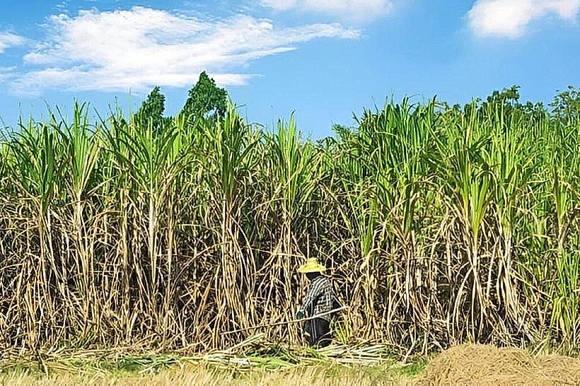
The city is organized along the main road and rail corridor connecting Bobo-Dioulasso to Côte d'Ivoire. The Commercial Center (Central) contains the main market and administrative buildings. The Industrial Zone (Northwest) is dominated by the SOSUCO sugar refinery and extensive cane plantations. The outlying districts are rural-transition zones leading to the town’s famous natural sites.
Top City Landmarks
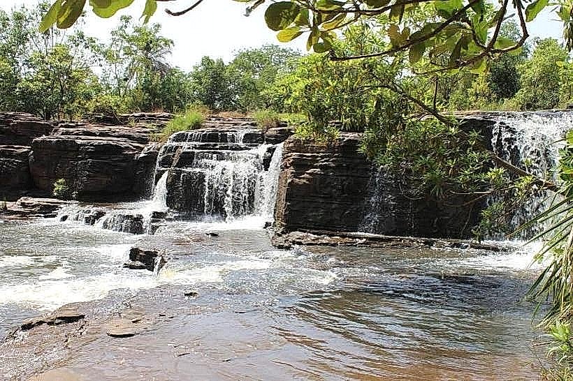
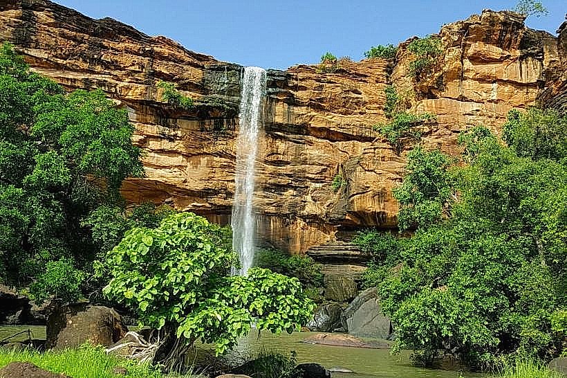
Cascades de Karfiguéla (Waterfalls)
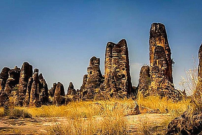
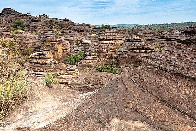
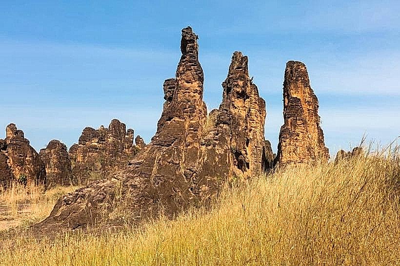
Dômes de Fabedougou (Geological rock formations)
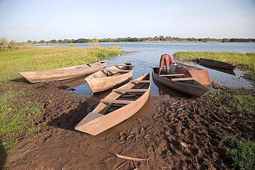
Lac de Tengréla (Known for its sacred hippopotamuses)
Grande Mosquée de Banfora
SOSUCO Sugar Cane Fields
Transportation Network
Movement is primarily conducted via motorbikes (motos) and private bush taxis (taxi-brousse). Banfora is a station on the Sitarail railway, providing passenger service between Ouagadougou and Abidjan. No metro or tram systems exist. Ride-sharing apps are not operational; local transport is negotiated individually. Traffic is moderate but dominated by heavy cargo trucks transiting to the border.
Safety & "Red Zones"
Current Status: Do Not Travel. As of 2026, the entire territory of Burkina Faso is under a "Level 4: Do Not Travel" advisory due to the high threat of terrorism, kidnapping, and violent crime. Banfora and the surrounding Cascades Region have seen increased activity from armed groups. Movement outside the city limits to tourist sites (like the waterfalls) is considered extremely high-risk and is generally discouraged by international security agencies.
Digital & Financial Infrastructure
Average internet speed is 5–20 Mbps via mobile data (Orange, Onatel, or Telecel). Connectivity is reliable in the city center but non-existent in the sugarcane fields or at natural sites. Card acceptance is rare; the economy is almost entirely cash-based (CFA Franc). ATMs are available at the few bank branches in the town center but frequently run out of cash.
Climate & Air Quality
Temperatures range from 20°C to 37°C. The climate is more humid than northern Burkina Faso, with a heavy rainy season from June to September. Air quality is fair during the rains but deteriorates during the dry season (October to May) due to the Harmattan wind, which brings Sahara dust, and the seasonal burning of sugarcane fields.
Culture & Social Norms
Tipping is not a standard requirement but 500–1000 CFA is appreciated for service. Greetings are formal and extensive; it is impolite to begin a transaction without inquiring about one's family and health. Dress code is modest. The region is known for traditional music and the use of the balafon (wooden xylophone).
Accommodation Zones
Stay in the town center near "Hotel Canne à Sucre" for the most reliable security, electricity, and water access.
Local Cost Index
1 Espresso: USD 1.50 (900 CFA)
1 Standard Lunch: USD 4.00 (2,400 CFA)
1 Moto-Taxi Trip: USD 0.50 – 1.00 (300–600 CFA)
Nearby Day Trips
Bobo-Dioulasso (85 km)
Sindou Peaks (Pic de Sindou) (50 km)
Niangoloko Border Post (45 km)
Facts & Legends
Banfora is known as the "City of the Sugar Cane" because it hosts the country's only sugar refinery. A local legend at Lac de Tengréla states that the hippopotamuses are the reincarnated souls of the village ancestors and will never harm residents as long as the sacred pact of respect is maintained.