Information
Landmark: Sindou PeaksCity: Banfora
Country: Burkina Faso
Continent: Africa
Sindou Peaks, Banfora, Burkina Faso, Africa
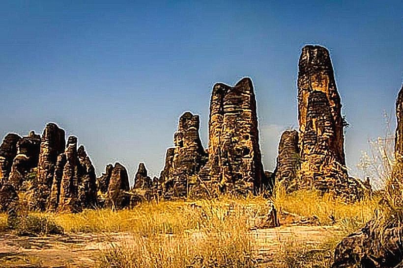
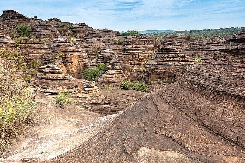
The Sindou Peaks are a geological formation of sandstone cliffs located in southwestern Burkina Faso, near the town of Banfora.
Visual Characteristics
The formation consists of weathered sandstone rock formations, characterized by sharp, eroded peaks and spires. The rock color ranges from ochre to reddish-brown, with variations due to mineral content. Vegetation is sparse, primarily consisting of dry savanna grasses and scattered trees adapted to arid conditions.
Location & Access Logistics
The Sindou Peaks are situated approximately 25 kilometers southwest of Banfora. Access is via the paved Route Nationale 1 (RN1) towards Bobo-Dioulasso, then turning south onto a secondary dirt road marked for Sindou village. The final approach to the peaks requires a short walk from the parking area near the village. Public transport to Banfora is available via bus from major cities; local taxis or hired vehicles are required for the onward journey to the peaks.
Historical & Ecological Origin
The Sindou Peaks are a result of long-term erosion of sedimentary rock layers, primarily sandstone, deposited during the Precambrian era. The distinctive shapes are formed by differential weathering and wind erosion over millions of years.
Key Highlights & Activities
Hiking through the rock formations is the primary activity. Designated trails allow exploration of the area. Observation points offer views of the surrounding savanna landscape. Photography is a common pursuit due to the unique geological structures.
Infrastructure & Amenities
Basic amenities are available in Sindou village, including small local eateries. There are no formal restrooms or designated shade structures within the immediate vicinity of the peaks. Cell phone signal is generally weak to non-existent within the core formation area.
Best Time to Visit
The best time for photography is during the early morning or late afternoon when the sun's angle creates distinct shadows and highlights the rock textures. The dry season, from November to April, offers the most favorable weather conditions with minimal rainfall. The hottest months are March and April.
Facts & Legends
Local folklore suggests the peaks are the petrified remains of ancient warriors. A specific rock formation, known as the "Grande Arche," is a popular point of interest for visitors.
Nearby Landmarks
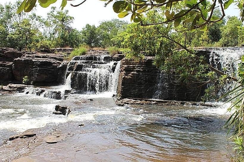
- Cascades de Karfiguéla (3.5km Northeast)
- Domes de Fabedougou (6.2km North)
- Banfora (25km Northeast)