Information
City: BluffCountry: USA Utah
Continent: North America
Bluff, USA Utah, North America
Bluff is an isolated, historic town in San Juan County, Utah, situated between sandstone cliffs and the San Juan River. It serves as a base for exploring the Bears Ears National Monument and the Four Corners region.
Historical Timeline
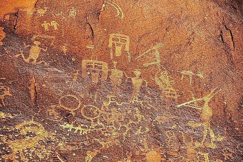
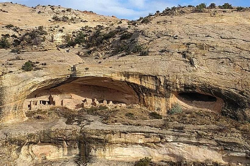
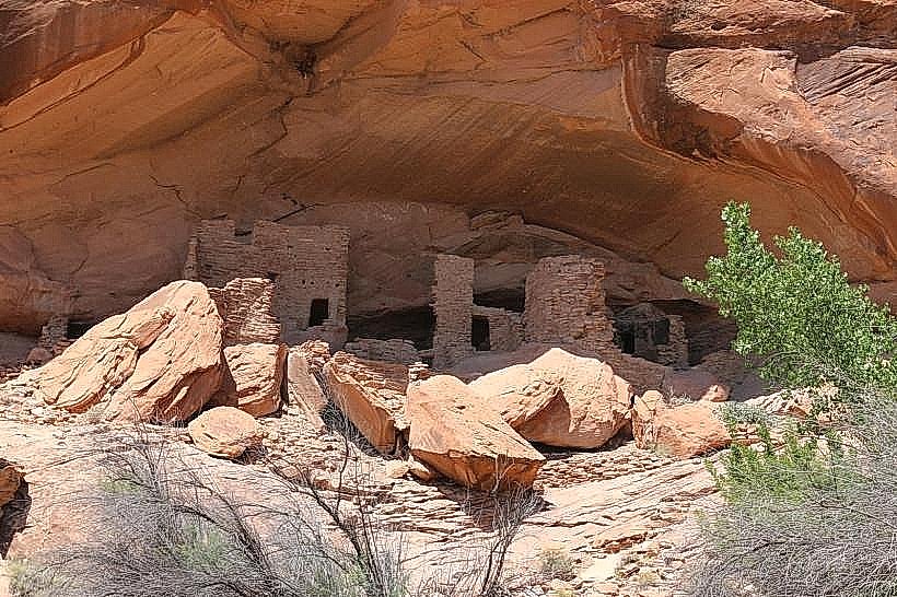
Ancient Origins: Ancestral Puebloan people inhabited the area for centuries, leaving extensive petroglyphs and cliff dwellings.
1880: Settled by the Hole-in-the-Rock expedition, a group of LDS pioneers who completed a legendary 200-mile trek across some of North America's most rugged terrain.
Late 19th Century: Became a prosperous ranching community; the "Bluff Tigers" cattle company dominated the regional economy.
Modern Era: Transitioned into a hub for archaeological research, river rafting, and sustainable tourism.
Demographics & Population
The estimated 2026 population is 244.
Composition: 65.2% White, 31.1% Native American (primarily Navajo/Diné), and 3.7% multiracial.
Economics: Median household income is $52,188. The economy is entirely tourism-based, with significant seasonal fluctuations.
Governance: Formally incorporated as a town in 2018 to gain local control over land use and resources.
Urban Layout & Landmarks
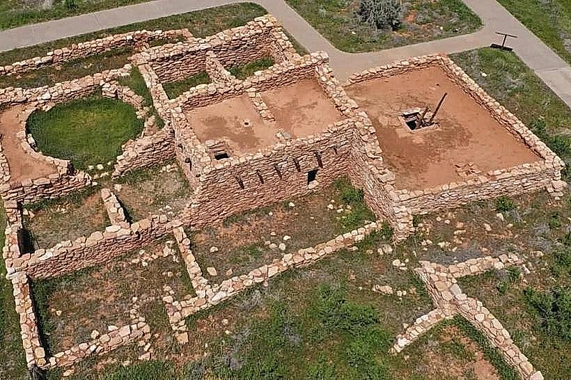
Bluff Fort: A free, restored historic site featuring the original cabins, a replica of the "Hole-in-the-Rock" wagon trail, and the Barton Cabin.
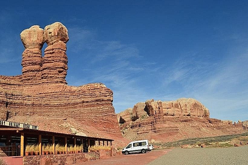
Twin Rocks: Two massive sandstone pillars that tower over the town and the Twin Rocks Trading Post, which is famous for contemporary Navajo baskets and jewelry.
Bears Ears Education Center: A community-led center that provides information on visiting the nearby National Monument respectfully.
Sand Island Petroglyphs: Located 3 miles west; features a massive panel of ancient rock art dating back 3,000 years, including depictions of Kokopelli.
Surrounding Wilderness
Valley of the Gods: Often called a "miniature Monument Valley," offering a 17-mile unpaved loop through towering mesas and buttes.
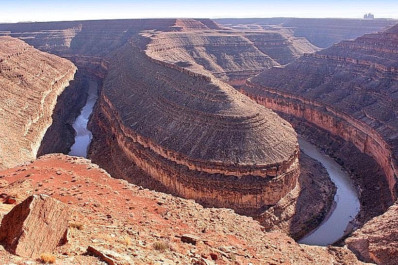
Goosenecks State Park: A dramatic overlook showing a "triple meander" of the San Juan River 1,000 feet below.
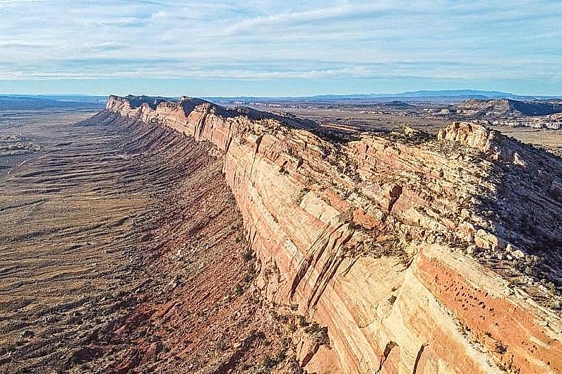
Moki Dugway: A steep, gravel-graded series of switchbacks on UT-261 that climbs 1,200 feet from the valley floor to Cedar Mesa.
Monument Valley Navajo Tribal Park: Located 45 miles south, iconic for its red-sandstone buttes and cinematic history.
Transportation & Infrastructure
Roads: Bluff is located at the junction of US-191 and US-163.
Connectivity: Due to its remote canyon location, cell service is inconsistent; satellite internet is the primary high-speed option for residents.
Infrastructure (2026): Local focus is on water conservation and the maintenance of the Bluff Community Center as a regional emergency hub.
Safety & Environmental Alerts (Jan 26, 2026)
Extreme Cold: Overnight lows are dropping to -14°C (7°F).
Travel Advisory: Winter conditions have made the Moki Dugway (UT-261) extremely hazardous; it is currently restricted to 4WD with high-clearance or snow chains.
Flash Flood Risk: While rare in January, residents monitor the San Juan River for ice jams that can cause localized shoreline flooding.
Fuel Warning: There is no fuel between Bluff and Blanding (26 miles north) or Bluff and Mexican Hat (26 miles south). Ensure tanks are full.
Climate & Air Quality
Bluff has a Cold Semi-Arid climate (BSk).
Current Air Quality: Excellent (AQI 12).
Conditions: Clear skies, high visibility, and very low humidity (22%).
Local Cost Index
1 Espresso: $4.50 – $6.00
1 Standard Lunch: $18.00 – $28.00
Median Home Value: $312,000 (reflects high demand for limited private land).
Accommodation: Limited availability; seasonal rates in "glamping" or boutique lodges range from $250 – $450.
Facts & Legends
Bluff is the only town in the region where the original 19th-century Victorian "pioneer mansions" are built of local red sandstone. A verified fact: It is an "International Dark Sky" destination with some of the lowest light pollution in the U.S. A local legend involves the "Skinwalkers" of the surrounding high desert-malevolent shapeshifters from Navajo folklore-with numerous accounts of unexplained sightings along the remote stretches of US-191.