Information
City: BrasovCountry: Romania
Continent: Europe
Brasov, Romania, Europe
Brașov serves as a regional administrative center and a major industrial hub for the automotive and aerospace sectors in central Romania. It is situated in the southeastern part of the Transylvania region, positioned within the internal curve of the Carpathian Mountains.
Historical Timeline
Founded by the Teutonic Knights in 1211 as Corona, the city was subsequently settled and developed by Transylvanian Saxons. It functioned as a major medieval trade node between the Kingdom of Hungary and the Ottoman Empire. Significant eras include the Austrian Habsburg rule (1688–1918) and the industrialization period under the Communist regime (1947–1989), during which it was briefly renamed "Orașul Stalin." The primary event shaping the current urban form was the Great Fire of 1689, which destroyed most of the medieval structures and led to the widespread Baroque reconstruction seen in the historic center today.
Demographics & Population
The population within city limits is approximately 237,600, with a metropolitan area of roughly 406,000. The top three ethnic demographics are Romanian (approx. 91%), Hungarian (approx. 7%), and German (0.5%). The median age of the population is 43.2 years.
Urban Layout & Key Districts
The city is constrained by the Tampa Mountain and the Postavaru Massif. Centrul Vechi (Old Town) is the historical and administrative core, located in the southern valley. Centrul Civic (Civic Center) is the modern commercial district located north of the Old Town. Astra and Tractorul are the primary residential and industrial districts located in the eastern and northern peripheries, respectively.
Top City Landmarks
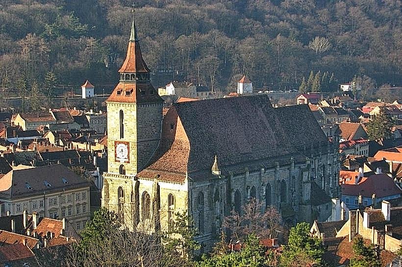
The Black Church (Biserica Neagră)
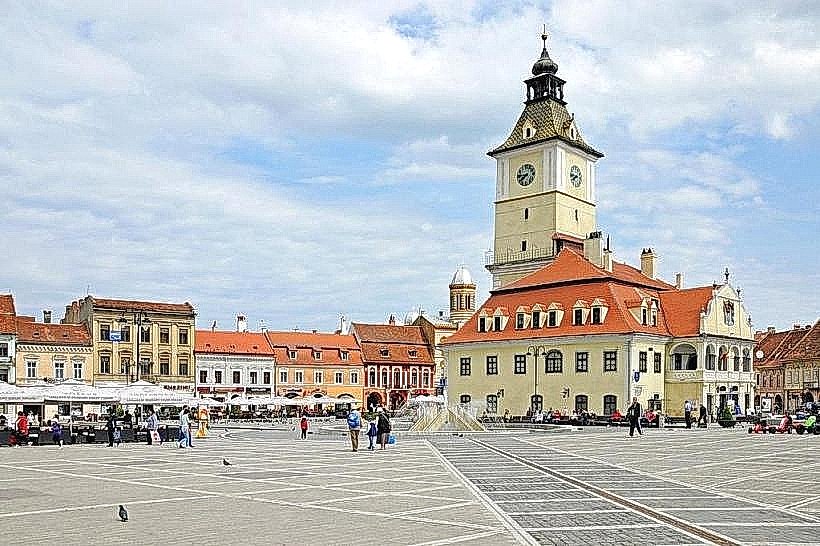
Council Square (Piața Sfatului)
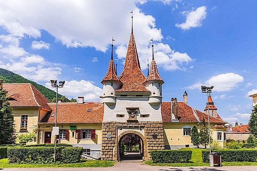
Catherine's Gate (Poarta Ecaterinei)
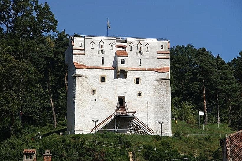
The Weaver's Bastion
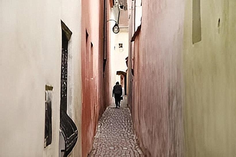
Rope Street (Strada Sforii)
Transportation Network
The city lacks a Metro system, relying on an extensive network of RATBV buses and trolleybuses. Trams are not present. Bolt and Uber are the primary ride-sharing apps. Official taxis are yellow and must display the tariff (approx. 3.00-4.00 RON/km) on the front doors. Traffic congestion is heavy on the Calea București arterial road during morning and afternoon shifts (08:00–09:00 and 16:00–18:00).
Safety & "Red Zones"
Brașov maintains a high safety rating. The Noua and Săcele (suburban) areas can have higher rates of petty theft. Visitors should exercise caution in the forest fringes surrounding the city (Tâmpa and Postăvaru) due to frequent brown bear sightings, especially near trash collection points at night.
Digital & Financial Infrastructure
Average internet speed is 160 Mbps, supported by widespread fiber-optic coverage. Main mobile carriers are Digi Mobil, Orange, and Vodafone. Card acceptance is high in the city center and malls; however, cash is required for small kiosks and public toilets. ATMs are densely distributed in the Old Town and Civic Center.
Climate & Air Quality
Temperatures range from -10°C to 1°C in winter (January) and 12°C to 26°C in summer (July). Air quality is generally high due to mountain proximity, though thermal inversions in winter can trap wood-burning smoke and vehicle emissions in the valley. Significant snowfall occurs from December through March.
Culture & Social Norms
Tipping is expected at 10% in restaurants and is usually not included in the bill. Handshakes are the standard greeting. Conservatism in dress is expected when entering Orthodox churches (shoulders and knees covered). Smoking is prohibited in all indoor public spaces.
Accommodation Zones
Stay in Centrul Vechi: Recommended for immediate walking access to historical sites, Council Square, and dining.
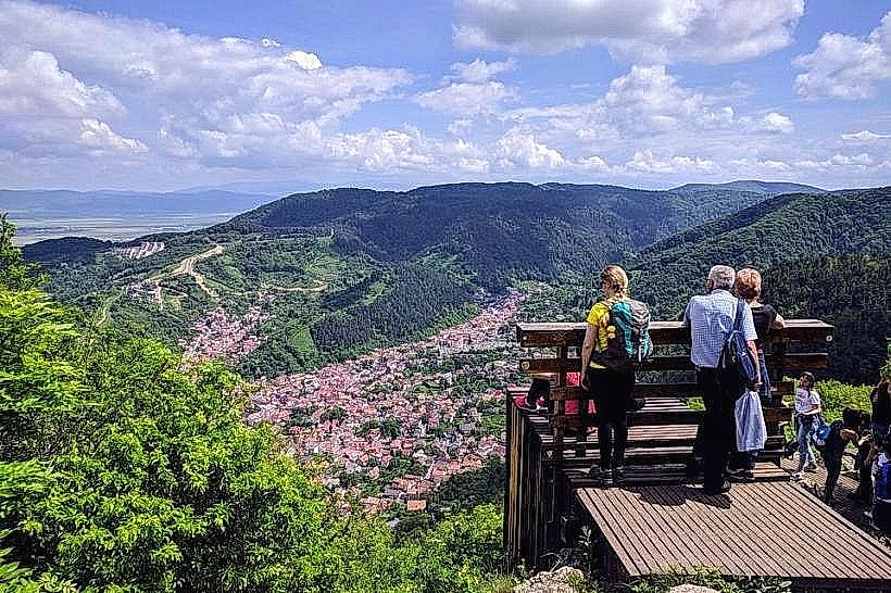
Stay in Poiana Brașov: Recommended for access to ski slopes and mountain trails, located 12 km from the city center.
Local Cost Index
1 Espresso: 10 RON ($2.20)
1 Standard Lunch: 45 RON ($9.90)
1 Metro/Bus Ticket: 5 RON ($1.10)
Nearby Day Trips
Bran Castle (Dracula's Castle): 30 km
Peleș Castle (Sinaia): 45 km
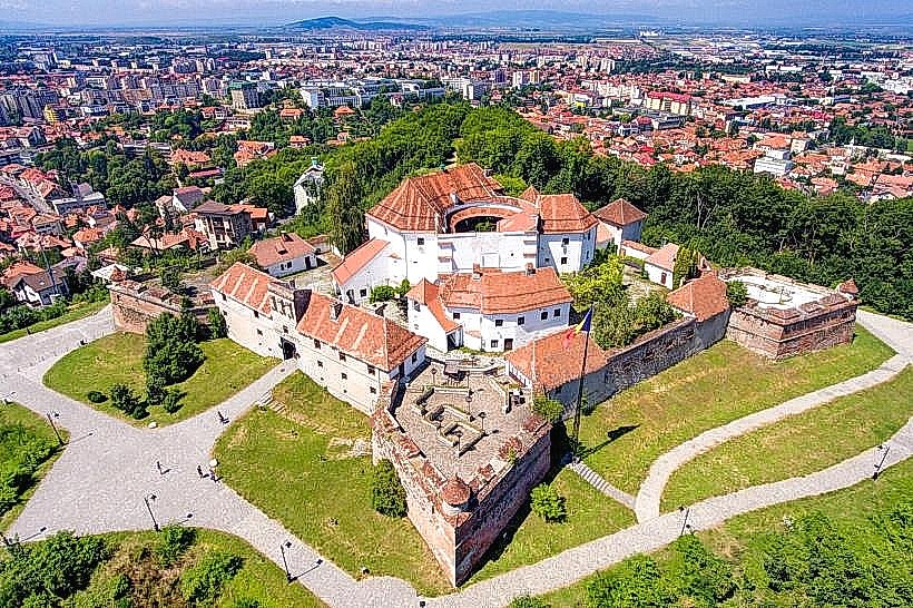
Râșnov Fortress: 18 km
Facts & Legends
Local legend suggests that the Catherine’s Gate area was the site of a strictly enforced ethnic divide; the Romanian population was forbidden from living inside the fortified Saxon walls and could only enter at specific times upon paying a toll. An urban legend also claims a secret network of tunnels exists under the Tâmpa Mountain, allegedly used for ammunition storage during WWII or as medieval escape routes.