Information
Landmark: White TowerCity: Brasov
Country: Romania
Continent: Europe
White Tower, Brasov, Romania, Europe
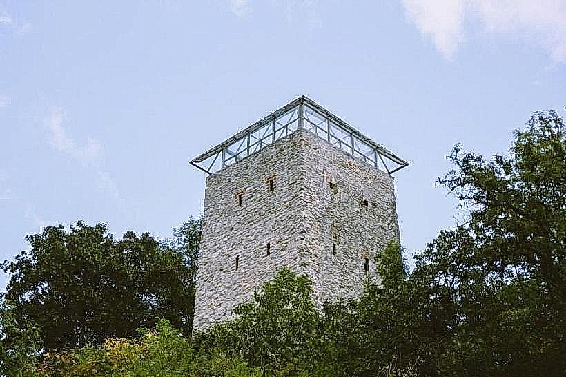
The White Tower is a 15th-century semicircular fortification located on a limestone cliff above the northwestern walls of Brașov, Romania. It served as the highest point in the city's defensive system, designed to monitor the northern approaches and the Blacksmiths' Bastion.
Visual Characteristics
The structure is built of stone and brick, reaching a height of 20 meters on the downhill side and featuring a diameter of 19 meters. Its namesake white appearance is due to the lime-washed exterior, which contrasts with the red-tiled conical roof. The interior consists of four levels equipped with defensive galleries, battlements, and pitch-pouring holes (machicolations), while the exterior is marked by several narrow firing slits.
Location & Access Logistics
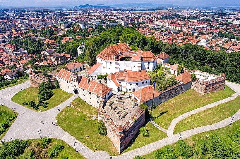
The tower is situated on a steep incline approximately 0.5 kilometers northwest of Council Square. Pedestrian access is provided via a stone staircase with over 200 steps beginning near the Graft Bastion on După Ziduri Street. Alternatively, it can be reached via a more gradual forested path starting from the Livada Poștei area. There is no direct vehicular access to the tower; parking must be secured at the base of the hill in public lots such as those at Livada Poștei.
Historical & Ecological Origin
Construction was completed between 1460 and 1494, funded and maintained by the Tinners' and Copperworkers' Guilds. It was integrated into the city's outer defense ring to provide a vantage point that compensated for the city's lower elevation relative to the surrounding hills. A large fire in 1689 caused significant damage, leading to several phases of reconstruction, with the most recent major restoration occurring in 2005.
Key Highlights & Activities
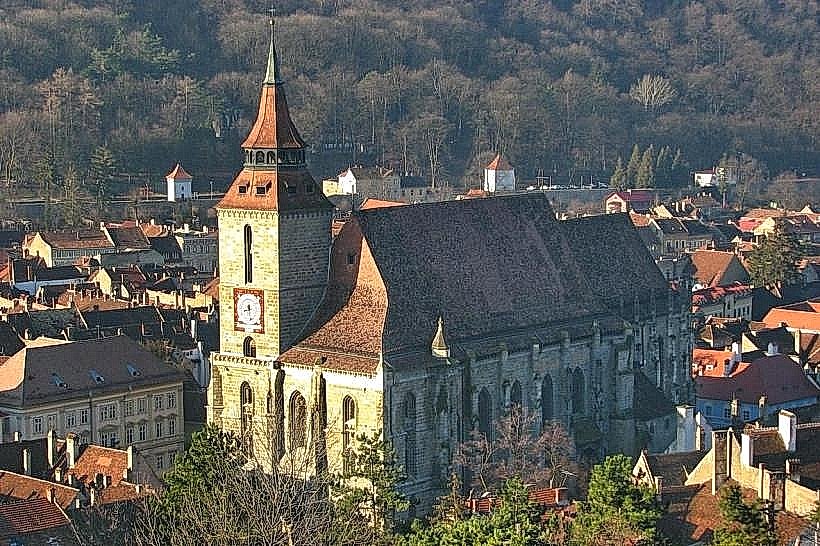
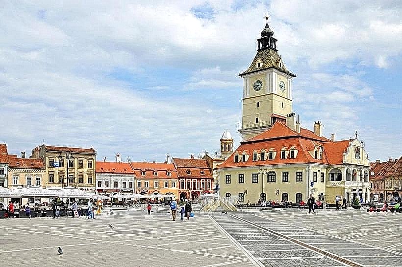
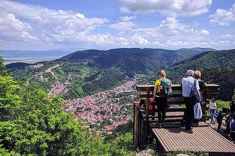
The tower contains a small museum exhibit focusing on medieval weaponry and local history, though access is subject to seasonal schedules. The primary activity is the observation of the historic center from the wooden viewing balconies. The exterior perimeter serves as a central point for photography, providing a high-angle view of the Black Church and the Council House. Hiking trails continue from the tower toward the Black Tower and the Warthe Hill.
Infrastructure & Amenities
Restrooms are not available inside the tower; the nearest facilities are located at the base of the hill in the park or within commercial venues in the Old Town. Seating is provided by a few benches along the access path. Cellular signal is 5G-capable. There is no natural shade at the summit or on the viewing platforms, though parts of the access staircase are shaded by overhanging trees.
Best Time to Visit
Optimal lighting for city photography occurs in the morning when the sun is behind the tower, illuminating the facades of the Old Town below. The tower is typically closed on Mondays. Visiting during the shoulder seasons (May–June or September–October) avoids the peak tourist congestion on the narrow staircases. Sunset provides an opportunity to photograph the city as the municipal lights are activated.
Facts & Legends
The tower was originally designed as an independent fortification, connected to the city walls only by a drawbridge over the Graft canal to prevent attackers from using it as a breach point. A local anecdote highlights its resilience during the 1689 fire; while the wooden interior collapsed, the massive stone walls remained intact, serving as a shell for the subsequent reconstruction that gave the tower its modern dimensions.
Nearby Landmarks
The Graft Bastion: 0.1km Southeast (at the base)
The Black Tower: 0.3km Southwest
Council Square: 0.5km Southeast