Information
City: CedrosCountry: Trinidad and Tobago
Continent: North America
Cedros, Trinidad and Tobago, North America
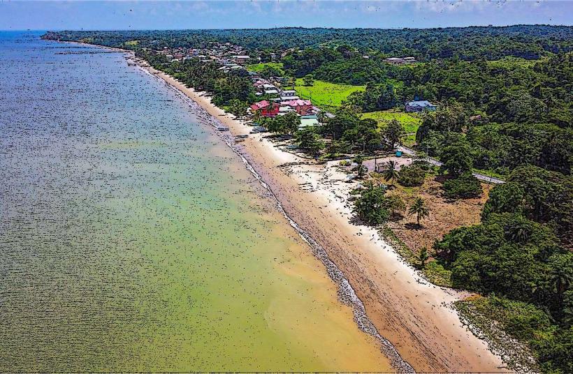
Cedros serves as the southwesternmost administrative district of Trinidad, functioning as a primary fishing hub and the closest legal port of entry to the South American mainland (Venezuela). It is a rural, coastal region within the Siparia Regional Corporation.
Historical Timeline
The area was originally inhabited by the Nepuyo people. During the Spanish colonial era, it became a center for coconut and cocoa cultivation. In the 19th century, Cedros was a major port for the arrival of East Indian indentured laborers. Historically, its proximity to Venezuela (approximately 11 km across the Columbus Channel) has made it a focal point for trade, migration, and maritime security.
Demographics & Population
The population is approximately 7,000 across several villages, including Bonasse, Fullarton, and Icacos. The demographic is a synthesis of Afro-Trinidadian and Indo-Trinidadian populations, with a significant and growing Venezuelan migrant community. The economy is almost entirely dependent on artisanal fishing and coconut estates.
Urban Layout & Key Districts
Cedros is a collection of coastal settlements linked by the Southern Main Road.
Bonasse Village: The commercial and administrative heart, containing the police station, health center, and Customs and Excise building.
Fullarton: A residential and fishing village known for its traditional wooden architecture.
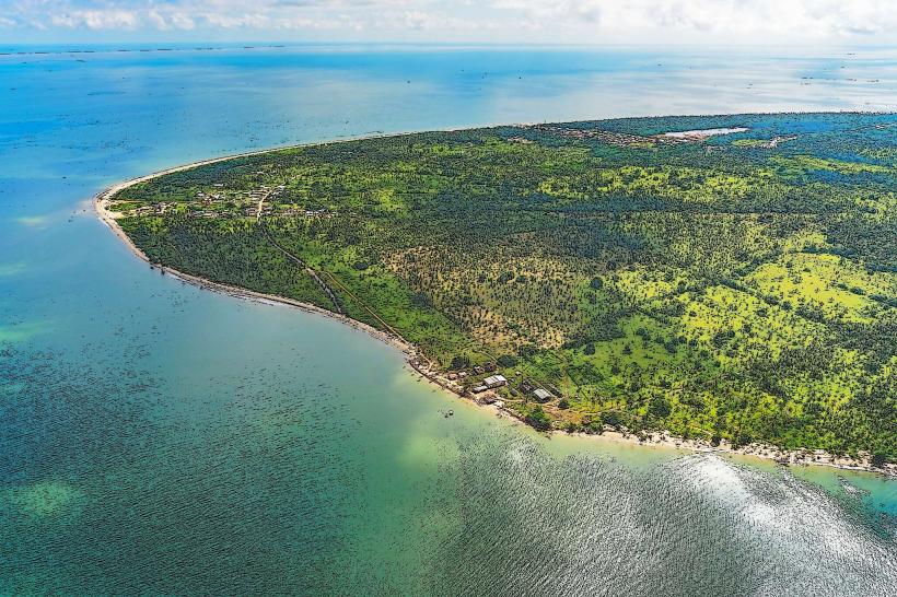
Icacos: The southernmost tip of the island, characterized by vast coconut groves and the direct view of the Venezuelan coastline.
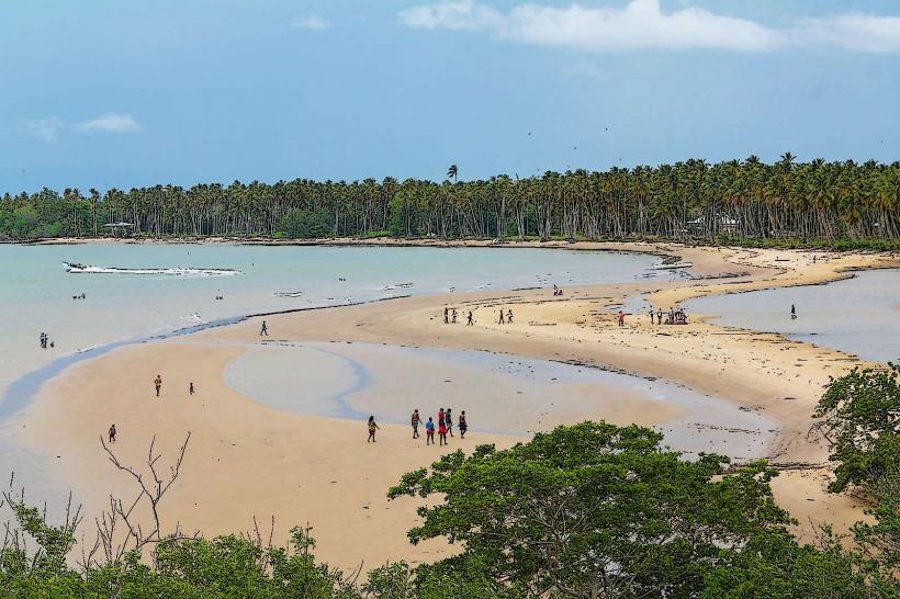
Columbus Bay: A scenic coastal stretch featuring unique rock formations and calm waters.
Top Landmarks
Cedros Public Pier: The center of maritime activity and the official port of entry/exit.
Galfa Point: A rugged cliff area providing clear views of the "Bocas" and the Venezuelan mainland.
Icacos Point: The geographical end of the island, marked by the meeting of the Gulf of Paria and the Columbus Channel.
St. Patrick’s Roman Catholic Church: A historic religious site central to the community's social fabric.
Transportation Network
Movement is restricted to the Southern Main Road.
Public Transit: Shared taxis and limited PTSC buses connect Cedros to Point Fortin (approx. 45–60 minutes) and San Fernando.
Maritime: The port handles legal vessel traffic between Trinidad and Venezuela.
Infrastructure: Roads are narrow and often subject to coastal erosion and flooding during heavy rains.
Safety & "Red Zones"
Cedros is generally safe for residents, but visitors must exercise caution. The region is a high-traffic zone for illicit trade and maritime smuggling. Avoid isolated beaches at Icacos or Columbus Bay after sunset. Be vigilant regarding maritime safety; the Columbus Channel has unpredictable currents. Use only registered "H" taxis for inter-village travel.
Digital & Financial Infrastructure
Mobile 4G/LTE coverage is available but can be inconsistent near the coastline where Venezuelan signals often interfere. Fiber-optic internet is extremely limited. The economy is strictly cash-based (TTD). There are no major commercial banks or 24-hour ATMs in Cedros; the nearest banking facilities are located in Point Fortin.
Climate & Air Quality
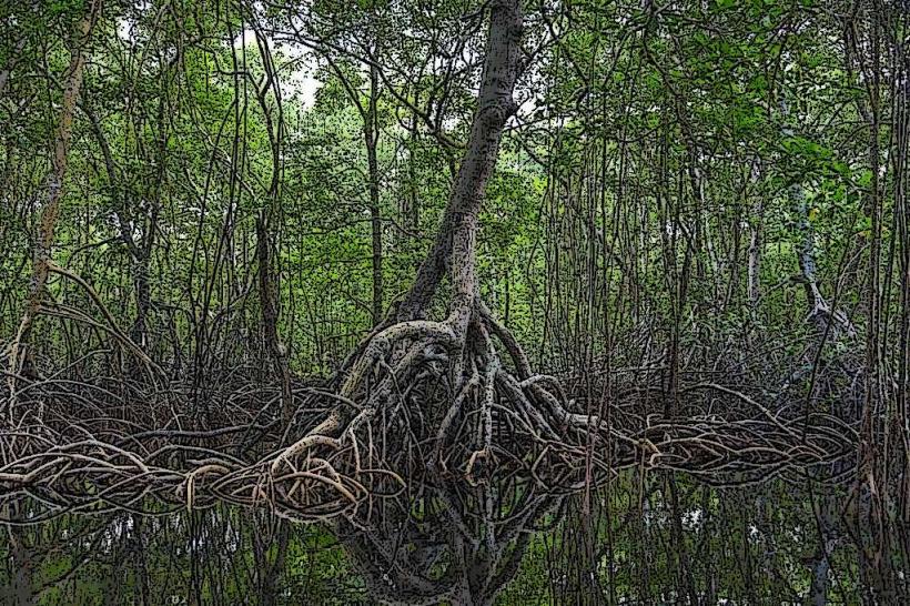
The region has a tropical marine climate. Air quality is high due to the lack of industrialization and the presence of the Columbus Channel breezes. The area is prone to significant coastal erosion and the "Red Ring" disease affecting its vast coconut estates.
Culture & Social Norms
The culture is defined by "fishing village" values-community-centric and traditional. Cedros is famous for the Hosein festival and its local regattas. Social etiquette is polite; greetings are expected. Dress is casual. Tipping is informal.
Local Cost Index (TTD)
1 Espresso: Not available (Instant coffee: 10 TTD)
1 Standard Lunch (Fresh Fish/Provisions): 40–80 TTD
1 Taxi Ride (to Point Fortin): 15–25 TTD
Nearby Day Trips
Columbus Bay: For birdwatching and viewing the "Three Sisters" rock formations.
Point Fortin: 45 minutes east for major shopping and services.
Erin: 30 minutes east, another historic fishing and agricultural village.
Facts & Legends
Cedros is the only place in Trinidad where you can clearly see the lights of Venezuelan towns on a clear night. A local legend involves "Douens" (spirits of unbaptized children) inhabiting the deep coconut estates of Icacos. Geographically, it is the first point of contact for many South American bird species migrating to Trinidad.