Information
Landmark: Cedros BeachCity: Cedros
Country: Trinidad and Tobago
Continent: North America
Cedros Beach, Cedros, Trinidad and Tobago, North America
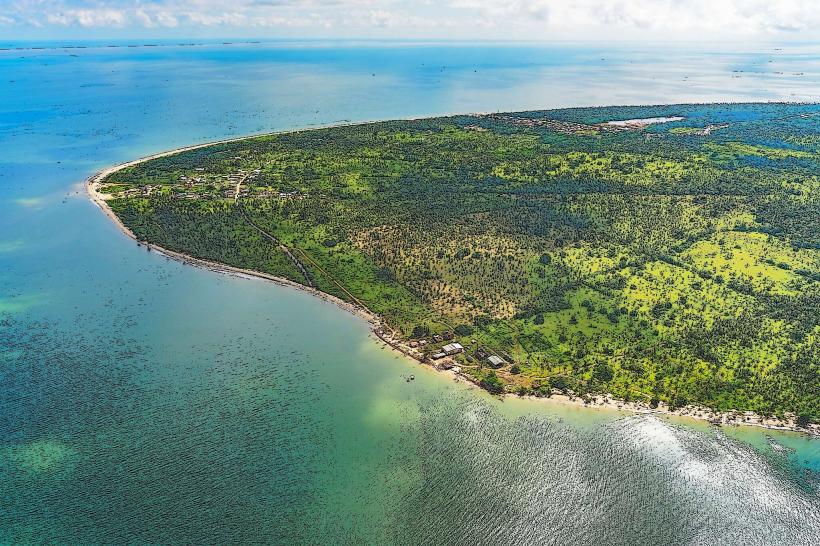
Cedros Beach is a coastal area situated at the southwestern tip of Trinidad, within the Cedros district of Trinidad and Tobago.
This location serves as a significant point of landmass extending into the Gulf of Paria.
Visual Characteristics
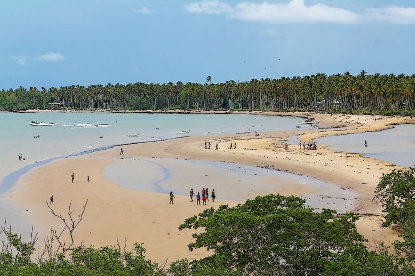
The beach consists of a long, narrow strip of sand. The sand exhibits a light brown to tan color with a medium grain texture. The water of the Gulf of Paria is generally calm and shallow, appearing a muted blue-green. Vegetation behind the beach is characterized by dense coastal scrub and scattered palm trees.
Location & Access Logistics
Cedros Beach is located approximately 100 kilometers southwest of Port of Spain. Access is via the main Cedros Road (Siparia Main Road transitioning to Cedros Road). The drive from San Fernando is approximately 1.5 hours. Parking is available along the roadside adjacent to the beach, with no designated parking lots. Public transport options are limited; local maxi-taxis operate on the Cedros route from Siparia, but direct service to the beach itself is infrequent.
Historical & Ecological Origin
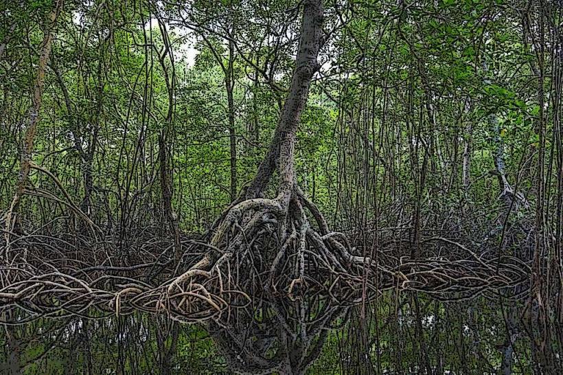
The geological formation of Cedros Beach is part of the deltaic deposits of the Orinoco River, influenced by coastal erosion and sedimentation processes. Ecologically, it is a coastal mangrove and beach ecosystem, supporting a variety of marine and terrestrial life adapted to saline conditions.
Key Highlights & Activities
Walking along the shoreline is a primary activity. Fishing from the beach is permitted. Birdwatching is possible due to the coastal vegetation. Swimming is generally not recommended due to shallow waters and potential currents.
Infrastructure & Amenities
There are no public restrooms or shade structures directly on Cedros Beach. Food vendors are typically absent. Cell phone signal (4G/5G) is generally available but can be intermittent closer to the water's edge.
Best Time to Visit
The best time of day for photography is late afternoon, approximately 1-2 hours before sunset, for softer lighting. The best months for weather are generally from January to May, during the dry season. There are no specific tide requirements for beach access.
Facts & Legends
A notable historical fact is that Cedros was once a significant port for the export of agricultural products, particularly cocoa and rubber, during the colonial era. Local lore suggests that the area was a favored landing spot for smugglers due to its remote location.
Nearby Landmarks
- Pointe Sable Lighthouse (1.2km Northeast)
- Icacos Village (3.5km Southwest)
- Columbus Bay (4.0km Southeast)
- Fullerton Village (4.8km East)