Information
City: Dassa ZoumeCountry: Benin
Continent: Africa
Dassa Zoume, Benin, Africa
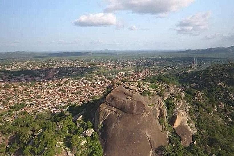
Dassa-Zoumé (often simply Dassa) serves as the spiritual crossroads of Benin, famously known as the "City of 41 Hills." It is located in the Collines Department, roughly 200 km north of Cotonou, and acts as a vital transit point between the northern and southern regions of the country.
Historical Timeline
Dassa was founded in the 17th century by an branch of the Idaasha (an ethnic group of Yoruba origin). The city's geography-surrounded by rocky massifs-provided a natural defense against the expanding Kingdom of Dahomey. For centuries, it remained a sovereign kingdom with its own monarch (the Agbaïgou). In the modern era, it has evolved into a center of religious syncretism, where Catholic pilgrimage sites and ancient Vodun shrines coexist on the same hillsides.
Demographics & Population
As of 2026, the population is approximately 115,000. The demographic is dominated by the Idaasha (Yoruba subgroup), but its position on the main transit axis has brought in Fon, Mahi, and Dendi traders. The city is a major center for both Roman Catholicism and traditional Vodun practices.
Urban Layout & Key Districts
Centre Ville: The commercial heart where the main north-south highway (RNIE 2) passes through.
Arigbo: The religious district at the base of the hills, home to the Basilica and the sacred grotto.
Soclogbo & Akofodjoule: Growing residential and commercial areas on the outskirts.
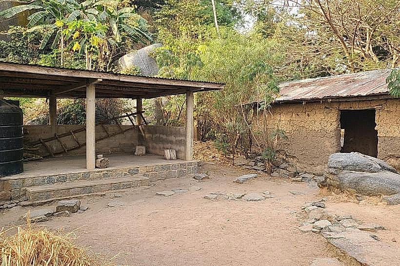
The Royal Quarter: Located at the foot of the "Hill of Princes," where the traditional palace of the Agbaïgou is situated.
Top City Landmarks
Grotte Notre-Dame d'Arigbo: A major Catholic pilgrimage site where the Virgin Mary is said to have appeared in 1954; millions visit annually, especially in mid-August.
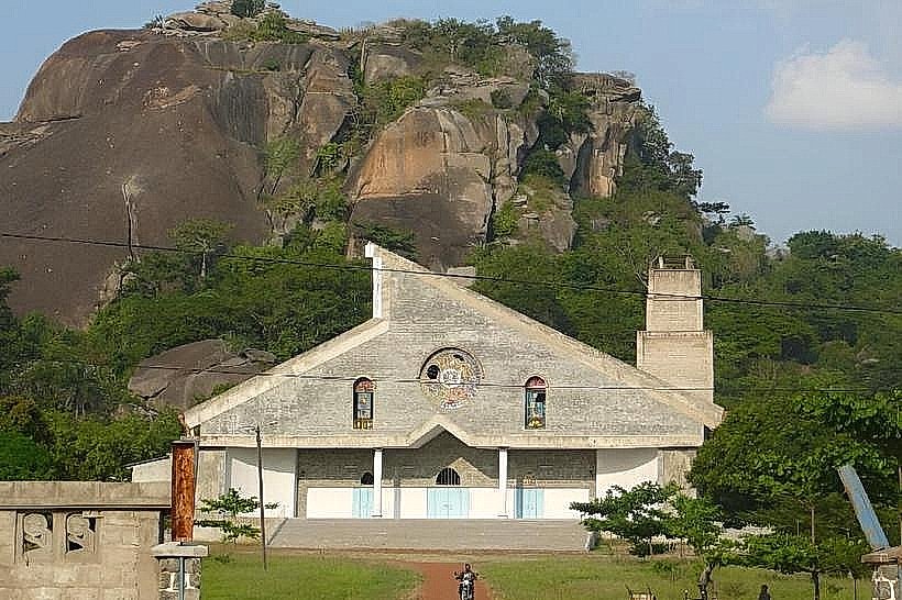
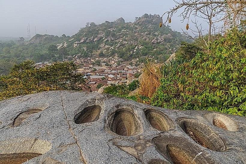
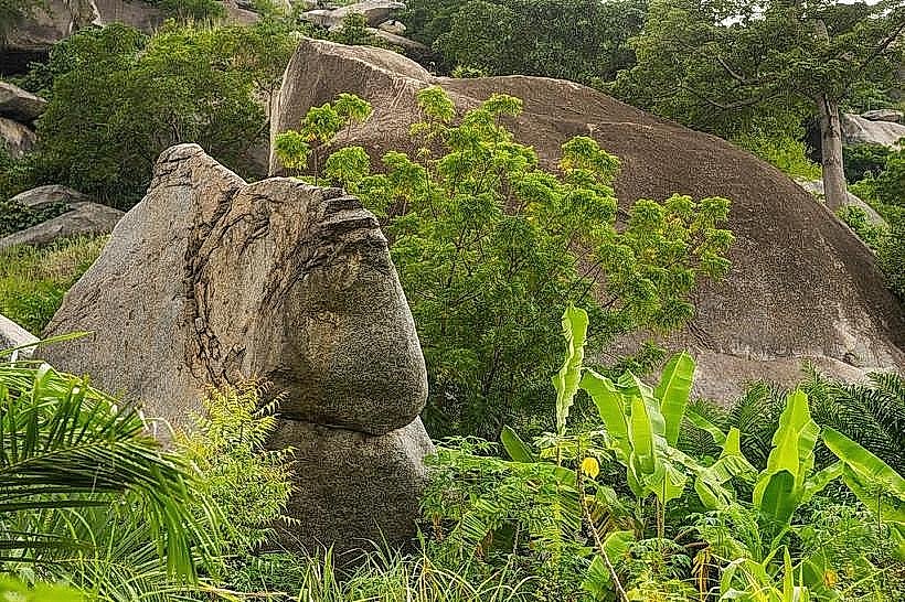
The 41 Hills: A series of granite outcrops surrounding the city. While there are actually more than 41, the number is symbolic and sacred in local tradition.
Hill of the Princes (Colline des Princes): The site of royal burial grounds and Vodun sanctuaries.
Notre-Dame d'Arigbo Basilica: A large modern church complex adjacent to the sacred grotto.
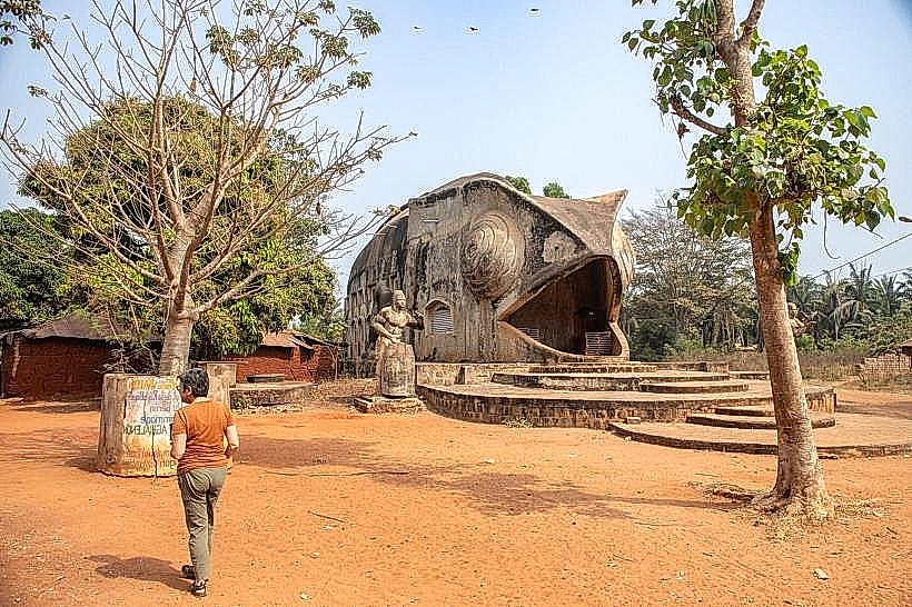
The "Fish Rock": A unique natural geological formation on one of the ridges that resembles a fish.
Transportation Network
Dassa is a major hub on the Cotonou–Parakou axis.
Road: The RNIE 2 highway is paved and in relatively good condition, though it is heavily used by large trucks.
Local: Transit is handled by Zémidjans (motorcycle taxis).
Bus: It is a primary stop for all intercity buses traveling between Cotonou (3-4 hours) and Parakou (3 hours).
Rail: Historically a stop on the national railway, though passenger services in 2026 are primarily chartered or irregular.
Safety & "Red Zones"
The safety level is generally high, but specific precautions apply:
Road Safety: Following a major accident in 2023, the government has instituted stricter road safety measures. Avoid nighttime travel on the highway due to heavy transit traffic and lack of lighting.
Hiking Safety: Never trek the 41 Hills without a local guide. Many areas are active Vodun sanctuaries, and entering without permission is considered a desecration.
Civil Unrest: Monitor the political situation leading up to the February 12, 2026 elections; avoid gatherings near the main intersections.
Digital & Financial Infrastructure
Internet speeds average 20–40 Mbps; 4G is reliable in the city center. The currency is the CFA Franc (XOF).
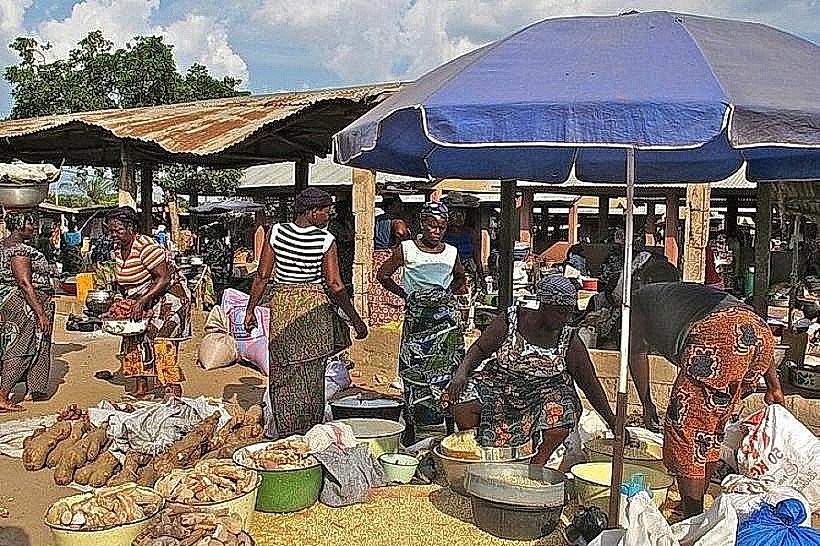
Payments: Cash is required for markets. MTN/Moov Mobile Money is the standard for digital payments.
Banking: Limited ATMs are available in the center (e.g., BOA, Ecobank). Card acceptance is rare outside of the Jeco Hotel or similar upscale establishments.
Climate & Air Quality
Tropical climate with a significant dry season.
Weather: In January 2026, temperatures reach 34°C. The Harmattan wind is active, creating a dry, hazy atmosphere.
Air Quality: Often Moderate to Unhealthy (AQI 120–160) during the dry season due to Saharan dust and seasonal agricultural burning in the Collines region.
Culture & Social Norms
The city is the heart of Idaasha culture.
Religious Syncretism: It is common to see people attend the Basilica in the morning and consult traditional shrines in the afternoon.
Etiquette: Dress modestly, especially near the Grotto or the Royal Palace. Always ask permission before photographing shrines or traditional ceremonies.
Local Cost Index
1 Espresso: 1,200 XOF ($2.15)
1 Standard Lunch: 3,500 XOF ($6.35)
1 Short "Zem" Ride: 400 XOF ($0.72)
1 Liter of Petrol: 650 XOF ($1.18)
Nearby Day Trips
Savé: Known for the "Mamelles de Savé," two breast-shaped hills (30 km north).
Glazoué: A nearby market town famous for its large regional commerce (20 km north).
Facts & Legends
The number 41 is considered auspicious in local numerology, representing the 41 original Idaasha families that settled the area. Legend holds that the hills themselves are the "bones" of the earth and that certain caves contain "invisible markets" where spirits trade at night. Archaeological findings on the hills, including man-made grooves in the granite for grinding grain, suggest the area has been continuously occupied for over a thousand years.