Information
Landmark: Scenic Overlook PointsCity: Dassa Zoume
Country: Benin
Continent: Africa
Scenic Overlook Points, Dassa Zoume, Benin, Africa
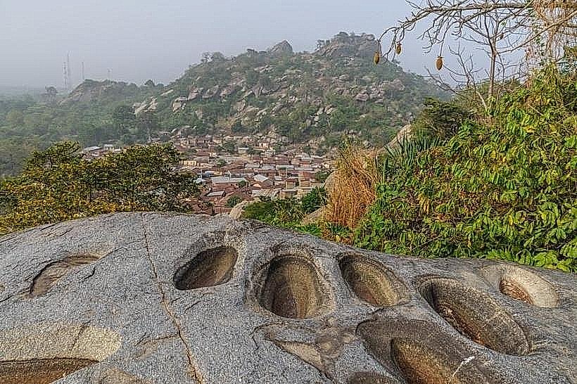
Scenic Overlook Points are a series of elevated viewpoints offering panoramic views of the surrounding landscape in Dassa Zoume, Benin.
These locations provide distinct vantage points for observing the topography and urban spread of the region.
Visual Characteristics
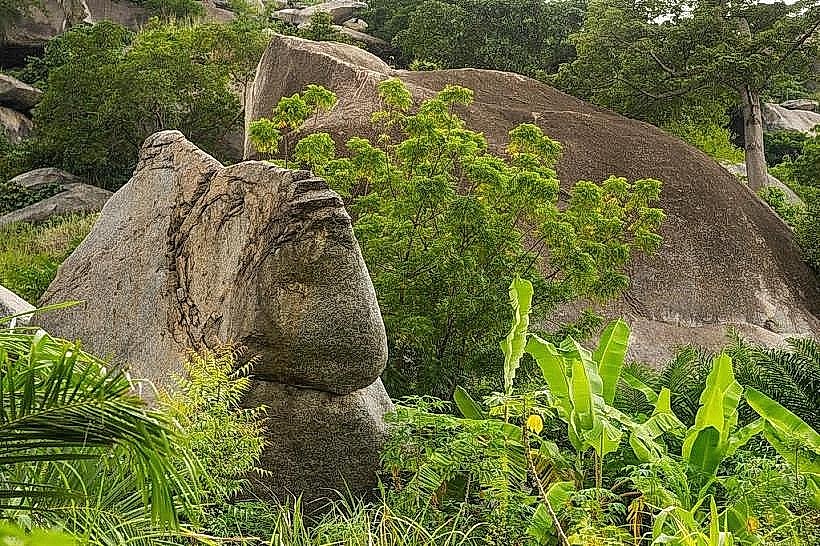
The overlooks are characterized by exposed laterite rock formations and sparse savanna vegetation, primarily consisting of drought-resistant grasses and scattered acacia trees. The elevation varies, with some points offering a gradual incline and others steeper ascents. The dominant colors are earthy browns and ochres from the soil, contrasted with the muted greens of the vegetation. The urban area of Dassa Zoume appears as a collection of low-rise structures with corrugated metal roofing.
Location & Access Logistics
The primary overlook points are situated approximately 3-5 kilometers north of the Dassa Zoume city center, accessible via the Route Nationale 1 (RN1). Turnoffs are marked by informal dirt tracks leading to the elevated areas. Parking is unpaved and available directly at the base of the most accessible points. Public transport to Dassa Zoume is primarily by shared taxi or bus; from the city center, local moto-taxis can be hired to reach the overlooks.
Historical & Ecological Origin
The geological origin of the elevated terrain is attributed to ancient lateritic duricrust formations, a common feature in the West African savanna. These formations are the result of prolonged weathering and leaching processes. Ecologically, the area represents a transition zone within the Sudanese savanna biome, adapted to seasonal rainfall patterns.
Key Highlights & Activities
Observation of the Dassa Zoume cityscape and surrounding agricultural fields. Photography of the landscape, particularly during sunrise and sunset. Hiking to different vantage points to compare perspectives. Identification of local flora adapted to arid conditions.
Infrastructure & Amenities
No formal infrastructure is present at the overlook points. Restrooms, shade structures, and food vendors are not available. Cell phone signal (4G/5G) is generally available but can be intermittent at higher elevations.
Best Time to Visit
The optimal time for photography is during the early morning (06:00-08:00) and late afternoon (17:00-18:30) to utilize the low-angle sunlight. The dry season, from November to April, offers clearer skies and more comfortable temperatures for visiting. There are no tidal considerations.
Facts & Legends
Local folklore suggests that certain rock formations at these overlooks were once dwellings for ancient spirits. A specific rock outcrop, known locally as "The Sleeping Giant," is said to resemble a reclining figure and is a focal point for traditional storytelling.
Nearby Landmarks
- Dassa Zoume City Center (3km South)
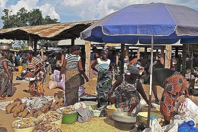
- Dassa Zoume Market (3.5km South)
- Notre Dame de la Miséricorde Cathedral (4km South)
- Parc National de la Pendjari (Access point approximately 80km North, not within 5km radius)