Information
City: IsaloCountry: Madagascar
Continent: Africa
Isalo, Madagascar, Africa
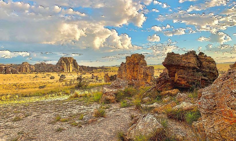
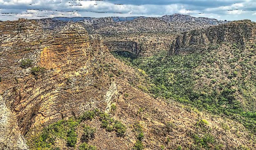
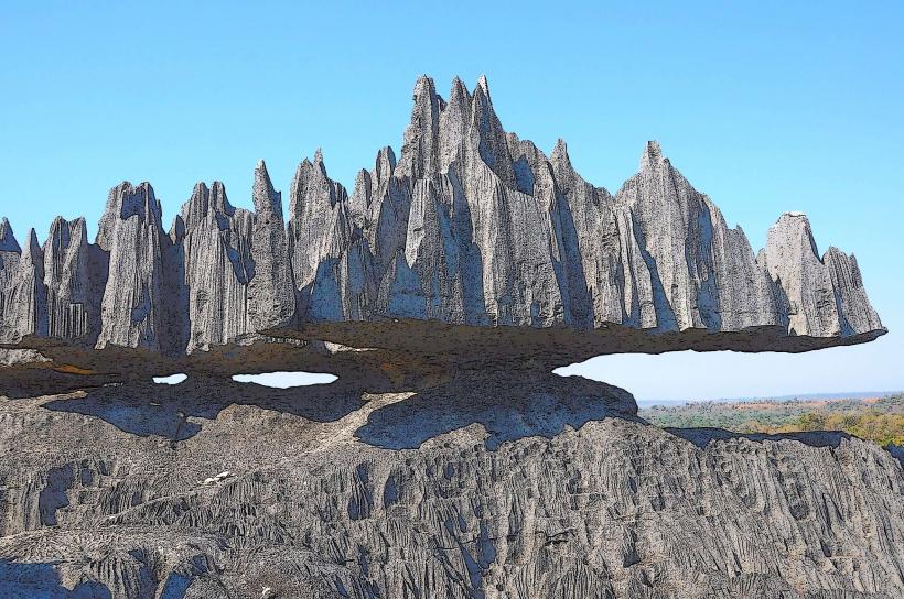
Isalo is a Jurassic-era sandstone massif located in the Ihorombe region of south-central Madagascar. It is defined by the Isalo National Park, the most visited protected area in the country, encompassing 815 square kilometers of wind-eroded canyons, ruiniform rock formations, and palm-lined oases.
Historical Timeline
The geological formation dates back over 150 million years. Historically, the rugged canyons served as a natural fortress for the Bara people, who used the caves for cattle protection and sacred burials. The area was officially designated as a National Park in 1962. It gained international prominence in the late 20th century as a primary "circuit" for European tourism due to its unique semi-arid biodiversity and spectacular landscapes.
Demographics & Population
The local population is concentrated in the gateway town of Ranohira. The dominant ethnic group is the Bara, semi-nomadic pastoralists known for their deep cultural connection to Zebu cattle. The social structure is heavily influenced by traditional beliefs, particularly regarding ancestor worship and the sanctity of the burial caves located within the park’s cliffs.
Urban Layout & Key Districts
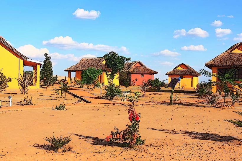
Ranohira: The administrative and commercial hub. It consists of a main street along the RN7 lined with hotels, restaurants, and the MNP (Madagascar National Parks) office.
The Massif: A vast uninhabited zone divided into trekking circuits (e.g., Namaza, Canyon of Rats).
The Savannah: Open plains surrounding the rocks, primarily used for Zebu grazing.
Top Landmarks
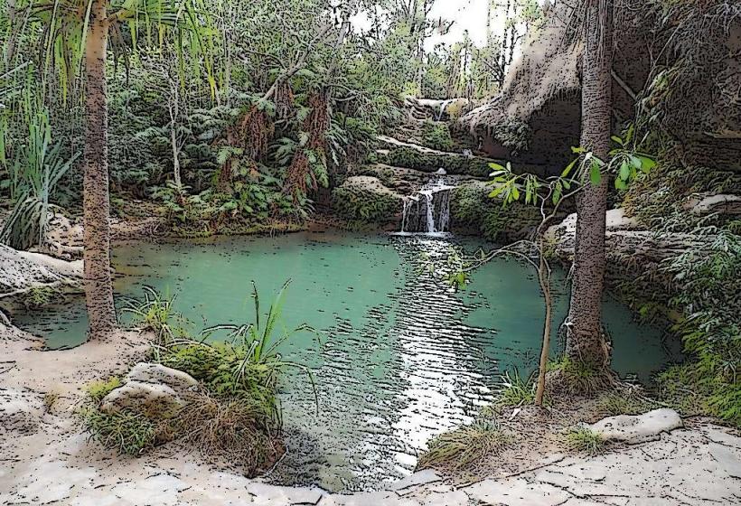
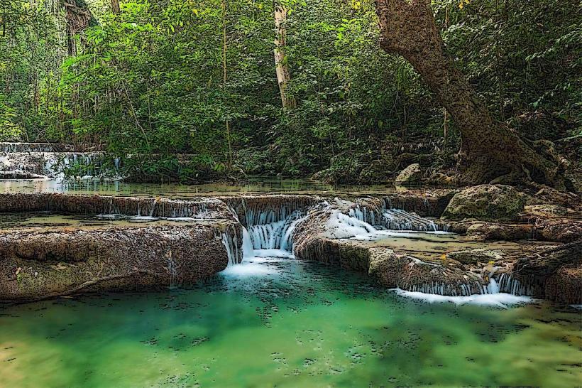
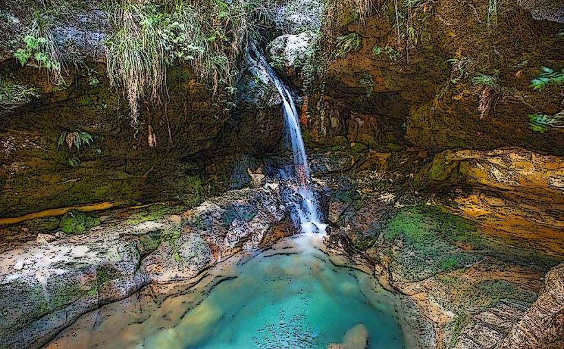
Piscine Naturelle (Natural Pool): A crystalline spring-fed pool surrounded by lush ferns and pandanus trees, located at the end of a desert canyon.
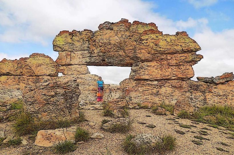
The Window of Isalo (La Fenêtre): A natural rock formation that frames the sunset, located south of Ranohira.
Canyon of Makis and Canyon of Rats: Deep, shaded gorges offering sightings of Ring-tailed lemurs, Verreaux's sifakas, and Red-fronted brown lemurs.
The Queen of Isalo: A rock formation resembling a crowned woman overlooking the plains.
Bara Burial Sites: Ancient and modern tombs placed high in the rock crevices (strictly off-limits to visitors; must be viewed from a distance).
Transportation Network
Roads: Located directly on the RN7 highway. It is approximately 250 km (4–5 hours) north of Toliara and 700 km (12–14 hours) south of Antananarivo.
Public Transit: Accessible via Taxi-brousse traveling between Toliara and the capital.
Internal: Exploration is strictly on foot within the park. 4x4 vehicles are required to reach certain remote trailheads from Ranohira.
Safety & "Red Zones"
Banditry: The Ihorombe plateau is a high-activity zone for Dahalo (cattle rustlers). While the park itself is guarded, the surrounding remote plains and the RN7 stretch toward Ilakaka should never be traversed at night.
Environment: Flash floods can occur in the canyons during the rainy season (December–March). Extreme heat and lack of shade on the plateau pose risks of sunstroke.
Guided Access: Entering the park without a licensed MNP guide is illegal and dangerous due to the complex terrain.
Digital & Financial Infrastructure
4G signal is available in Ranohira but non-existent once inside the deep canyons of the massif. Banking is limited; there are no reliable ATMs in Ranohira. Travelers must withdraw sufficient Malagasy Ariary (MGA) in Fianarantsoa (north) or Toliara (south).
Climate & Air Quality
Climate: Tropical dry. Daytime temperatures on the open rocks can exceed 35°C. Nighttime temperatures in winter can drop significantly.
Air Quality: Exceptional. The area has no industrial activity and is purified by persistent winds across the plateau.
Culture & Social Norms
Fady (Taboos): Do not point with a straight finger at tombs; use a folded knuckle.
Zebu Culture: For the Bara, stealing a Zebu was traditionally a rite of passage for marriageable men to prove their bravery.
Photography: Always ask permission before photographing Bara herders or their livestock.
Local Cost Index
1 Bottle of Water (Ranohira): ~3,000 MGA ($0.65)
1 Day Park Entry Fee: ~65,000 MGA ($14.50)
1 Local Guide (Daily): ~40,000–80,000 MGA ($9–$18)
Nearby Day Trips
Ilakaka: 30 mins south; once a tiny village, now a "Wild West" sapphire mining town responsible for a significant portion of the world's sapphire supply.
Zombitse-Vohibasia National Park: 1.5 hours south; a transition forest famous for rare birds and Hubbard’s sportive lemurs.
Facts & Legends
A verified geological oddity is the presence of the Bismarck Palm (Bismarckia nobilis), a fire-resistant endemic palm that thrives in the park’s scorched savannah. Local legend says that the spirits of the ancestors live in the wind that whistles through the rock "windows," and that certain canyons are "singing" because of the way the air vibrates through the ancient sandstone.