Information
City: LeitrimCountry: Ireland
Continent: Europe
Leitrim, Ireland, Europe
Leitrim functions as the primary hub for slow-adventure tourism and inland water navigation in the Northwest of Ireland. It is Ireland's least densely populated county and is characterized by its "drumlin" topography and extensive lake systems. Despite having a coastline of only 4 km on the Atlantic, it serves as a critical junction for the Shannon-Erne Waterway.
Historical Timeline
Leitrim originated as the western half of the Kingdom of Breifne, ruled by the O'Rourke clan. The primary era of governance shifted in the 13th century when Breifne sundered into East (Cavan) and West (Leitrim). The primary event shaping the county's modern demographics was the Great Famine (1845–1852), which triggered a population collapse from 155,000 to approximately 25,000 by the late 20th century-the most severe decline in Ireland.
Demographics & Population
The population is approximately 35,000 (2022 Census). It remains the most rural county in Ireland. The demographic is predominantly Irish, with a small but significant community of international artists and organic farmers drawn to its remote landscape. The median age is approximately 41 years.
Urban Layout & Key Districts
The county is bisected by Lough Allen, dividing it into two distinct geographical zones.
Carrick-on-Shannon: The county town and administrative center, functioning as the "Cruising Capital of Ireland."
Manorhamilton: The primary settlement of North Leitrim, characterized by a limestone valley and 17th-century castle ruins.
Drumshanbo: A historic industrial town at the foot of Sliabh an Iarainn, now a center for artisanal distilling.
Leitrim Village: A strategic canal-side hub connecting the Shannon to the Erne system.
Top Landmarks
Glencar Waterfall: A 15-meter cascade that served as the inspiration for W.B. Yeats' poem The Stolen Child.
Parke’s Castle: A restored 17th-century plantation-era castle situated on the shores of Lough Gill.
Costello Memorial Chapel: Located in Carrick-on-Shannon, it is the second-smallest chapel in the world.
Arigna Mining Experience: Located on the border, this center preserves the county's coal and iron mining heritage.
Eagle’s Rock: Ireland’s highest free-standing rock formation, situated in the Dartry Mountains.
Transportation Network
Movement is primarily reliant on private vehicles. Public transit is limited, though the Dublin-Sligo Rail Line serves stops at Dromod and Carrick-on-Shannon. National roads N4 and N16 provide the primary east-west and north-south corridors. There is no light rail. The Shannon-Erne Waterway serves as a specialized transit network for leisure craft.
Safety & "Red Zones"
The general safety level is very high. Crime is statistically negligible. there are no "red zones." The primary risks are environmental: rural roads are narrow and winding (drumlin hills), and the extensive lake systems require strict adherence to water safety protocols due to hidden currents and cold temperatures.
Digital & Financial Infrastructure
Internet speeds average 100–500 Mbps in towns, with the National Broadband Plan extending fiber to rural areas. 5G is available in Carrick-on-Shannon. Card acceptance is standard. ATMs are concentrated in Carrick-on-Shannon, Manorhamilton, and Ballinamore.
Climate & Air Quality
Leitrim has a maritime temperate climate with high annual rainfall, particularly in the northern glens. Daytime temperatures range from 7°C in January to 18°C in July. Air quality is among the highest in Ireland due to the lack of heavy industry and low population density.
Culture & Social Norms
Leitrim's culture is defined by "Slow Adventure"-walking, angling, and traditional music. Tipping is standard in restaurants (10%). Social life is centered on the pub culture of Carrick-on-Shannon and the heritage festivals of Drumshanbo.
Accommodation Zones
Carrick-on-Shannon: Recommended for nightlife, river cruises, and hotel availability.
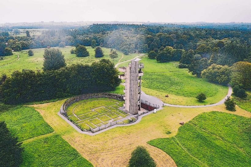
Lough Rynn (Mohill): Recommended for luxury castle stays and formal gardens.
North Leitrim Glens: Recommended for eco-tourism and remote self-catering.
Local Cost Index
1 Espresso: €2.90 ($3.15 USD)
1 Pint of Stout: €5.50–€6.20 ($6.00–$6.75 USD)
1 Standard Lunch: €12.00–€16.00 ($13.00–$17.40 USD)
Nearby Day Trips
Lough Key Forest Park: 15 km south in County Roscommon.
Sligo Town: 30 km west of Manorhamilton.
Enniskillen: 40 km north of Ballinamore.
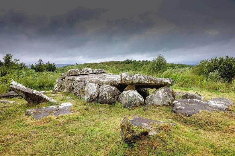
Facts & Legends
Leitrim is the site of the legend of the Sliabh an Iarainn (Iron Mountain), where the Tuatha Dé Danann were said to have landed in a cloud of mist. A verified historical fact is that the county possesses only two sets of traffic lights. A local legend claims that a "Great Serpent" inhabits the depths of Lough Allen, surfacing only once every century.