Information
City: NgaoundereCountry: Cameroon
Continent: Africa
Ngaoundere, Cameroon, Africa
Ngaoundéré serves as the administrative capital of the Adamawa Region and functions as the primary railhead for the northern half of Cameroon. It is situated on the Adamawa Plateau at an elevation of approximately 1,200 meters, serving as the geological transition point between the southern rainforests and northern savannas.
Historical Timeline
The city was founded in the 1830s by Ardo Ndjobdi as a Fulbe settlement. Primary eras of governance include the Fulbe Lamidat, the German colonial period (1901–1916), the French mandate, and the post-independence era. The most significant architectural and logistical reconstruction occurred in 1974 with the completion of the Trans-Cameroon Railway (Transcamerounais). The primary event shaping its current urban form was the selection of the city as the northern terminus for the national rail line, establishing it as a transshipment hub for goods heading to Chad and the Central African Republic.
Demographics & Population
The total population is approximately 320,000 residents. The top three ethnic demographics are the Fulbe (Peul), Mboum, and Dii. The median age is 18.2 years.
Urban Layout & Key Districts
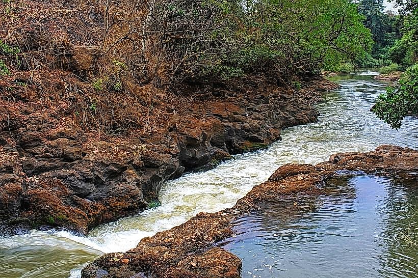
The city is organized into a tiered layout dictated by topography. Key districts include the Center-Ville (Commercial area), the Plateau (Administrative and upscale residential zone), and Dang (The university district) located 15 km to the north. The city is bounded by the Ngaoundéré mountains to the west and the Vina River valley to the south.
Top City Landmarks
The Lamidat of Ngaoundéré (Traditional Palace)
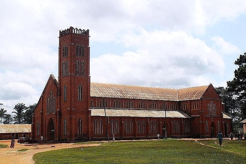
Grande Mosquée de Ngaoundéré
Ngaoundéré Railway Station (Gare Voyageurs)
Mount Ngaoundéré (Viewpoint)
Lake Tison (Crater Lake)
Transportation Network
Movement within the city relies on motorcycle taxis (Benskins) and yellow shared taxis. Ngaoundéré is the northern terminal of the Camrail passenger and freight line from Yaoundé. There is no metro or tram system. Official taxis are yellow. Traffic density is moderate, with heavy truck concentrations near the "Entrepôts" (warehouses) and rail yards.
Safety & "Red Zones"
The general safety level is moderate. Petty theft occurs frequently near the railway station and the central market. Avoid the unlit areas surrounding the Gare Marchandise (Freight Station) after 20:00. Common risks include "highway bandits" on the N1 highway leading north toward Garoua during night hours.
Digital & Financial Infrastructure
Average internet speed is 10–20 Mbps (4G). Main mobile carriers are MTN, Orange, and Camtel. Card acceptance is extremely low; the economy is cash-based (XAF). ATMs are concentrated near the central banks and the University of Ngaoundéré campus.
Climate & Air Quality
Temperatures range from 12°C to 30°C. Due to its altitude, the city is significantly cooler than the northern plains. Air quality is generally high, though the Harmattan (Saharan dust) affects the area from December to February, causing haze and dry conditions. There is a distinct rainy season from April to October.
Culture & Social Norms
Tipping is not mandatory; 500 XAF is standard for service. Social norms are heavily influenced by the Fulbe Islamic culture; conservative dress (covering shoulders and knees) is required. Handshakes are standard; titles such as "Alhadji" or "Ma" are used for respect. Alcohol is generally restricted to the "Quartier Baladji."
Accommodation Zones
Le Plateau: Recommended for security, quieter environment, and proximity to government offices.
City Center: Recommended for logistical access to the railway station and bus agencies.
Local Cost Index
1 Espresso: 1,100 XAF ($1.80)
1 Standard Lunch: 3,500 XAF ($5.72)
1 Metro/Bus Ticket: 250 XAF ($0.41) - (Standard shared taxi fare)
Nearby Day Trips
Lake Tison (10 km)
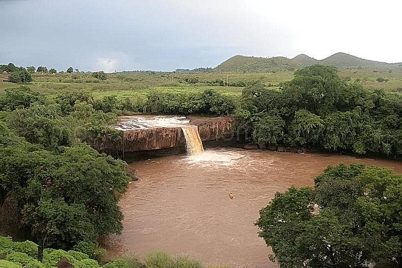
Vina Falls (15 km)
Benue National Park (entrance approx. 120 km)
Idool Village (Traditional Architecture) (70 km)
Facts & Legends
A verified historical oddity is that the city serves as the "Gateway to the North" where the tropical forest landscape abruptly changes to savanna within a few kilometers of the escarpment. Local legend surrounds the "Witch of Lake Tison," a spirit said to guard the deep volcanic waters; it is believed that the lake's color changes according to the spiritual state of the city’s inhabitants, and swimming is often discouraged by locals who claim the lake has no bottom.