Information
City: Ponta do SolCountry: Cabo Verde
Continent: Africa
Ponta do Sol, Cabo Verde, Africa
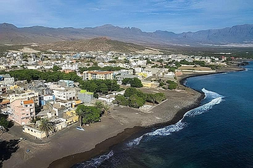
Ponta do Sol is a picturesque coastal town at the northernmost tip of Santo Antão Island. Built on a narrow volcanic promontory jutting into the Atlantic, it serves as a primary center for fishing and a major hub for hikers exploring the island's rugged northern coast.
Historical Timeline
Ponta do Sol became an important maritime center in the late 19th century when it was designated as the primary port for the nearby administrative center of Ribeira Grande. Its development was marked by the construction of colonial-style administrative buildings and a small airfield, the Agostinho Neto Airport, which operated on a precarious runway until its closure in the late 1990s due to safety concerns. Today, it has transitioned from a commercial port into the island's most atmospheric tourist village.
Demographics & Population
The 2026 population is estimated at 4,800. The population is predominantly Mestiço. While Portuguese is used in official capacities, the local Santo Antão Creole is the language of daily life. The town hosts a significant seasonal population of European hikers and divers.
Urban Layout & Key Districts
The town is compact and centered around a large, paved plaza (Praça).
The Historic Core: Characterized by colorful colonial buildings (Sobrados) and narrow cobblestone streets.
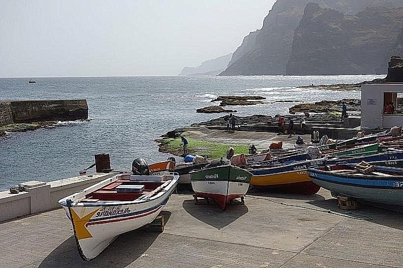
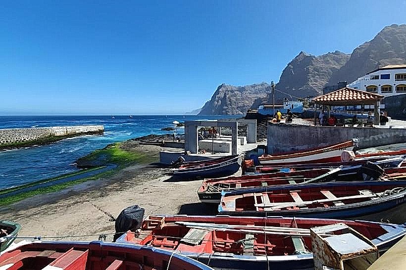
The Port (Cais): A small, active fishing harbor protected by stone walls from the heavy Atlantic swells.
The Aerodrome Zone: The area surrounding the defunct runway, now used for local recreation and walking.
The Cliffside: Home to several guesthouses overlooking the rocky northern coastline.
Top City Landmarks
The Town Hall (Câmara Municipal): A prominent, elegantly restored colonial building in the main square.
Igreja de Nossa Senhora do Livramento: The town's primary church, located in the historic center.
The Fishing Pier: A focal point in the late afternoon when the fishing fleet returns with catches of tuna and grouper.
Agostinho Neto Airport (Defunct): A striking site where the runway ends abruptly at the sea.
Jewish Cemetery: Located on the outskirts, a historical site reflecting the 19th-century Jewish migration to the island.
Transportation Network
Movement is conducted on foot within the town; regional travel relies on alugueres.
Roads: Connected to Ribeira Grande (6 km) and Porto Novo via the coastal highway.
Public Transit: Shared minibuses (Hiaces) run continuously to Ribeira Grande (10 mins) and connect to the ferry terminal in Porto Novo (approx. 1 hour).
Aviation/Maritime: No active air or sea links; all transit is overland through the port of Porto Novo.
Safety & "Red Zones"
Current Status: Exercise Normal Precautions. Ponta do Sol is exceptionally safe. The primary physical hazard is the ocean; the northern coast of Santo Antão is notorious for powerful waves and dangerous currents. Swimming is strictly prohibited at the town's rocky waterfront; the nearest safe beach is a small cove about a 20-minute walk east.
Digital & Financial Infrastructure
Average internet speed is 15–25 Mbps via 4G mobile data. The town has at least one Vinti4 ATM in the center. Card acceptance is more common here than in other northern towns due to the high density of international tourists, though cash is still preferred for local shops.
Climate & Air Quality
The climate is semi-arid but frequently humid. Temperatures range from 18°C to 28°C. The town is exposed to constant northern trade winds, ensuring Excellent air quality. It is often significantly cooler than the southern port of Porto Novo.
Culture & Social Norms
The town has a vibrant musical tradition, particularly Coladeira. Social life revolves around the cafes in the main square. Tipping is not mandatory but 100–200 CVE is standard for good service.
Local Cost Index
1 Espresso: USD 1.25 (130 CVE)
1 Standard Lunch: USD 10.00 (1,100 CVE)
1 Aluguer trip to Ribeira Grande: USD 0.50 (50 CVE)
Nearby Day Trips
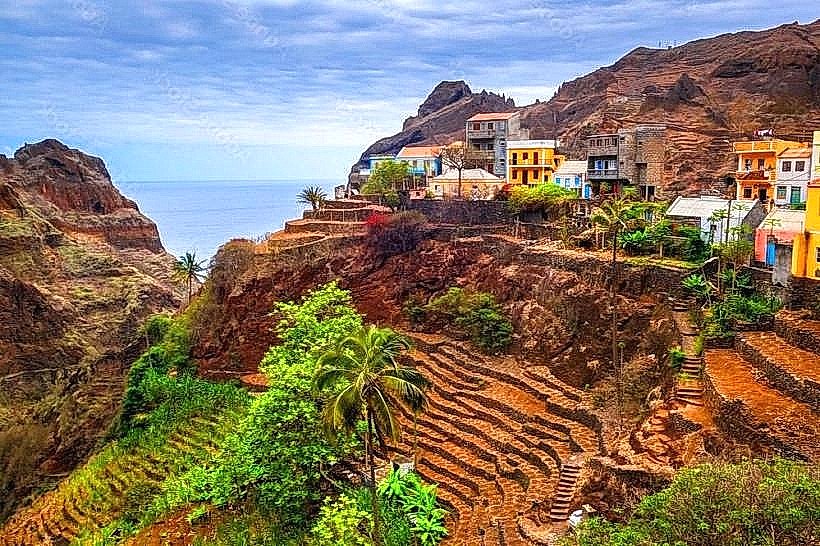
Fontainhas (4 km): A spectacular hike to a mountain village perched on a ridge.
Cruzinha (15 km): The destination of the famous northern coastal trail (approx. 5-hour hike).
Ribeira da Torre (8 km): A lush valley famous for banana and coffee plantations.
Facts & Legends
Ponta do Sol is often cited as the starting point for the "most beautiful hike in the world"-the coastal path to Cruzinha. A local legend says the town’s lighthouse is haunted by a former keeper who continues to watch for ships that never arrive. Historically, the town was so important that it once had its own consular representative for European nations, despite its tiny size.