Information
City: Porto InglesCountry: Cabo Verde
Continent: Africa
Porto Ingles, Cabo Verde, Africa
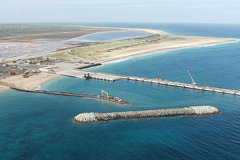
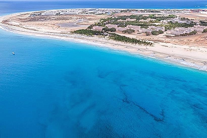
Porto Inglês serves as the administrative capital of Maio Island and functions as the primary maritime gateway for the island. It is situated on the southwest coast, positioned on a low-lying coastal plain adjacent to extensive salt flats and the Atlantic Ocean.
Historical Timeline
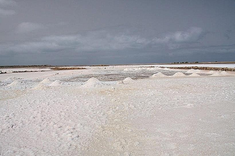
The settlement was established in the late 15th century and gained significance in the 17th century through the salt trade with British mariners. Primary eras of governance include the Portuguese colonial period and the post-1975 independence era. The town underwent its most significant architectural development during the peak of the salt industry in the 1800s. The current urban form was primarily shaped by the decline of the salt monopoly and the subsequent transition to a subsistence and artisanal fishing economy.
Demographics & Population
The town contains approximately 3,000 residents, representing nearly half of the island's total population. The demographics are predominantly Crioulo (Mestizo). The population is characterized by a significant diaspora influence, with many households supported by remittances from Europe and the United States. The median age is approximately 26 years.
Urban Layout & Key Districts
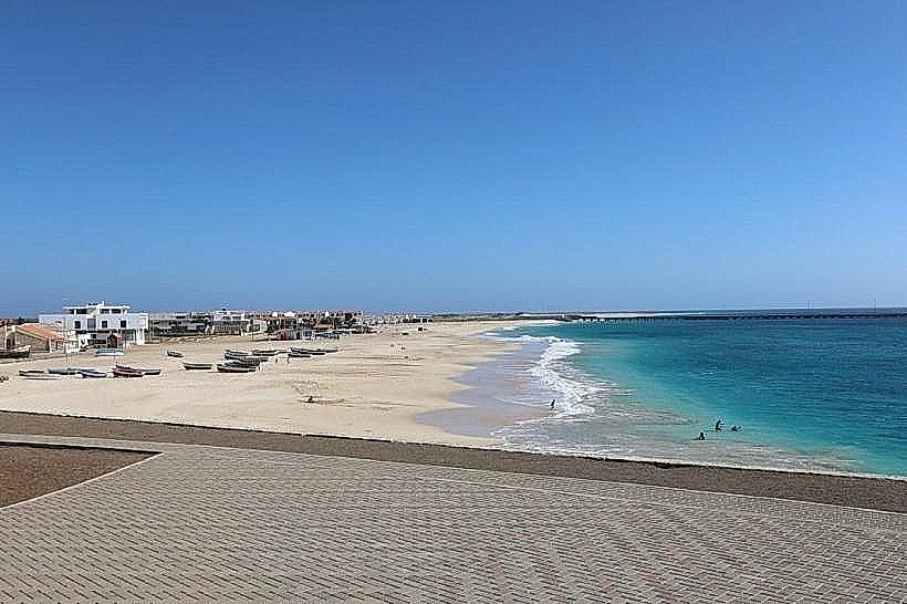
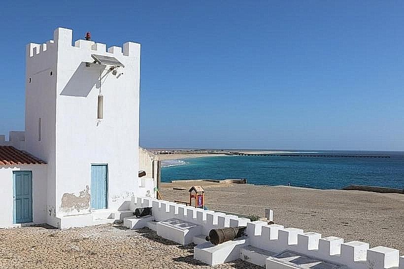
The city is organized around a central axis extending from the pier (Porto) to the main church. The two most important districts are the Historic Center (Bila), located at the coastal edge, and the newer residential expansions (Fontona) situated to the northeast. The town is physically bounded by the Forte de São José to the west and the Salinas (salt pans) to the north.
Top City Landmarks
Forte de São José (18th-century fortress)
Church of Nossa Senhora da Luz
The Salinas (Historical Salt Pans)
Porto Inglês Lighthouse
Avenida Amílcar Cabral (Main Waterfront)
Transportation Network
Movement within the town is almost entirely pedestrian due to its compact size. For island-wide travel, Aluguer (shared minibuses) depart from the central market. There is no metro or rail system. Taxis are blue and white, operating on fixed rates rather than meters. Traffic density is negligible.
Safety & "Red Zones"
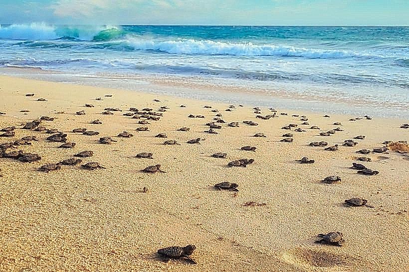
The general safety level is very high. Crime is statistically rare. There are no designated "red zones" or neighborhoods to avoid. Visitors should exercise standard caution regarding unattended belongings on the beaches (Praia da Vila).
Digital & Financial Infrastructure
Average internet speed is 20-30 Mbps (4G). Main mobile carriers are CV Móvel and T+. Card acceptance is very low; cash is the primary medium of exchange. There are two ATMs (Vinte4 network) located in the town center; these frequently run out of cash during weekends or holidays.
Climate & Air Quality
Temperatures range from 20°C–25°C in winter to 24°C–30°C in summer. The climate is semi-arid. Air quality is high, although Saharan dust (Bruma Seca) affects the area from December to March. The island is subject to strong trade winds (Alizeus), particularly between January and April.
Culture & Social Norms
Tipping is not expected but 5% is acceptable for exceptional service. Handshakes are the standard greeting, often accompanied by a light touch on the shoulder. Dress code is casual; however, entering government buildings or churches in swimwear is prohibited. Alcohol consumption is socially integrated through the use of "pontche" (honey and rum mixture).
Accommodation Zones
Bila (Town Center): Recommended for logistical proximity to the ferry port, restaurants, and the main beach.
Stella Maris Area: Recommended for elevated ocean views and a quieter, more secluded environment south of the center.
Local Cost Index
1 Espresso: 80 CVE ($0.78)
1 Standard Lunch: 700 CVE ($6.80)
1 Metro/Bus Ticket: 100 CVE ($0.97) - (Inter-village Aluguer rate)
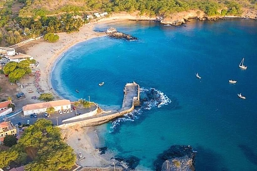
Nearby Day Trips
Calheta (12 km)
Morro (5 km)
Ribeira Dom João (18 km)
Barreiro (10 km)
Facts & Legends
A verified historical oddity is the city’s name itself; while officially Porto Inglês (English Port), locals almost exclusively refer to the town as "Vila" or "Cidade do Maio." The name Porto Inglês originated because British ships held a preferential monopoly on the island's salt exports for over a century. Local legend speaks of "hidden tunnels" beneath the Forte de São José, allegedly used by Portuguese soldiers to smuggle salt and gold during pirate raids, though no archaeological evidence has confirmed their existence beyond the fort's storage vaults.