Information
City: RichfieldCountry: USA Utah
Continent: North America
Richfield, USA Utah, North America
Richfield is the seat of Sevier County and the largest commercial center in South-Central Utah. Located in the Sevier Valley along the I-15 corridor, it serves as the primary service hub for a massive rural region spanning multiple counties. It is known as a gateway to the Fishlake National Forest and the world-famous "Paiute ATV Trail."
Historical Timeline
Originally inhabited by the Nuche (Ute) people. Settled in 1864 by LDS pioneers led by Albert Lewis, but the settlement was abandoned in 1867 during the Black Hawk War. It was resettled in 1870 and named for the region's exceptionally fertile soil. It evolved from a strictly agrarian community into a regional distribution and healthcare hub due to its strategic position between Salt Lake City and St. George.
Demographics & Population
The estimated 2026 population is 8,451.
Composition: 88.2% White, 6.1% Hispanic/Latino, 2.4% Native American, and 2.3% multiracial.
Economics: Median household income is $58,220. Major employers include Intermountain Sevier Valley Hospital and the Snow College Richfield campus.
Role: While its population is modest, Richfield provides retail and medical services for a catchment area of approximately 45,000 people.
Urban Layout & Landmarks
Main Street: A wide, classic Western thoroughfare featuring the historic Sevier County Courthouse and local businesses.
The "R" Mountain: A prominent hillside featuring a large white "R" overlooking the city.
Snow College Richfield: A technical and vocational campus specializing in high-demand trades.
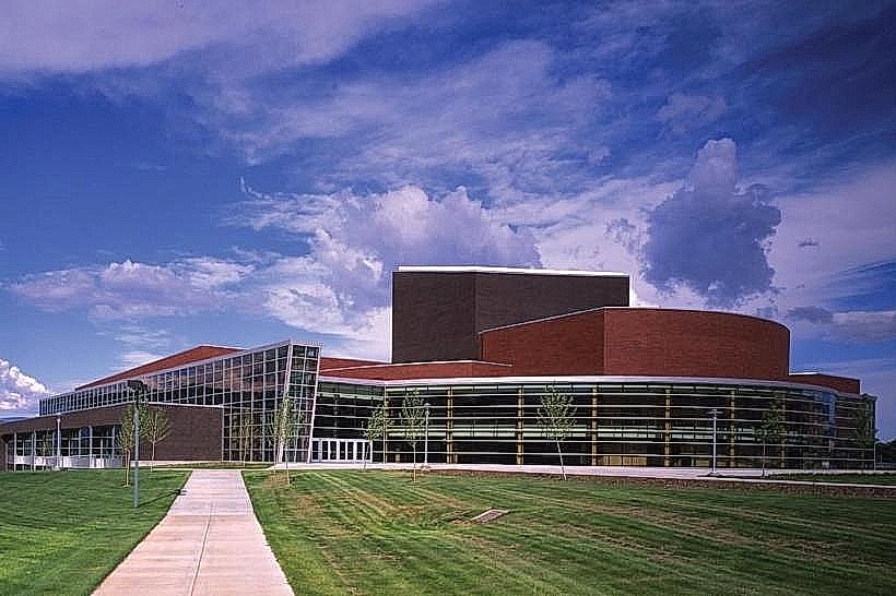
Sevier Valley Center: A multi-use arena and theater that serves as the region's primary venue for sports, graduations, and concerts.
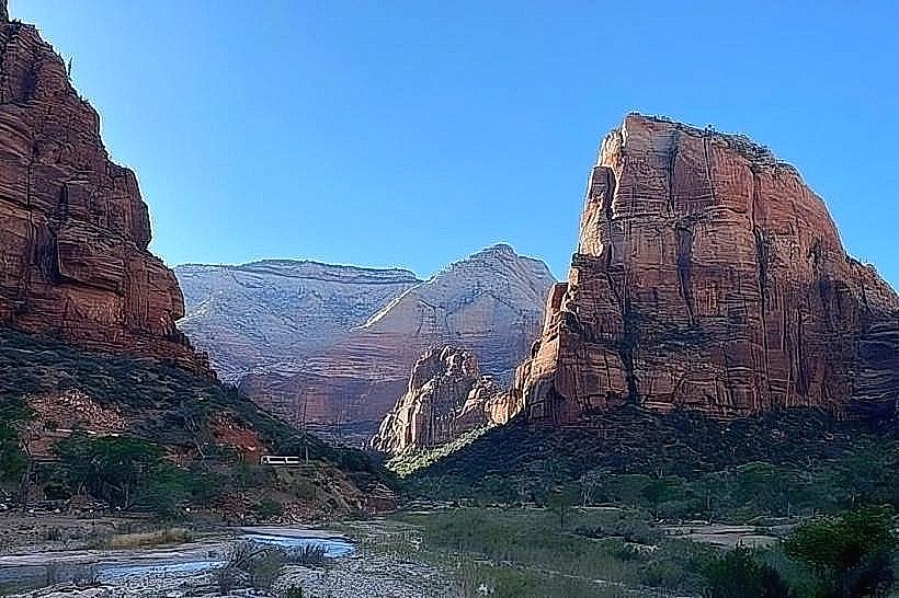
Regional Outdoor Access
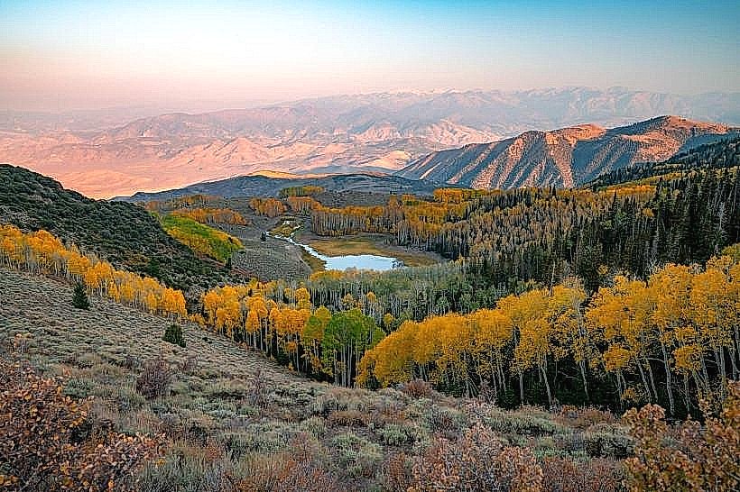
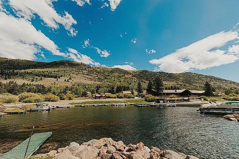
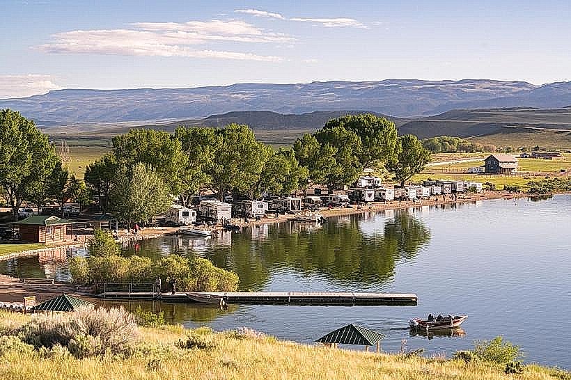
Fish Lake: Located 40 miles southeast; home to Pando, an 80,000-year-old quaking aspen colony that is the world’s most massive living organism.
Paiute ATV Trail: A 275-mile loop (with over 1,000 miles of side trails) that passes directly through Richfield, allowing riders to access city services via OHV-legal streets.
Fremont Indian State Park: Preserves the ruins and rock art of a large Fremont culture village discovered during I-70 construction.
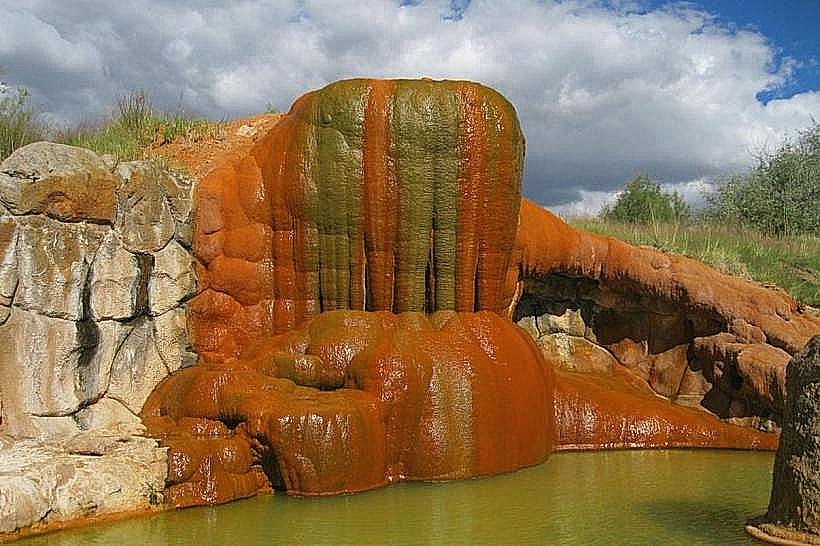
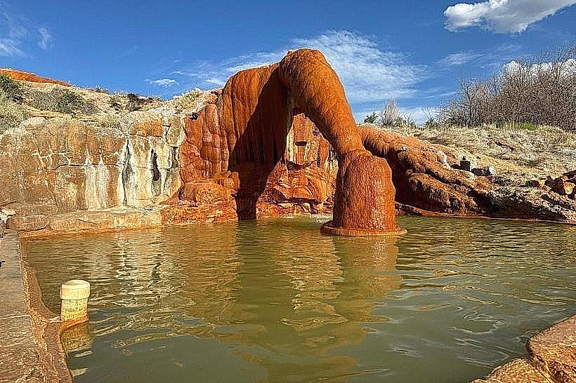
Big Rock Candy Mountain: A colorful geological formation located 20 miles south along the Sevier River.
Transportation & Infrastructure
Highways: Strategically located at the junction of I-15 and I-70, making it a vital stop for interstate trucking and travelers.
Aviation: Richfield Municipal Airport (RIF) serves general aviation and emergency medical flights.
2026 Infrastructure: The city is currently completing a major upgrade to its Secondary Water System to improve agricultural and residential drought resilience.
Safety & Environmental Alerts (Jan 26, 2026)
High Pressure/Inversion Warning: A strong winter inversion is currently trapping cold air in the Sevier Valley.
Air Quality: Moderate (AQI 58). Fine particulate matter ($PM_{2.5}$) is elevated due to wood-burning stoves and vehicle emissions trapped under the inversion layer.
Extreme Cold: Overnight lows are dropping to -15°C (5°F).
Travel Note: Black ice is reported on I-70 through Clear Creek Canyon; winter tires are recommended for mountain passes.
Climate & Air Quality
Richfield has a Cold Semi-Arid climate (BSk).
Conditions: Sunny but hazy due to the inversion; current temperature is -2°C (28°F).
Precipitation: The area is currently at 94% of its median snow water equivalent for the 2025–2026 winter season.
Local Cost Index
1 Espresso: $3.50 – $4.50
1 Standard Lunch: $14.00 – $22.00
Median Home Value: $342,000
Property Tax: Remains among the lowest for a city of its size in Utah.
Facts & Legends
Richfield is often called the "Center of Everywhere" due to its proximity to Utah’s national parks and forests. A verified fact: It was one of the first rural Utah towns to legally permit ATVs on city streets to boost tourism. A local legend involves the "Lost Gold of the Sevier," a rumored cache of Spanish gold supposedly buried in the foothills to the west during the 18th century, though no verifiable proof has ever been found.