Information
City: Rock SpringsCountry: USA Wyoming
Continent: North America
Rock Springs, USA Wyoming, North America
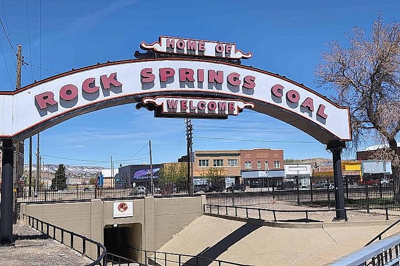
Rock Springs is an incorporated city in Sweetwater County, situated on the high desert plains of the Bitter Creek valley. Known as the "Home of 56 Nationalities," it is defined by its deep coal mining roots, its extreme ethnic diversity resulting from the Union Pacific Railroad's recruitment of global labor, and its role as a gateway to the high-desert wilderness of Southwest Wyoming.
Historical Timeline
Inhabited by the Shoshone and Ute peoples. A critical historical event occurred in 1885 with the Rock Springs Massacre, a violent labor conflict where white miners killed at least 28 Chinese miners and burned their homes; federal troops remained in the city until 1898 to maintain order. Founded in 1862 as a stage stop and formally incorporated in 1888 following the arrival of the Union Pacific Railroad. The city’s history is inextricably linked to the extraction of coal, which powered the transcontinental rail line. In 2026, the city remains a critical industrial hub for Trona mining (soda ash), oil, and natural gas.
Demographics & Population
The 2026 population is approximately 22,950. The demographics are White (80%), Hispanic or Latino (17%), and Two or more races (10%). The economy is driven by Mining and Extraction (Sweetwater County contains the world's largest trona deposit), Energy, Transportation, and Education (Western Wyoming Community College).
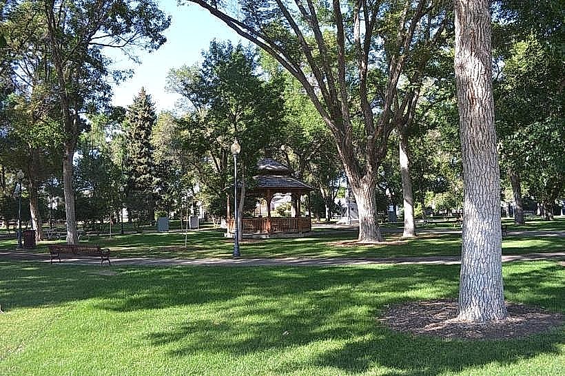
Urban Layout & Key Districts
Rock Springs is a sprawling, high-desert city bifurcated by the Union Pacific rail lines and I-80.
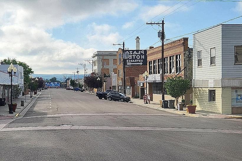
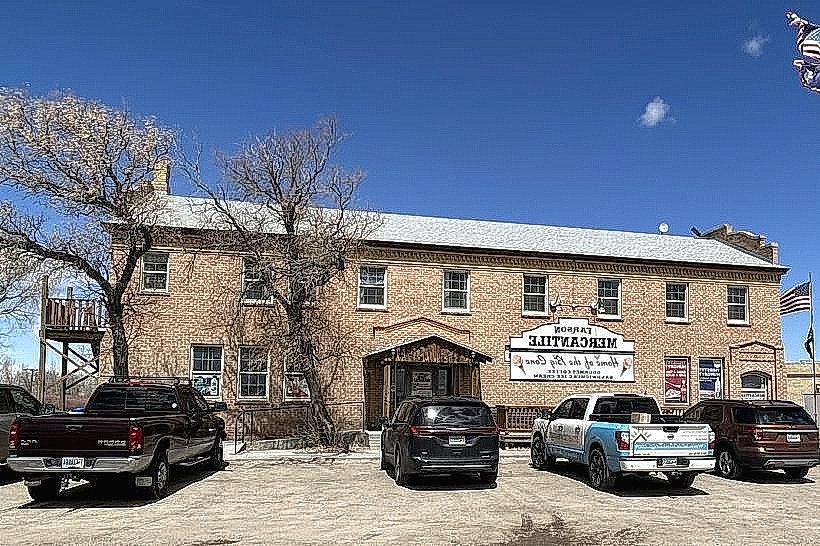
Downtown: The historic commercial core; characterized by 19th-century Romanesque architecture, the Broadway Theater, and the "underpass" culture that connects the north and south sides.
The North Side: Historically the immigrant residential district where different ethnicities settled in distinct blocks.
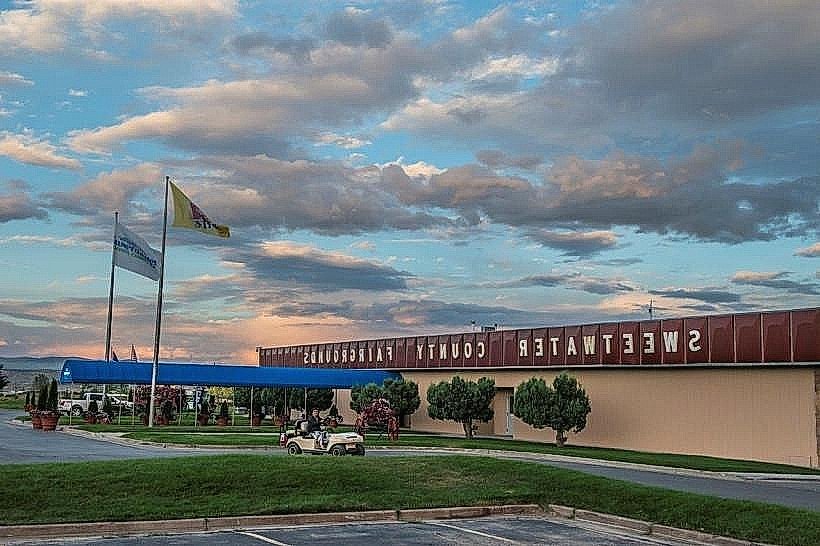
The South Side: Home to the Sweetwater Events Complex and modern residential expansions.
College District: Located on the western edge, centered around the Western Wyoming Community College (WWCC) campus.
Top City Landmarks
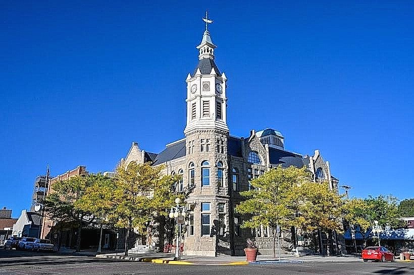
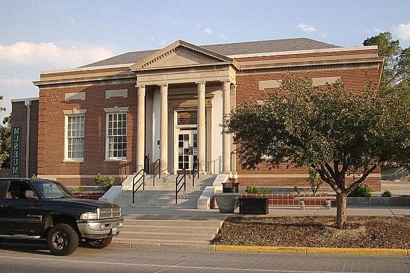
Rock Springs Historical Museum: Housed in the original 1894 stone City Hall; features extensive exhibits on the 56 nationalities and the city’s coal heritage.
WWCC Natural History Museum: Features five life-sized dinosaur casts and significant archaeological artifacts from the region’s prehistoric past.
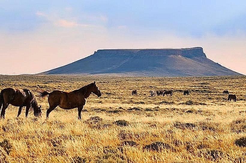
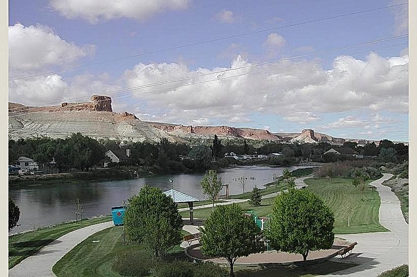
Pilot Butte Wild Horse Scenic Loop: A 37-km high-desert drive providing sightings of wild horse herds and panoramic views of the Green River Basin.
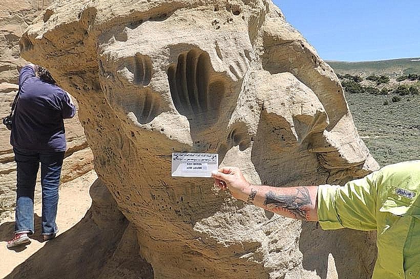
White Mountain Petroglyphs: (Located 25 km north); a 100-meter cliff face featuring hundreds of ancient carvings by Plains and Great Basin indigenous cultures.
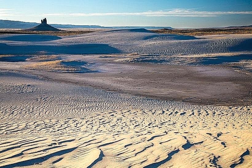
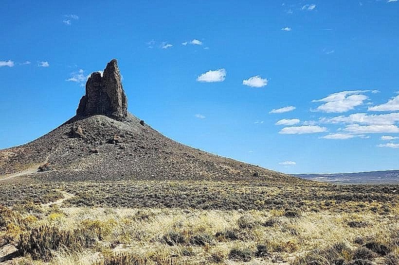
Killpecker Sand Dunes: (Located 40 km north); one of the largest active sand dune systems in the world, featuring "booming dunes" and the Boar’s Tusk volcanic neck.
Flaming Gorge National Recreation Area: (Located 40 km south); a massive reservoir and canyon system popular for "Blue Ribbon" trout fishing and watersports.
Transportation Network
Movement is automotive-centric. Rock Springs is a major stop on I-80 and is served by US-191. Public transit is provided by STAR Transit. Southwest Wyoming Regional Airport (RKS) offers commercial flights to Denver. There is no passenger rail service; the city remains one of the highest-volume freight rail corridors in the U.S.
Safety & "Red Zones"
The general safety level is moderate. As an industrial hub and transit stop on I-80, the city sees higher rates of property crime compared to rural Wyoming. Standard awareness is advised near the railroad corridor and industrial parks after dark. Environmental hazards include extreme wind speeds, intense alkaline dust storms, and winter whiteout conditions that frequently close I-80.
Digital & Financial Infrastructure
Internet speeds are high, with 1 Gbps fiber available via All West Communications and Spectrum. Mobile service is robust in the city but drops immediately upon entering the high-desert backcountry. Card acceptance is universal. Wyoming has no state income tax. Sweetwater County levies a 6% total sales tax.
Climate & Air Quality
Temperatures range from -12°C to 0°C in winter and 13°C to 29°C in summer. The city is semi-arid and exceptionally sunny (240+ days/year). Air quality is generally high, though regional dust and industrial emissions can occasionally affect visibility.
Culture & Social Norms
The standard tipping percentage is 20%. A "No-Nonsense-Multicultural" greeting is standard. Dress codes are "Industrial-Utility" (high-visibility gear and work boots are common). The city is culturally defined by Labor History, International Heritage, and High-Desert Resilience.
Local Cost Index
1 Espresso: $4.50 (USD)
1 Standard Lunch: $15.50 (USD)
1 Museum Admission: Free (donations accepted).
Nearby Day Trips
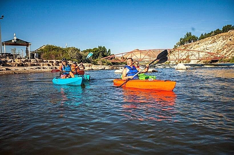
Green River, WY: (20 km west; known for the Expedition Island Park and river floating).
Fossil Butte National Monument: (115 km west; home to some of the world's best-preserved prehistoric fish fossils).
Seedskadee National Wildlife Refuge: (60 km northwest; a riparian oasis in the high desert).
Facts & Legends
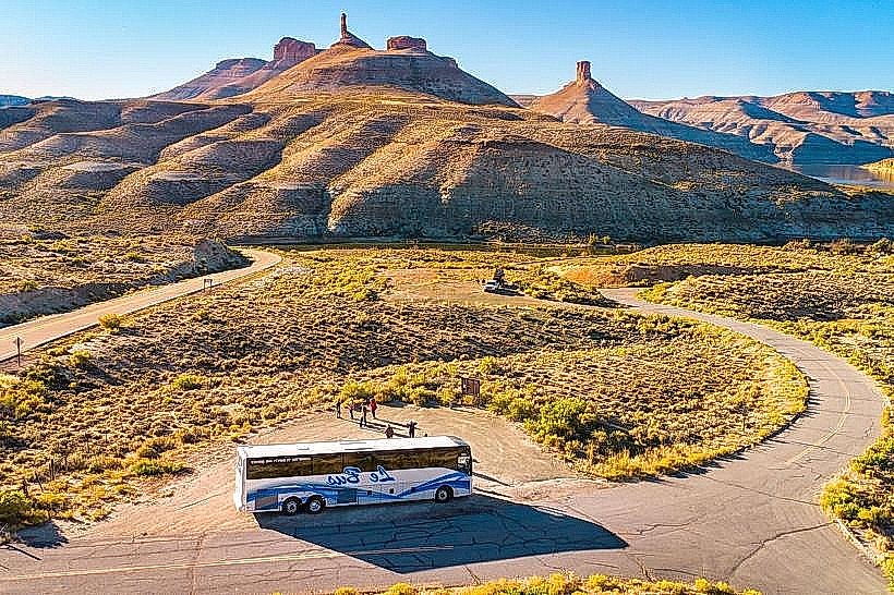
Rock Springs is where the outlaw Butch Cassidy earned his nickname while working at a local butcher shop (Robert LeRoy Parker became "Butch"). Historically, the city was the only place in the U.S. where the "International Day" festival originated to celebrate 56 different immigrant groups simultaneously. A local legend involves the "Underground Chinatown," rumored tunnels beneath the modern streets where survivors of the 1885 massacre allegedly sought refuge and lived in secrecy. Another legend concerns "Boar's Tusk," a 120-meter volcanic spire north of town said to be a spiritual focal point that causes compasses to fail.