Information
City: San IgnacioCountry: Belize
Continent: North America
San Ignacio, Belize, North America
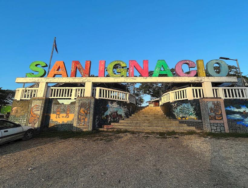
San Ignacio is the second-largest town in Belize and the cultural and economic heart of the Cayo District. Situated on the banks of the Macal River, it forms a twin-town urban area with neighboring Santa Elena. It is the primary gateway for adventure tourism and Mayan archaeological exploration.
Historical Timeline
Pre-Columbian: Originally a Maya center due to its proximity to the Mopan and Macal rivers.
19th Century: Established as a center for the extraction of chicle (chewing gum base) and mahogany.
1904: Formally recognized as a town by the British colonial administration.
2000s–Present: Evolved from an agricultural outpost into the "eco-tourism capital" of Belize.
Urban Layout & Districts
Burns Avenue: The town's main pedestrian artery, lined with tour operators, cafes, and artisanal shops.
The Hawkesworth Bridge: Completed in 1949, this is the only suspension bridge in Belize, connecting San Ignacio to Santa Elena.
San Ignacio Market: A major regional hub, particularly active on Saturdays, where local farmers, Mennonite producers, and artisans sell goods.
Top Landmarks & Attractions
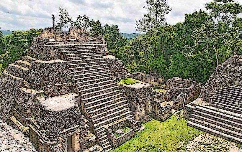
Cahal Pech: A Maya ceremonial center located on a hill overlooking the town; it is one of the oldest recognizable ruins in the Belize River Valley.
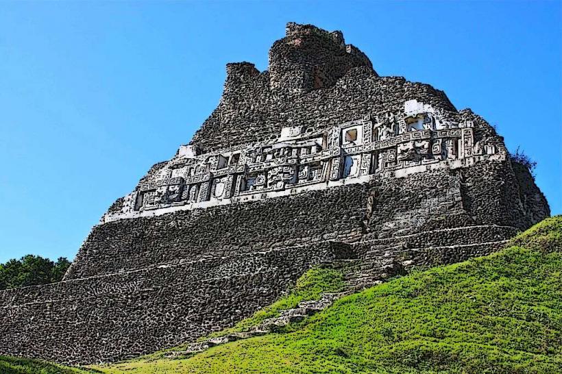
Xunantunich: Located 13 km west; features "El Castillo," a 40m pyramid. Access requires crossing the Mopan River via a hand-cranked ferry.
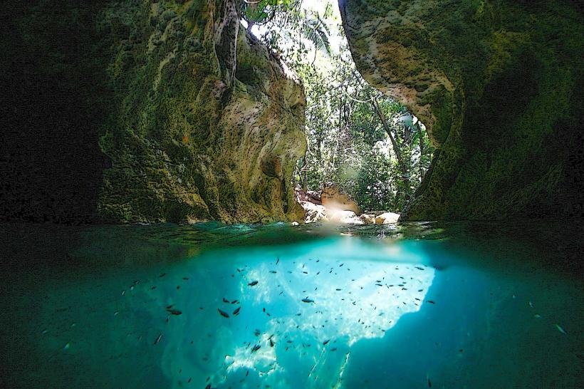
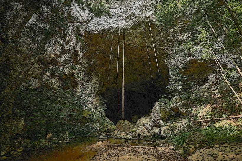
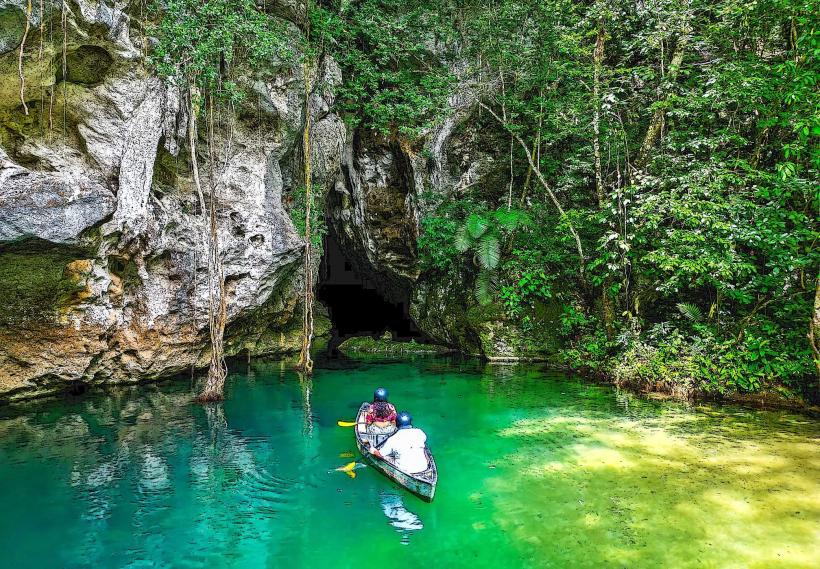
Actun Tunichil Muknal (ATM) Cave: A world-renowned subterranean site containing Maya pottery and skeletal remains, including the "Crystal Maiden."
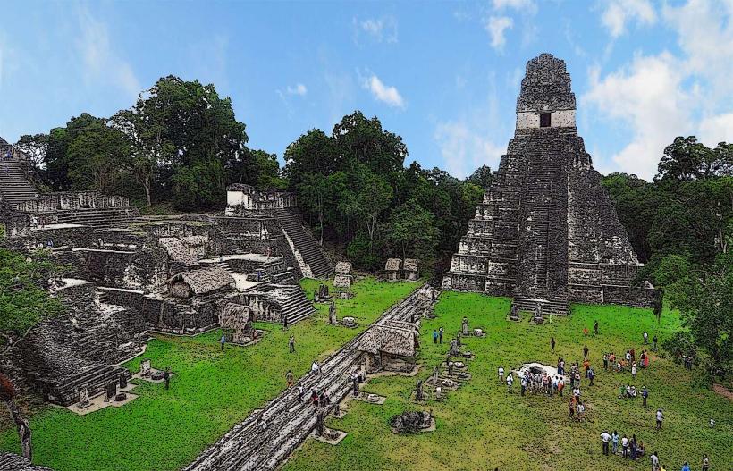
Caracol: The largest Maya site in Belize, located deep within the Chiquibul Forest Reserve, approximately 80 km south of town.
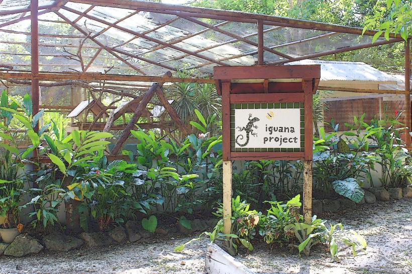
Iguana Conservation Project: Located at the San Ignacio Resort Hotel, dedicated to the protection of the Green Iguana.
Transportation & Logistics
Road: San Ignacio is situated on the George Price Highway, roughly 115 km (2 hours) from Belize City.
Public Transport: Frequent "chicken bus" service connects the town to Belmopan and Belize City.
Air: Served by the Maya Flats Airstrip, located 8 km west, for domestic flights to Belize City and the Cayes.
Safety & Health
Security: Generally safer than Belize City, though petty theft occurs. Solo hiking in remote areas near the Guatemalan border is discouraged due to occasional incidents involving illegal loggers.
Health: The San Ignacio Community Hospital provides public care; private clinics like La Loma Luz are located in Santa Elena.
Water: Tap water is treated but many travelers prefer bottled or filtered water to avoid stomach upset.
Digital & Financial Infrastructure
4G coverage is robust within the town center but dissipates rapidly in the surrounding jungle and cave systems. ATMs are plentiful on Burns Avenue (Atlantic Bank, Belize Bank, Heritage Bank). The exchange rate is fixed at $2.00 BZD = $1.00 USD.
Ecology & Climate
Geography: Set in the foothills of the Maya Mountains, the terrain is hilly and surrounded by broadleaf tropical forest.
Wildlife: Common sightings include toucans, howler monkeys, and leaf-cutter ants.
Climate: Notably more humid and slightly cooler at night than the coastal regions.
Local Cost Index
1 Espresso: ~$6.00 BZD ($3.00 USD)
1 Fry Jack Breakfast: ~$10.00 BBD ($5.00 USD)
1 ATM Cave Tour: ~$220.00 – $280.00 BZD ($110.00 – $140.00 USD)
Facts & Legends
A verified archaeological fact is that the name "Cahal Pech" translates to "Place of Ticks" in the Yucatec Maya language, a name given by researchers in the 1950s due to the infestation at the time. Local legend warns of the Xtabay, a malevolent spirit appearing as a beautiful woman with long hair who lures men into the jungle near the ruins to their disappearance.