Information
Landmark: Mountain Pine Ridge Forest ReserveCity: San Ignacio
Country: Belize
Continent: North America
Mountain Pine Ridge Forest Reserve, San Ignacio, Belize, North America
Mountain Pine Ridge Forest Reserve is a protected area located in the Cayo District of Belize, west of San Ignacio.
This reserve encompasses a significant portion of Belize's Maya Mountains, characterized by its unique pine-oak ecosystem.
Visual Characteristics
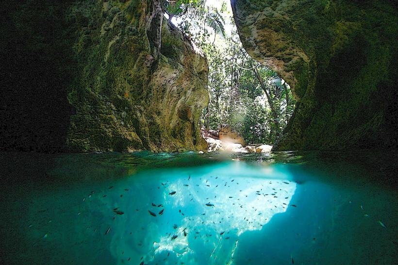
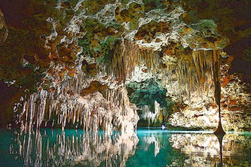
The landscape is dominated by extensive stands of Caribbean pine (Pinus caribaea) interspersed with oak species. The terrain is rugged, featuring steep hills, deep valleys, and numerous limestone caves. Elevation ranges from approximately 300 to over 1,000 meters (984 to 3,281 feet). Water features include rivers, streams, and waterfalls, often with clear, cool water flowing over granite and limestone formations. The undergrowth is typically sparse in pine-dominated areas and denser in broadleaf forest sections.
Location & Access Logistics
The reserve is situated approximately 30 kilometers (19 miles) southwest of San Ignacio. Access is primarily via the Mountain Pine Ridge Road, a gravel track that requires a 4x4 vehicle due to its condition, especially during the rainy season. The drive from San Ignacio takes approximately 1.5 to 2 hours. There is no public transport directly into the reserve. Limited parking is available at designated trailheads and visitor areas.
Historical & Ecological Origin
The reserve was established in 1944 to protect the native pine forests and their associated biodiversity. Ecologically, it represents a distinct subtropical pine forest ecosystem, unusual for Central America, which is more commonly characterized by tropical rainforest. The geology is primarily composed of ancient Maya Mountains granite and limestone, contributing to the formation of caves and karst topography.
Key Highlights & Activities
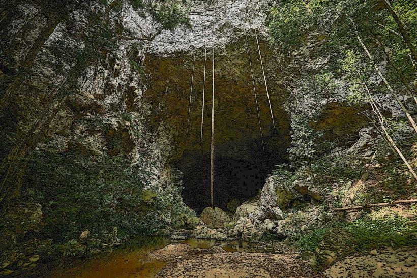
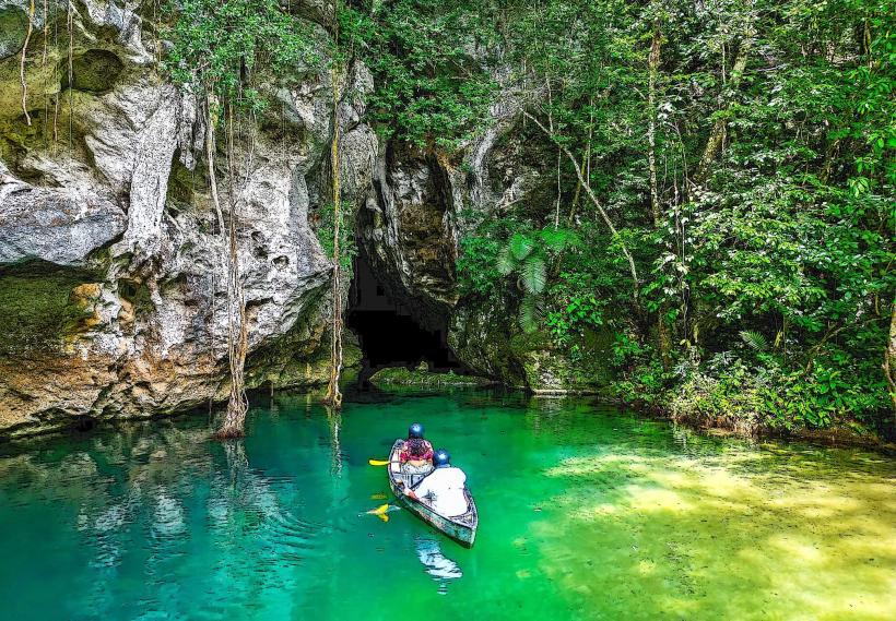
Activities include hiking on marked trails such as the Rio Frio Cave Trail and the Baldy Beacon Trail. Exploration of caves like Rio Frio Cave and Actun Tunichil Muknal (ATM Cave) is possible with certified guides. Birdwatching is a significant activity due to the diverse avian population. Swimming is permitted at designated waterfall areas, such as Big Rock Falls and Thousand Foot Falls (also known as Hidden Valley Falls).
Infrastructure & Amenities
Basic amenities are present. Restrooms are available at some key locations, including the park entrance and near major attractions like Rio Frio Cave. Shade is provided by the forest canopy in many areas. Cell phone signal is intermittent and generally unreliable within the reserve. Limited food and drink options may be available from small, local vendors near the park entrance or at lodges within or adjacent to the reserve, but visitors should plan to bring their own supplies.
Best Time to Visit
The dry season, from December to May, offers the most accessible conditions for travel within the reserve. The best time of day for photography is generally early morning or late afternoon for softer light. Water levels at waterfalls are typically higher after the rainy season (June to November), but access roads can be more challenging.
Facts & Legends
The reserve is home to the Belizean subspecies of the jaguar (Panthera onca). A specific local legend speaks of the "Lost City of the Maya," a mythical settlement rumored to be hidden deep within the reserve's unexplored cave systems, though no archaeological evidence has confirmed its existence.
Nearby Landmarks
- San Ignacio Town (30km Northeast)
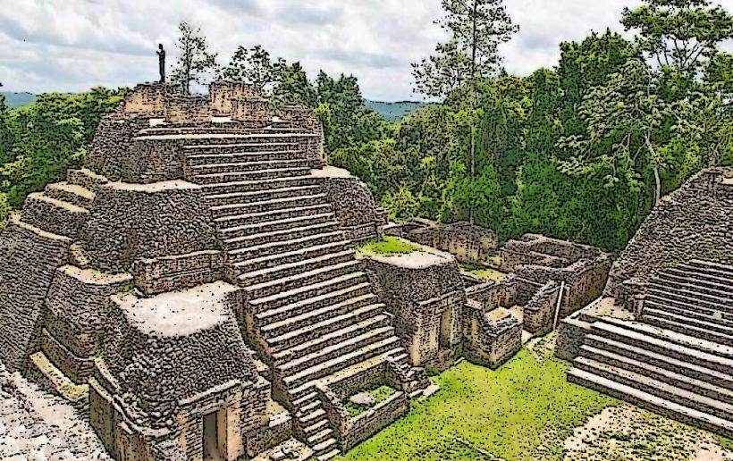
- Caracol Archaeological Site (45km Southwest)
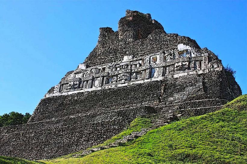
- Xunantunich Archaeological Site (35km Northeast)
- Actun Tunichil Muknal (ATM) Cave (Within reserve, 20km Southwest)
- Barton Creek Cave (25km Northeast)