Information
Landmark: Baraboo RangeCity: La Crosse
Country: USA Wisconsin
Continent: North America
Baraboo Range, La Crosse, USA Wisconsin, North America
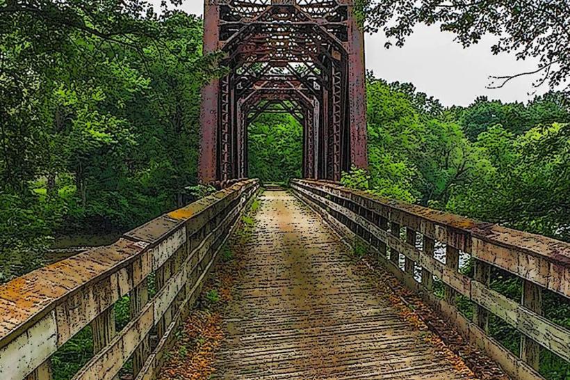
The Baraboo Range in south-central Wisconsin is a rare, ancient landscape with remarkable geological, ecological, and educational significance. It is centered near the town of Baraboo and stretches about 25 miles long and up to 10 miles wide, forming a distinct U-shaped ridge surrounding the Baraboo Valley. This area is part of the greater Driftless Region, which was largely untouched by the most recent glaciation.
Geological Significance
The Baraboo Range is one of the oldest exposed rock formations in North America. Its core is made of hard, purple quartzite, a metamorphic rock that originated as sandy sediments deposited in shallow seas approximately 1.7 billion years ago. Over time, these sediments were buried, compressed into sandstone, and later metamorphosed by intense heat and pressure into quartzite.
Tectonic forces folded the quartzite into a large syncline-a U-shaped geologic fold-and buried it beneath layers of younger rock. Over hundreds of millions of years, erosion stripped away these layers and exposed the ancient quartzite once again. Today, the Baraboo Range stands as a remnant of a Precambrian mountain range that has been worn down and revealed by natural forces.
During the last Ice Age, the glaciers covered only the eastern edge of the range, leaving the western side untouched. This makes the range part of Wisconsin’s Driftless Area, a region with deeply carved valleys, bluffs, and natural diversity due to the absence of glacial leveling. Glacial activity helped form Devil’s Lake by blocking natural drainage routes, creating a rare endorheic lake nestled between steep quartzite bluffs.
One of the most famous geological sites in the range is Van Hise Rock, just west of the city of Baraboo. This small but important outcrop helped geologist Charles Van Hise establish foundational theories about rock deformation and metamorphism.
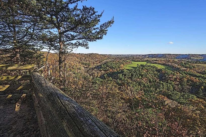
Topography and Natural Features
The range rises sharply from the surrounding countryside, with elevations climbing up to 800 feet above the Wisconsin River Valley. The terrain features dramatic ridges, steep cliffs, deep gorges, and narrow valleys. These features are most prominently visible in areas like:
Devil’s Lake State Park, where quartzite bluffs tower above a pristine lake.
Ableman’s Gorge, a canyon with visible folds and layers of ancient rock.
Parfrey’s Glen, Wisconsin’s first State Natural Area, with a lush ravine and moss-covered cliffs.
The rock exposures across the range provide some of the best examples of early continental geology in North America.
Ecological Richness
The Baraboo Range supports a diverse mosaic of habitats due to its varied elevation, slope aspect, soil types, and the mix of glaciated and unglaciated areas. The landscape includes:
Hardwood forests dominated by oak, maple, basswood, and birch.
Northern coniferous trees like white pine and eastern hemlock on cooler, shaded slopes.
Remnant prairies and oak savannas on dry, open hilltops and ridges.
Wetlands, seeps, and springs that support rare amphibians, reptiles, and plants.
This diversity makes the range a hotspot for biodiversity in Wisconsin. Over 1,800 species of plants and animals have been recorded, including a significant number of rare or threatened species. The combination of old-growth forest patches, glacial and non-glacial soils, and topographical variation supports habitats not typically found together in a single region.
Conservation and Recognition
In 1980, the Baraboo Range was designated a National Natural Landmark due to its outstanding geologic formations and biological significance. Conservation efforts have been ongoing for decades, involving partnerships between the Baraboo Range Preservation Association, The Nature Conservancy, state agencies, and private landowners.
Approximately 144,000 acres are considered part of the broader Baraboo Range ecosystem, with over 55,000 acres in relatively intact condition. Much of this land is protected through state parks, nature preserves, scientific study areas, and conservation easements.
Educational and Recreational Value
The range is a natural outdoor classroom for geologists, ecologists, and students. Field trips from universities across the country visit the area to study its ancient rock formations and varied ecosystems. Trails, observation points, and educational signage provide visitors with an opportunity to understand and appreciate the region’s complexity.
Recreational opportunities abound throughout the Baraboo Range. Popular activities include hiking, rock climbing, birdwatching, cross-country skiing, and photography. Devil’s Lake State Park, which lies within the range, is one of the most visited state parks in the Midwest.
In summary, the Baraboo Range is a landscape shaped by deep time and natural forces. It is both a geological treasure and an ecological sanctuary-an ancient ridge that continues to inspire scientific study, conservation efforts, and outdoor exploration.