Information
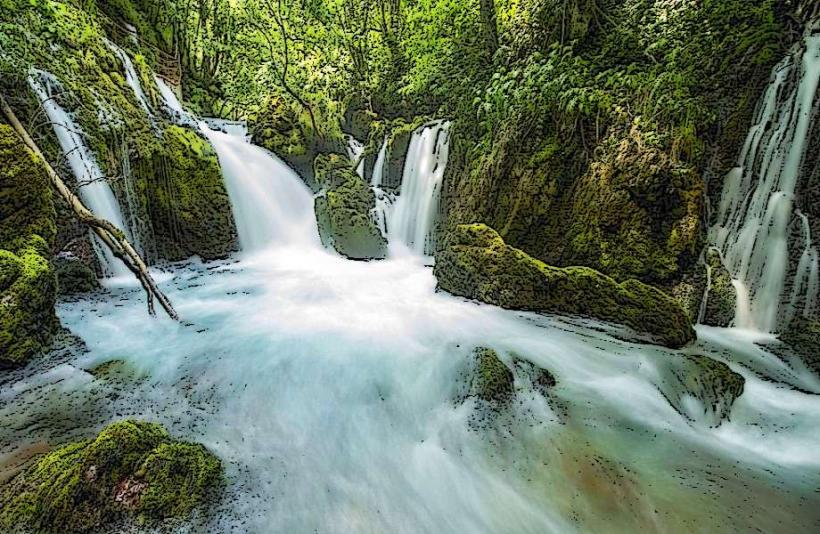
Landmark: Bogas WaterfallCity: Pec
Country: Kosovo
Continent: Europe
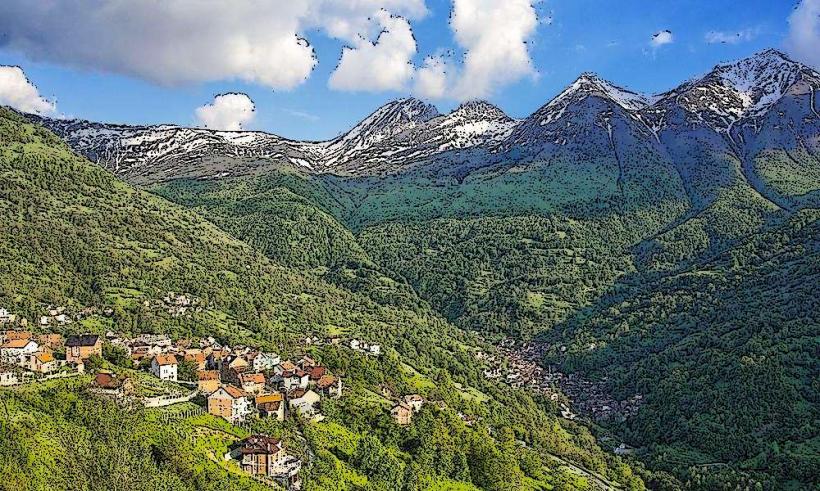
Bogas Waterfall, Pec, Kosovo, Europe
Bogas Waterfall (Ujëvara e Bogës) is a seasonal mountain cascade located in the Rugova Valley of the Accursed Mountains. It is situated approximately 30 kilometers west of the city of Peja, near the alpine village of Bogë at an elevation of roughly 1,400 meters.
Visual Characteristics
The waterfall features a narrow stream of water dropping approximately 15 meters over dark, moss-covered limestone rock faces. During peak flow, the water appears white and aerated, collecting in a small, shallow stony basin at the base. The surrounding landscape consists of dense coniferous forests, specifically silver fir and Bosnian pine, with sharp grey karst peaks visible above the tree line.
Location & Access Logistics
Access is via the M9 motorway from Peja, traveling 28 kilometers through the Rugova Canyon to the village of Bogë. From the main village road, a marked hiking trail leads approximately 2 kilometers to the waterfall site. Parking is available at local guesthouses or the "Boga" ski center parking lot. Daily minibuses (furgons) operate between the Peja bus station and Bogë village.
Historical & Ecological Origin
The waterfall is a nival-fluvial formation, meaning its primary water source is the melting snowpack from the Hajla and Shtedim mountain massifs. Geologically, it sits on Triassic limestone typical of the Dinaric Alps. The site is part of the Bjeshkët e Nemuna National Park, established to protect the high-altitude biodiversity and water sources of the region.
Key Highlights & Activities
Hiking is the primary activity on the trail connecting the village to the falls. Photography is common due to the dense forest backdrop. During late spring, the high water volume allows for observation of the local endemic flora along the stream banks. Snowshoeing to the frozen falls is a frequent winter activity.
Infrastructure & Amenities
There are no public restrooms or commercial facilities at the waterfall itself; these are located 2 kilometers away in Bogë village. Natural shade is continuous under the forest canopy. Cell phone signal (4G) is functional but may drop in the deepest parts of the ravine. Food vendors and restaurants are concentrated in the village center.
Best Time to Visit
The optimal period for visiting is May and June when snowmelt ensures maximum water volume. By late August, the waterfall may diminish to a trickle or dry up completely. For photography, midday provides the best overhead lighting through the thick canopy. Winter visits offer views of ice formations, provided the trail is accessible.
Facts & Legends
The waterfall is part of a complex hydrological system where water frequently disappears into underground karst channels only to resurface further down the Rugova Valley. Local mountaineers often use the site as a landmark for navigating toward the Hajla peak. A specific "secret" is the presence of rare alpine salamanders often found near the moist rocks at the base during early morning hours.
Nearby Landmarks
Hajla Peak – 4.5km Northwest
Boga Ski Center – 2.0km South
Rugova Canyon Entrance – 25.0km East
Guri i Kuq Lake – 5.0km Southwest