Information
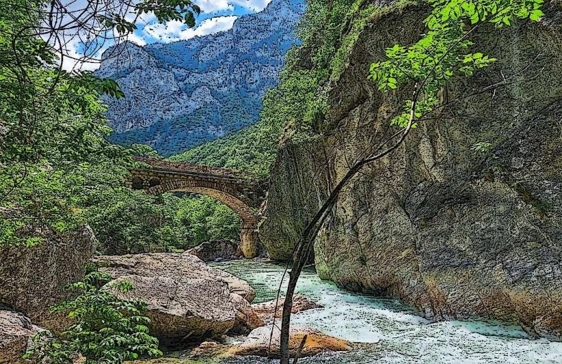
Landmark: Gjakova BridgeCity: Pec
Country: Kosovo
Continent: Europe
Gjakova Bridge, Pec, Kosovo, Europe
The Terzi Bridge (Ura e Terzive) is an 18th-century Ottoman stone arched bridge spanning the Erenik River. It is located approximately 35 kilometers south of Peja (Pec) and 7 kilometers outside the city center of Gjakova.
Visual Characteristics
The bridge is constructed from local grey and yellowish hewn stone blocks and features 11 arches with a total length of 190 meters. The structure is approximately 3.5 meters wide and reaches a height of 7 meters above the riverbed. It is characterized by its asymmetric "camel-back" profile and the inclusion of niche-like decorative windows (spandrels) between the primary arches to reduce water pressure during floods.
Location & Access Logistics
The bridge is situated on the R107 regional road connecting Gjakova to Prizren, specifically in the village of Bishtazhin. From Peja, follow the M9.1 and R107 highways for approximately 50 minutes. There is no formal parking lot, but vehicles can park on the gravel shoulders of the main road near the bridge entrance. Intercity buses between Gjakova and Prizren stop upon request at the Bishtazhin junction.
Historical & Ecological Origin
The bridge was originally built in the 15th century but was extensively reconstructed and expanded in the 18th century by the Tailors' Guild (Terzit) of Gjakova. Its primary purpose was to facilitate trade on the "Silk Road" route between Shkodër and Constantinople. It is designated as a Monument of Culture of Exceptional Importance.
Key Highlights & Activities
Walking across the original stone pavers is the primary activity, as the bridge is now closed to motorized traffic. Landscape photography is frequent from the riverbanks to capture the symmetry of the 11 arches. The surrounding river area is used for local fishing and seasonal picnicking on the grassy eastern bank.
Infrastructure & Amenities
There are no public restrooms, visitor centers, or formal shaded areas at the site. 4G/5G mobile signal is strong and consistent throughout the area. Food vendors and small grocery shops are located in Bishtazhin village, roughly 400 meters from the bridge.
Best Time to Visit
The best time for photography is late afternoon (16:00 – 18:00) when the low sun angle highlights the texture of the masonry and creates reflections in the Erenik River. The site is accessible year-round, though spring (April–May) offers the highest water levels beneath the arches.
Facts & Legends
The bridge is named after the Tailors' Guild, which entirely funded its 18th-century expansion to ensure their trade caravans could cross the river safely during winter floods. A local technical "secret" is the use of lead and iron clamps to bind the largest stones together, a technique that has allowed the bridge to survive multiple major seismic events and military conflicts.
Nearby Landmarks
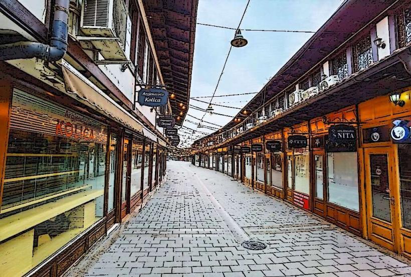
Gjakova Grand Bazaar – 7.0km Northwest
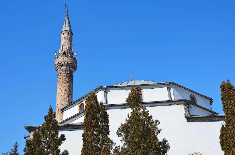
Hadum Mosque – 7.2km Northwest
Erenik River Confluence – 4.5km Southeast
Bishtazhin Church – 0.6km North