Information
Landmark: Cerro BaúlCity: Moquegua
Country: Peru
Continent: South America
Cerro Baúl, Moquegua, Peru, South America
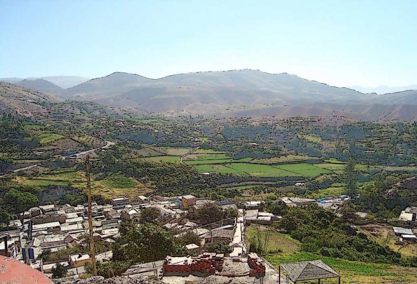
Cerro Baúl is a flat-topped mountain located approximately 15 kilometers northwest of the city of Moquegua, Peru.
Visual Characteristics
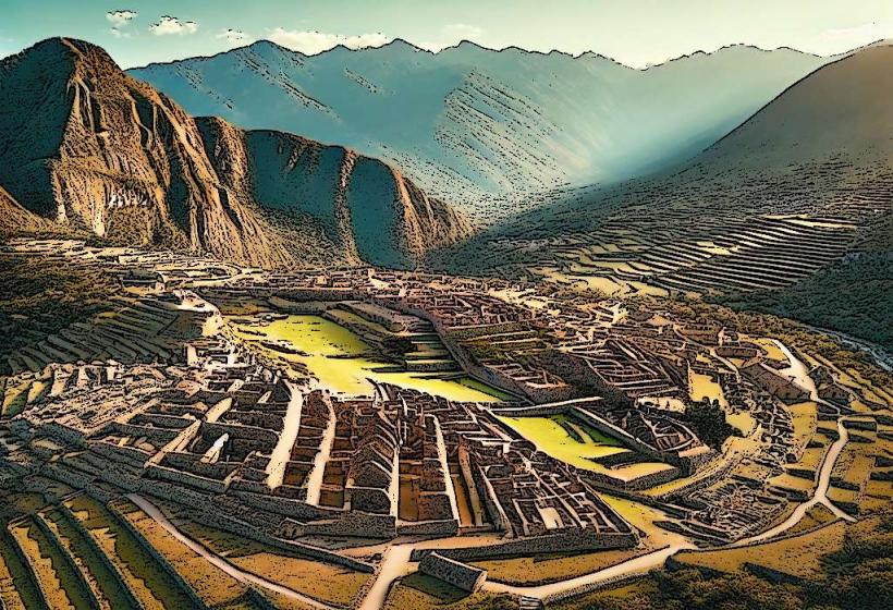
The summit of Cerro Baúl is a mesa, characterized by a level plateau with steep, eroded sides. The rock formations are primarily sedimentary, exhibiting layers of sandstone and conglomerate. Vegetation on the slopes is sparse, consisting of xerophytic shrubs and grasses adapted to arid conditions. The plateau itself is largely barren, with exposed rock and soil.
Location & Access Logistics
Access to Cerro Baúl is via the Moquegua-Cuajone road (PE-16A). The turnoff for the site is approximately 10 kilometers from Moquegua. From the turnoff, a dirt track extends for about 5 kilometers to the base of the mesa. This track is generally passable by 4x4 vehicles. Parking is available at the base of the mesa. Public transport does not directly service Cerro Baúl; private vehicles or organized tours are required.
Historical & Ecological Origin
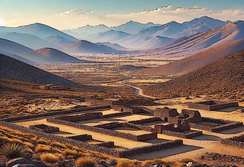
Cerro Baúl is a geological formation, a remnant of an ancient riverbed or lacustrine environment that has been uplifted and eroded. Its flat summit is a result of differential erosion, where a harder caprock protected the underlying softer sediments. Historically, the site was utilized by pre-Inca cultures, notably the Estuquiña people, who established a ceremonial center on the plateau. The Inca later occupied the site, constructing fortifications and administrative buildings around the 15th century.
Key Highlights & Activities
Exploration of the Inca ruins on the summit plateau is the primary activity. This includes viewing the remains of walls, plazas, and ceremonial structures. Hiking to the summit requires navigating the steep slopes. Archaeological interpretation of the site is ongoing.
Infrastructure & Amenities
There are no permanent infrastructure or amenities at Cerro Baúl. Visitors should carry all necessary water and food. Cell phone signal is unreliable to non-existent on the plateau and slopes.
Best Time to Visit
The best time of day for visiting is during the morning or late afternoon to avoid the midday sun. The dry season, from April to October, offers the most favorable weather conditions with minimal rainfall. The site is accessible year-round, but road conditions can deteriorate after heavy rains.
Facts & Legends
The name "Baúl" translates to "trunk" or "chest," likely referring to the flat, box-like shape of the mesa. Archaeological evidence suggests that the Inca used Cerro Baúl as a strategic administrative and religious center, controlling trade routes in the region. A specific architectural feature is the presence of a small, well-preserved Inca ushnu (ceremonial platform) on the summit.
Nearby Landmarks
- Estuquiña Archaeological Site (0.8km Southeast)
- Cuajone Mine (12km Northwest)
- Cerro Colorado Archaeological Site (18km Southwest)
- Moquegua City Center (15km Southeast)