Information
Landmark: Copper Falls State ParkCity: Green Bay
Country: USA Wisconsin
Continent: North America
Copper Falls State Park, Green Bay, USA Wisconsin, North America
Copper Falls State Park is a protected natural area located in the northern part of Wisconsin, near the city of Mellen.
This park features a series of waterfalls and gorges carved into the ancient lava flows of the Penokee Range.
Visual Characteristics
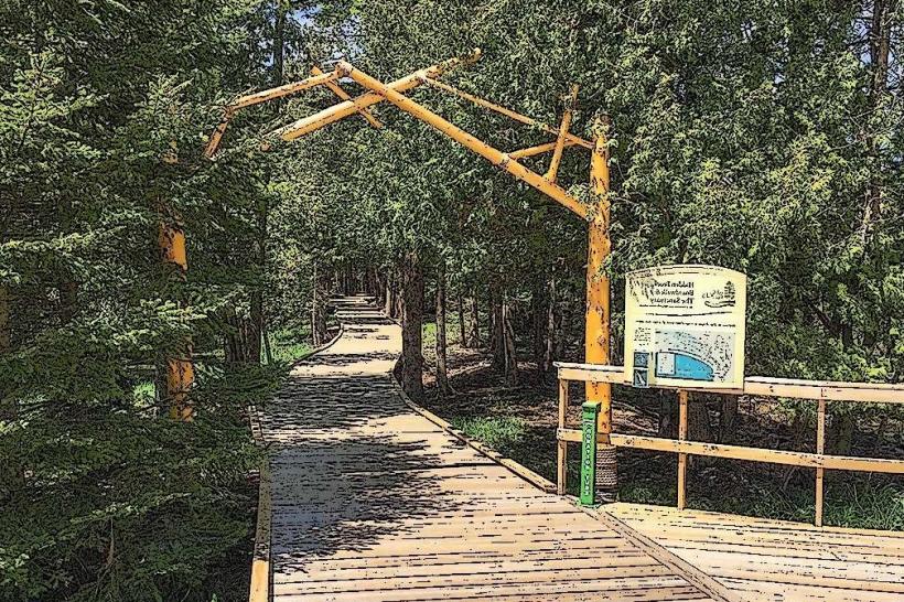
The park's primary features are the waterfalls, including Copper Falls and Brownstone Falls, which cascade over reddish-brown sandstone cliffs. The Bad River flows through a deep gorge, with sheer rock walls reaching up to 100 feet. The surrounding vegetation consists of mature hemlock and hardwood forests, with dense undergrowth in many areas. The water color varies from clear to a reddish-brown hue, depending on recent rainfall and sediment levels.
Location & Access Logistics
Copper Falls State Park is situated approximately 3 miles northeast of Mellen, Wisconsin. Access is via State Highway 13, turning onto County Road C. The park entrance is clearly marked. Ample parking is available at the main visitor center and at trailheads throughout the park. No public transport directly serves the park; private vehicle is the primary mode of access.
Historical & Ecological Origin
The geological formations in Copper Falls State Park are the result of ancient volcanic activity, specifically lava flows from the Penokee Range, which occurred over a billion years ago. Subsequent erosion by the Bad River over millennia has carved the present-day gorges and waterfalls. The park was established in 1908 to preserve these unique geological features and the surrounding old-growth forest.
Key Highlights & Activities
Visitors can hike the 1.7-mile Doughboy Trail, which circles the gorge and offers views of Copper Falls and Brownstone Falls. The 2.7-mile Red Granite Falls Trail leads to a more remote waterfall. Observation platforms are positioned at key viewpoints. Picnicking is permitted in designated areas. Camping facilities are available, including campsites and cabins. Fishing is permitted in the Bad River, subject to state regulations.
Infrastructure & Amenities
Restrooms are available at the main park office and at several trailheads. Sheltered picnic areas with tables and grills are provided. Cell phone signal is intermittent within the park, with limited coverage in deeper gorge areas. A small park store near the entrance offers basic supplies and snacks. No on-site food vendors are present within the park boundaries.
Best Time to Visit
For optimal waterfall viewing, spring (April-May) and early summer (June) are recommended, as snowmelt and rainfall increase water flow. Autumn (September-October) offers fall foliage colors. Midday lighting can be harsh for photography; early morning or late afternoon provides softer light. High tide is not a relevant factor for this inland park.
Facts & Legends
The name "Copper Falls" is derived from the reddish-brown color of the sandstone cliffs, which can resemble copper. Local folklore suggests that the area was once a sacred site for indigenous tribes, who believed the waterfalls possessed healing properties. A specific tip for visitors: the less-trafficked Red Granite Falls Trail requires sturdy footwear due to uneven terrain.
Nearby Landmarks
- Amnicon Falls State Park (25km Northwest)
- Pattison State Park (35km Southwest)
- Chequamegon-Nicolet National Forest (Adjacent)
- Iron County Historical Museum (4km Southwest)