Information
Landmark: Etosha LookoutCity: Tsumeb
Country: Namibia
Continent: Africa
Etosha Lookout, Tsumeb, Namibia, Africa
The Etosha Lookout is a designated viewing point located in the central region of the Etosha Pan within Etosha National Park, Namibia. It is positioned at the terminus of a specialized gravel cul-de-sac that extends approximately 4km into the saline basin from the primary northern transit road.
Visual Characteristics
The site is characterized by a 360-degree horizon of white, salt-crusted clay and calcrete. The surface is entirely devoid of vegetation, featuring a flat, cracked mud texture with extreme solar reflectivity. Optical illusions, specifically mirages, are frequently visible across the pan floor due to intense heat convection.
Location & Access Logistics
The lookout is accessed via a gravel spur road branching off the main route between the Halali and Namutoni rest camps. It is situated roughly 75km east of Okaukuejo and 12km north of Halali. Visitors are permitted to exit their vehicles only at the designated turnaround circle at the end of the spur road; driving off the demarcated track onto the pan surface is strictly prohibited.
Historical & Ecological Origin
The lookout sits upon a remnant of a massive paleolake system that formed during the Pliocene epoch. Geologically, the pan was created when tectonic shifts diverted the Kunene River away from the basin, leading to the desiccation of the standing water and the accumulation of salt and clay deposits. The site was integrated into the park's tourism infrastructure following the region's proclamation as a game reserve in 1907.
Key Highlights & Activities
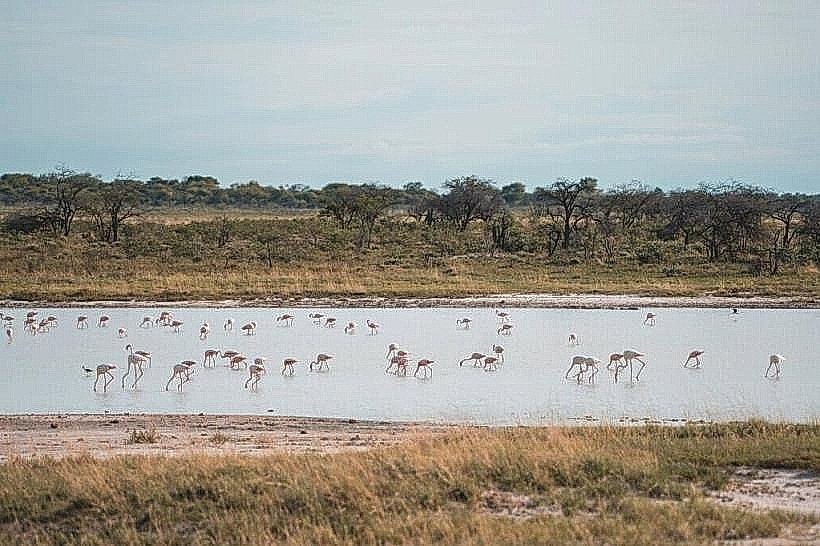
The primary activity is the panoramic observation of the pan's vastness and the photography of the horizon line. Birdwatching is possible during the wet season when the pan may hold a thin layer of water, attracting flamingos and other migratory species. Wildlife sightings are rare but include nomadic predators or elephants traversing the salt flats.
Infrastructure & Amenities
The site lacks all physical infrastructure; there are no restrooms, shade structures, or seating areas. Cellular signal (MTC 4G) is weak or non-existent due to the distance from camp base stations. Full amenities, including fuel and food, are located 12km south at Halali Rest Camp.
Best Time to Visit
The dry season (May to October) ensures the road remains accessible and the pan surface is bone-dry. Sunrise and sunset are the optimal times for photography to capture long shadows and color gradients across the white calcrete. During the rainy season (January to March), the spur road is frequently closed to prevent vehicles from becoming bogged in saturated clay.
Facts & Legends
The Etosha Lookout is one of the few places in the world where the curvature of the Earth is visible to the naked eye on land due to the total lack of vertical obstructions. Local legend suggests the pan was formed by the tears of a grieving woman whose village was destroyed, though geologically it is a terminal playa of the Cuvelai drainage system.
Nearby Landmarks
Salvadora Waterhole – 4.2km South
Sueda Waterhole – 4.8km Southwest
Halali Rest Camp – 11.9km South
Nuamses Waterhole – 3.9km Southeast