Information
Landmark: Grosse Scheidegg TrailCity: Grindelwald
Country: Switzerland
Continent: Europe
Grosse Scheidegg Trail, Grindelwald, Switzerland, Europe
The Grosse Scheidegg Trail is a high-altitude hiking route connecting the First summit station (2,168m) to the Grosse Scheidegg pass (1,962m). It is recognized as one of the most accessible panoramic trails in the Bernese Oberland.
Visual Characteristics
The trail follows a relatively flat contour along the southern slopes of the Schwarzhorn range. It features unobstructed, horizontal views of the "Bernese Trilogy" (Eiger, Mönch, Jungfrau) and the sheer vertical north face of the Wetterhorn. The terrain consists of wide gravel paths, alpine meadows, and sections of scree. Vegetation includes low-lying alpine shrubs, wildflowers, and scattered larch trees at lower elevations.
Location & Access Logistics
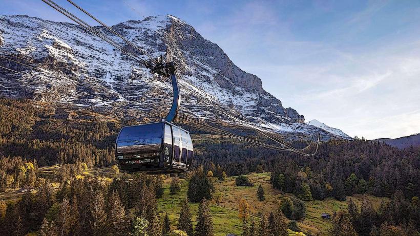
The standard route starts at the First gondola station and ends at the Grosse Scheidegg pass.
Distance: 5.5 kilometers.
Duration: 1 hour 30 minutes to 2 hours (one way).
Gradient: Mostly downhill or flat when hiking from First to Grosse Scheidegg.
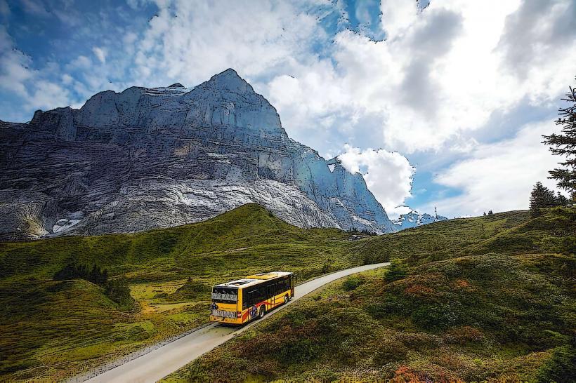
Transport: Take the gondola from Grindelwald to First. At the end of the trail, take the PostBus (Line 128) from Grosse Scheidegg back down to Grindelwald. Note: PostBus reservations are recommended during peak July/August periods.
Historical & Ecological Origin
The trail follows ancient livestock paths used for "Alpabzug" (seasonal cattle movement). Geologically, the path traverses the boundary between the sedimentary limestone of the Prealps and the crystalline basement of the High Alps. The area is part of the Jungfrau-Aletsch UNESCO World Heritage site and is a frequent sighting location for alpine marmots.
Key Highlights & Activities
Panoramas: Continuous views of the Upper Grindelwald Glacier and the Grindelwald valley.
Flora: High biodiversity of alpine flora, including gentians and globeflowers, particularly in June and July.
Wildlife: Numerous marmot colonies are active in the rocky sections near the Schreckfeld area.
Photography: The approach to the Wetterhorn near the end of the trail provides a unique perspective of the mountain's massive scale.
Infrastructure & Amenities
The trail is well-signposted with yellow Swiss hiking markers.
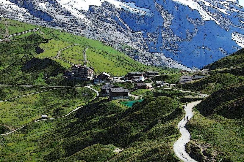
Dining: Restaurants are located at the start (First), midpoint (Schreckfeld), and end (Berghotel Grosse Scheidegg).
Water/Restrooms: Available only at the mountain stations/hotels; there are no facilities on the trail itself.
Connectivity: 5G cellular coverage is maintained along the entire route.
Accessibility: The path is a wide "Wanderweg" (hiking path) suitable for most fitness levels and robust strollers, though it is not classified as fully wheelchair accessible due to gravel sections.
Best Time to Visit
The trail is typically accessible from mid-June to late October, depending on snowmelt. Optimal lighting for the Eiger and Wetterhorn occurs in the late afternoon. Early morning (09:00) is recommended to avoid the midday sun, as the southern exposure provides no natural shade.
Facts & Legends
A verified geological feature along the trail is the "Upper Grindelwald Glacier" viewpoint, which demonstrates the rapid glacial retreat over the last 30 years. Local legend suggests that the Wetterhorn, which looms over the end of the trail, was once considered the "Peak of Storms" because it is often the first mountain to be shrouded in clouds before a weather change.
Nearby Landmarks
Bachalpsee – 3.0km North (via detour from First)
Wetterhorn – 1.0km East (Visual)
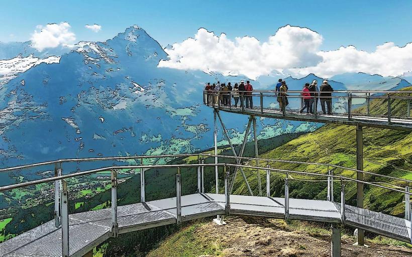
First Cliff Walk – 0.1km from Trailhead
Upper Grindelwald Glacier – 3.0km South (Visual)
Schreckhorn – 8.0km South (Visual)