Information
Landmark: Isla de la ProvidenciaCity: San Andres
Country: Colombia
Continent: South America
Isla de la Providencia, San Andres, Colombia, South America
Isla de la Providencia is a Colombian island located in the western Caribbean Sea, approximately 90 kilometers northwest of San Andrés Island.
Visual Characteristics
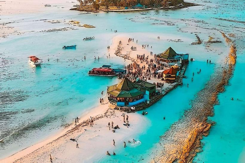
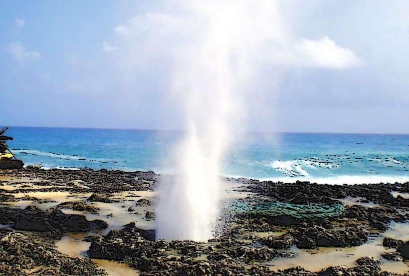
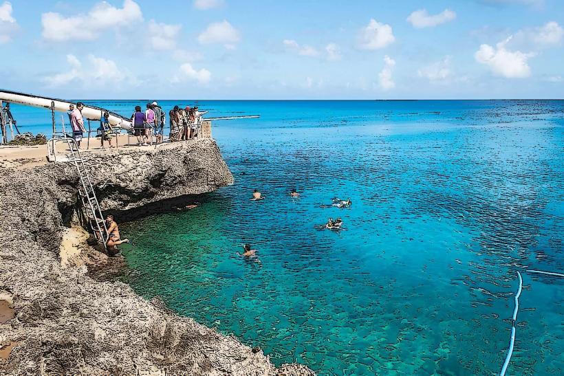
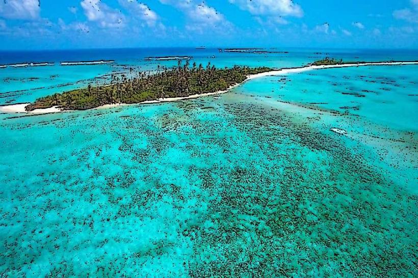
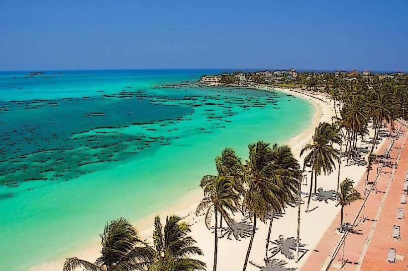
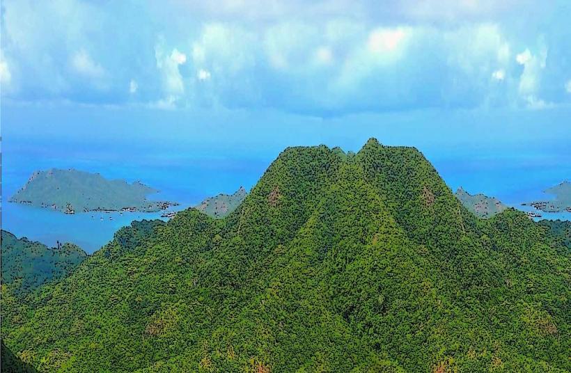
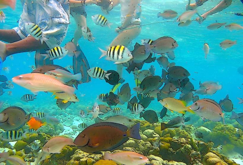
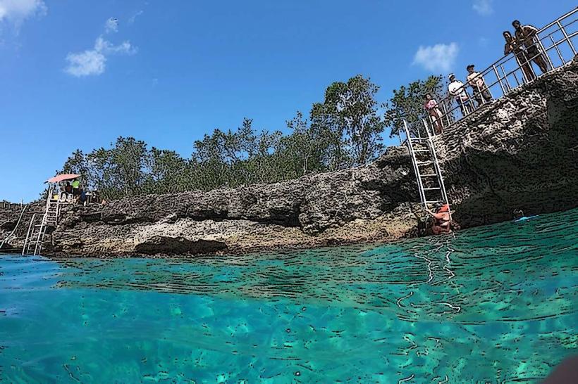
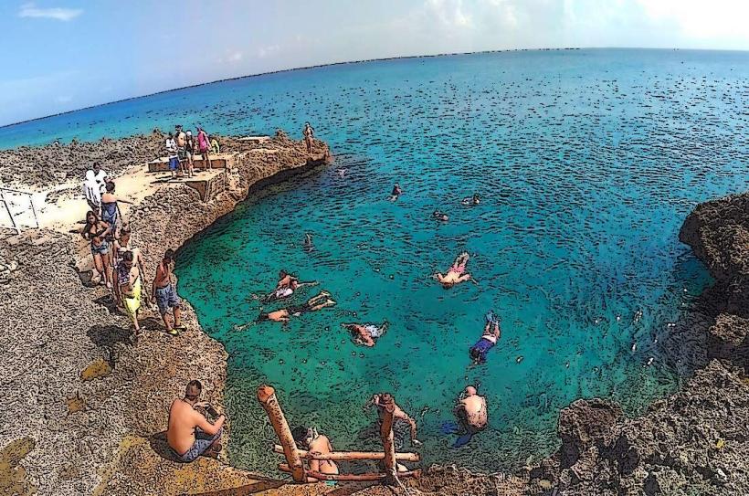
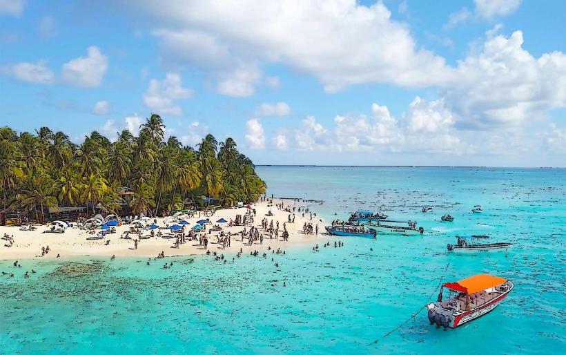
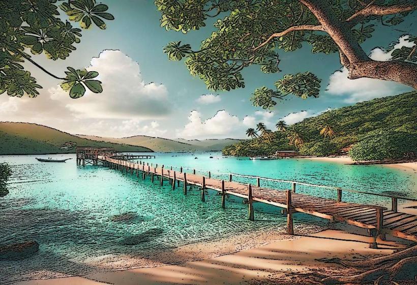
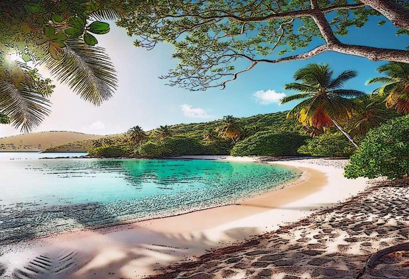
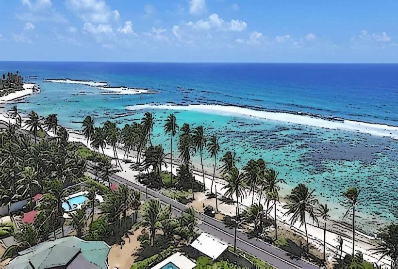
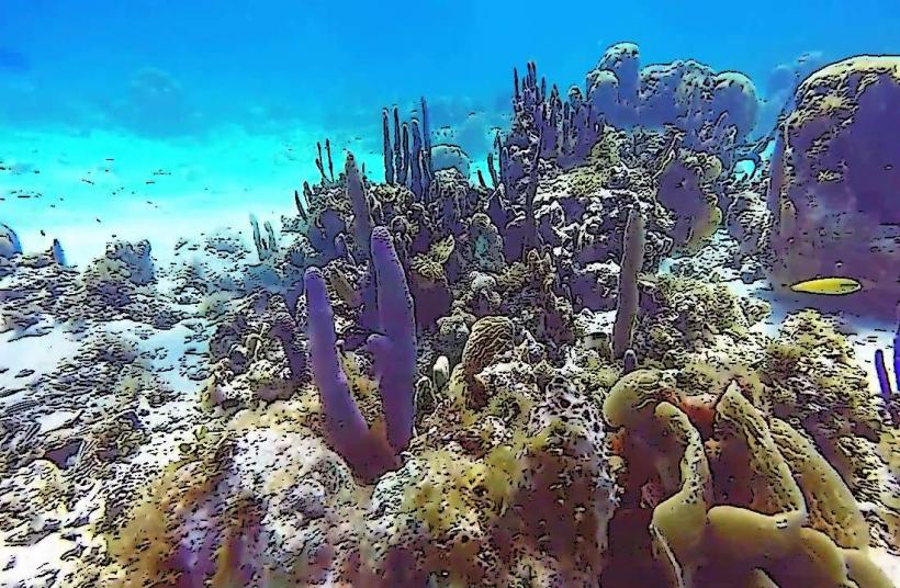
The island is characterized by its volcanic origins, featuring a central mountainous spine covered in dense tropical vegetation. Coastlines vary from sandy beaches with clear, shallow waters to rocky outcrops. The surrounding coral reef system contributes to the turquoise and blue hues of the sea.
Location & Access Logistics
Access to Isla de la Providencia is primarily via San Andrés Island (Andrés International Airport - ADZ). From San Andrés, regional flights operate daily to Providencia's El Embrujo Airport (PVA). Alternatively, ferry services are available from San Andrés, with a journey time of approximately 3 to 4 hours, weather permitting. Within Providencia, transportation is mainly by motorcycle taxi, bicycle, or rental scooter. Road infrastructure is limited, with the main road encircling the island.
Historical & Ecological Origin
Isla de la Providencia is a volcanic island, part of the Archipelago of San Andrés, Providencia and Santa Catalina. Its geological formation dates back millions of years. The island's ecological significance is tied to the Seaflower Biosphere Reserve, a UNESCO World Heritage site, which protects its extensive coral reef systems and marine biodiversity.
Key Highlights & Activities
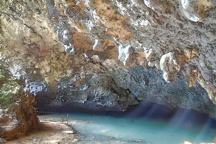
Activities include snorkeling and diving within the coral reef, accessible via boat tours. Hiking trails lead to viewpoints such as El Pico, the island's highest point. Kayaking and paddleboarding are available in calmer bays. Fishing excursions can be arranged with local operators.
Infrastructure & Amenities
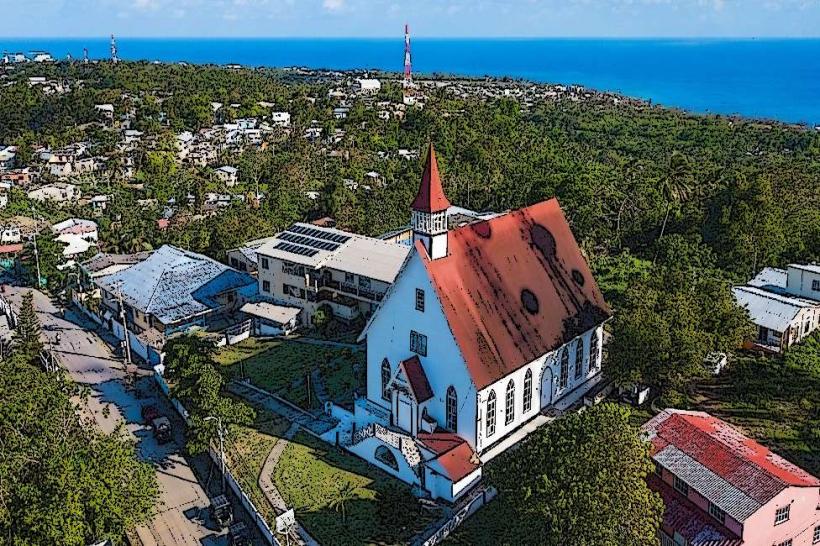
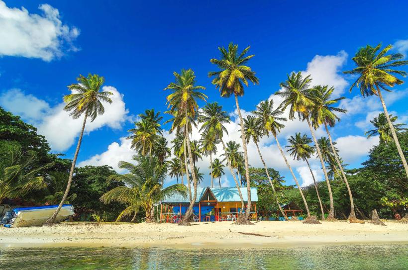
Restrooms are available at designated public beaches and some restaurants. Shade is provided by natural vegetation and some man-made structures. Cell phone signal (4G) is generally available in the main settlements but can be intermittent in more remote areas. Limited food vendors and small restaurants are located in the primary village of Santa Isabel.
Best Time to Visit
The dry season, from December to April, offers the most favorable weather conditions with lower rainfall. For underwater visibility, the period between March and May is often recommended. High tide is generally preferred for accessing certain snorkeling spots near the shore.
Facts & Legends
A local legend suggests that Captain Henry Morgan, the famous pirate, buried treasure on the island. While unverified, this tale contributes to the island's mystique. The island's primary settlement, Santa Isabel, is built on a small islet connected by a causeway.
Nearby Landmarks
- Santa Catalina Island (0.2km West)
- Cayo Cangrejo (1.5km Southeast)
- Bahía Suroeste (3km Southwest)
- Punta Sur Ecological Park (4km South)