Information
Landmark: Lake LucerneCity: Lucerne
Country: Switzerland
Continent: Europe
Lake Lucerne, Lucerne, Switzerland, Europe
Lake Lucerne (Vierwaldstättersee) is a complex, multi-branched lake in Central Switzerland, bordered by the four "forest cantons" of Lucerne, Uri, Schwyz, and Unterwalden. It is the fourth largest lake in the country, situated at an elevation of 434 meters above sea level.
Visual Characteristics
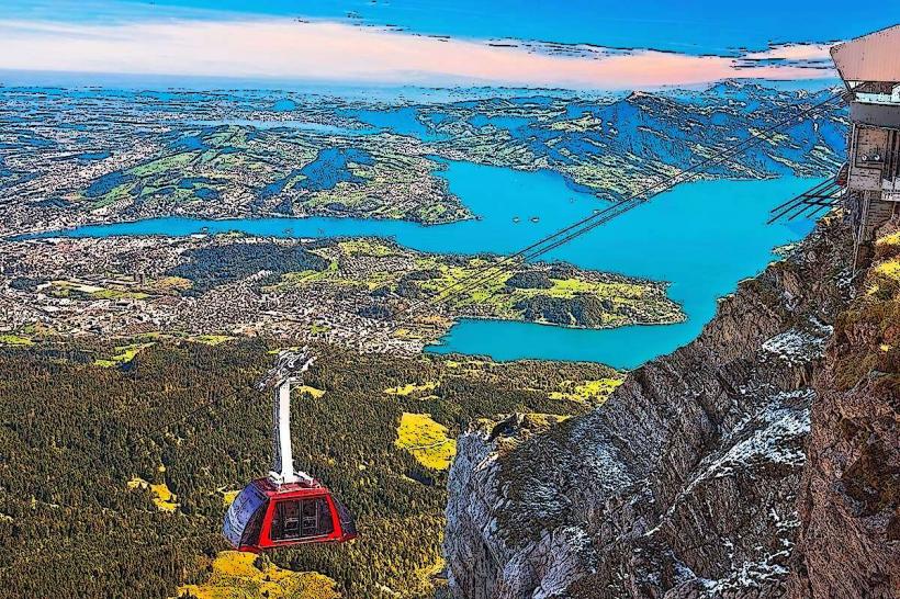
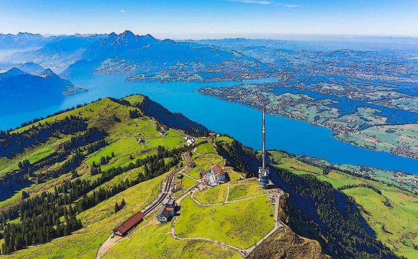
The lake features a highly irregular shape with four major basins and several narrow reaches, including the Bürgenstock and the Muota deltas. The water color varies from deep turquoise to emerald green depending on glacial silt and sunlight. The shoreline is characterized by steep limestone cliffs, particularly in the Urnersee section, and is surrounded by major Alpine massifs including Mount Rigi and Mount Pilatus. The maximum depth of the lake is 214 meters.
Location & Access Logistics
The primary access point is the city of Lucerne, located at the lake's western outflow. The main boat pier (Luzern Bahnhofquai) is situated directly opposite the Lucerne railway station. Access is provided via the A2 and A4 motorways. Public transport is dominated by the Schifffahrtsgesellschaft des Vierwaldstättersees (SGV), which operates a fleet of five historic paddle steamers and 15 motor vessels connecting lakeside towns like Weggis, Vitznau, and Brunnen.
Historical & Ecological Origin
The lake was formed approximately 12,000 years ago during the retreat of the Reuss Glacier at the end of the last ice age. Historically, it served as a vital transit route for the Gotthard Pass. The lake's shores are famously associated with the Rütli Meadow, the site of the legendary 1291 oath that marked the foundation of the Swiss Confederation.
Key Highlights & Activities
Passenger boat cruises are the primary activity, with routes covering the entire length to Flüelen. The "Swiss Path" (Weg der Schweiz) is a 35km themed hiking trail around the Urnersee branch. Seasonal swimming is possible at numerous "Lidos" or lakeside beaches. Cogwheel railways and cable cars depart from various lakeside stations, such as the Vitznau-Rigi Kulm line and the Alpnachstad-Pilatus line.
Infrastructure & Amenities
Lakeside towns provide comprehensive infrastructure including public restrooms, marinas, and tourist information centers. Most major boat piers offer 5G cell coverage and integrated ticketing offices. Shaded areas are prevalent in the public parks of Lucerne and Weggis. Numerous food vendors and high-end restaurants are situated along the quays in Lucerne and Brunnen.
Best Time to Visit
The peak season for navigation and hiking is from June to September. For photography, the late afternoon provides optimal lighting for the surrounding peaks, particularly when viewing Mount Pilatus from the Lucerne lakefront. Winter offers a distinct atmosphere, though several boat routes operate on a reduced schedule.
Facts & Legends
According to 14th-century legend, the folk hero William Tell escaped from a boat during a storm on the Urnersee by jumping onto a rock ledge now known as the Tellsplatte. A verified oddity is the "Seelisberg" underwater shelf, where the lake bottom drops precipitously, creating unique currents studied by limnologists.
Nearby Landmarks
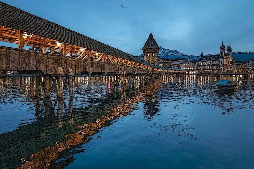
Chapel Bridge (Kapellbrücke) - 0.1km West (from Lucerne pier)
Mount Rigi - 10km East
Mount Pilatus - 7km Southwest
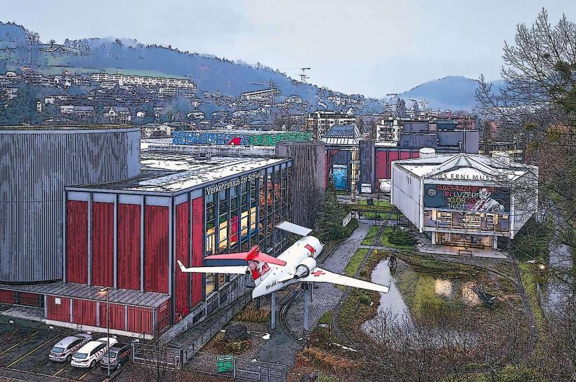
Swiss Museum of Transport - 2km East
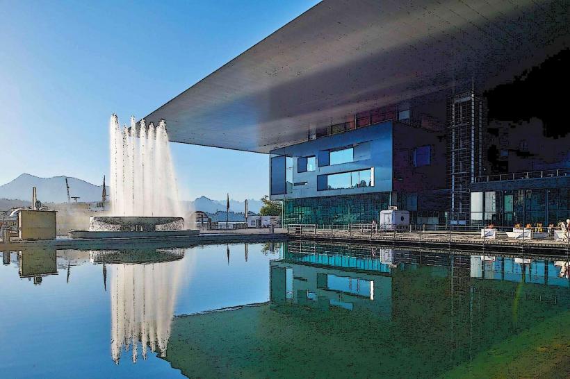
KKL Luzern (Culture and Convention Centre) - 0.1km South