Information
Landmark: Old Town (Altstadt)City: Lucerne
Country: Switzerland
Continent: Europe
Old Town (Altstadt), Lucerne, Switzerland, Europe
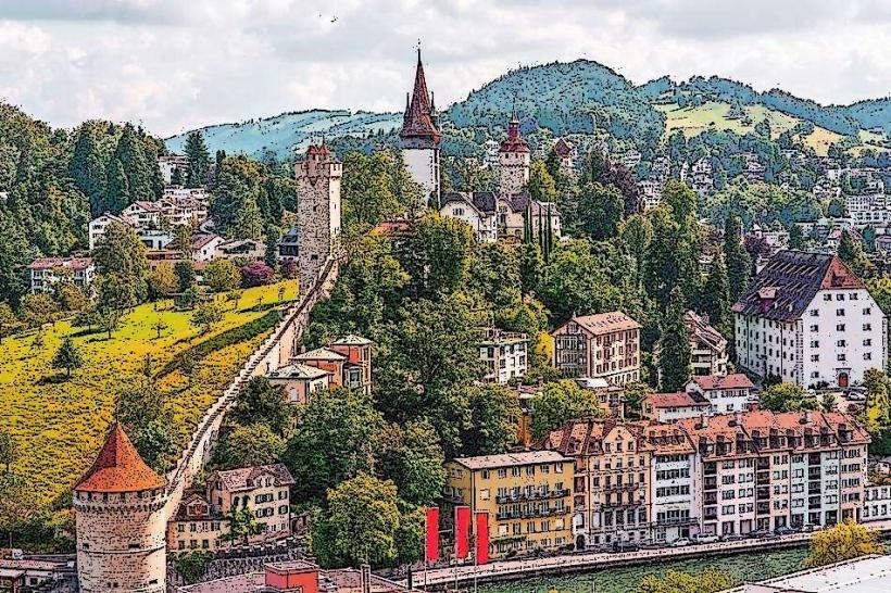
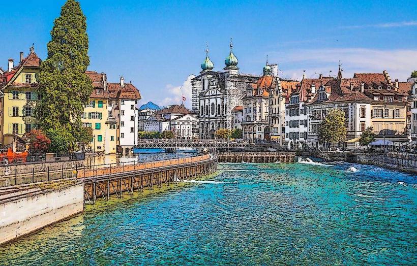
The Lucerne Old Town (Altstadt) is a preserved medieval core situated on the north bank of the Reuss River. It is characterized by pedestrian-only cobblestone streets, ornate frescoed facades, and historic guild squares.
Visual Characteristics
The architecture spans the 14th to 18th centuries, featuring timber-framed buildings and stone structures with colorful mural paintings depicting biblical, historical, and heraldic scenes. The district is defined by open squares (squares) like Weinmarkt and Kornmarkt, containing ornate stone fountains and clock towers. The northern perimeter is bounded by the Musegg Wall, while the southern side faces the river.
Location & Access Logistics
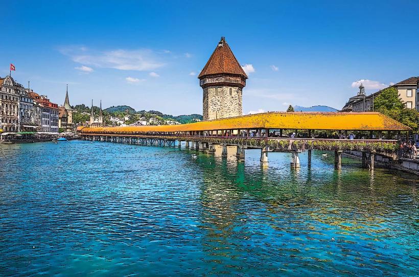
The Old Town is centered around the Weinmarkt, approximately 0.4km north of the Lucerne main railway station. Access is primarily pedestrian via the Chapel Bridge or the Seebrücke. Public transport stops at "Schwanenplatz" or "Luzern, Bahnhof" provide the closest proximity. Vehicle traffic is strictly prohibited; the "City Parking" or "Bahnhofparking" garages are the nearest parking options.
Historical & Ecological Origin
Established in the 12th century as a trading hub, the Altstadt developed around the Benedictine monastery of St. Leodegar. It sits on a flat alluvial plain formed by the Reuss River and glacial deposits. Most current structures date from the late Middle Ages and the Renaissance, built following several major fires in the 14th century.
Key Highlights & Activities
Weinmarkt: The site where Lucerne citizens swore their oath of confederation in 1332; it features the city's most elaborate fountain.
Kornmarkt: Location of the Old Town Hall (Altes Rathaus), a Renaissance building from 1602.
Fresco Viewing: Notable murals are found on the "Haus zum Pfistern" and the "Zunfthaus zu Metzgeren."
Shopping: The district houses specialized boutiques, watch shops, and traditional craft workshops.
Infrastructure & Amenities
Public restrooms are located at the Rathaus and near the Schwanenplatz. The area is dense with cafes, bakeries, and high-end restaurants, many offering outdoor seating in the squares. 5G mobile reception is excellent. While the cobblestones can be uneven, the main thoroughfares are wheelchair accessible.
Best Time to Visit
The district is best explored in the early morning (before 09:00) to observe the architecture without tourist crowds. Tuesday and Saturday mornings feature local markets on the riverbanks. Nighttime provides a distinct visual experience as the frescos and monuments are illuminated.
Facts & Legends
A verified historical detail is that many of the elaborate facades were painted or restored in the late 19th and early 20th centuries during a period of romanticized architectural revival. Legend holds that the giant depicted on the facade of the "Haus zu Liebenau" refers to a prehistoric skeleton found in the area, once believed to be a giant's remains.
Nearby Landmarks
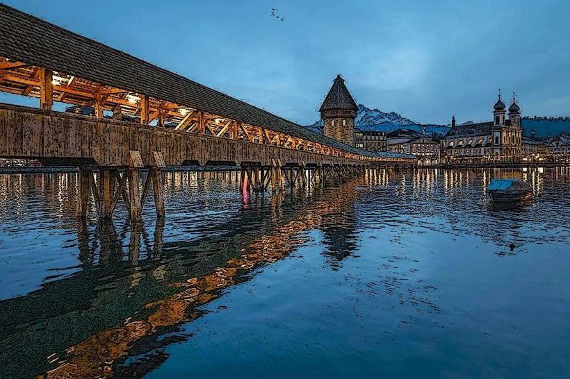
Chapel Bridge (Kapellbrücke) – 0.1km South
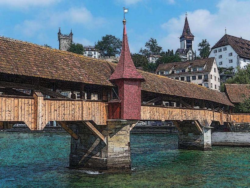
Musegg Wall – 0.2km North
Jesuit Church – 0.3km Southwest (across river)
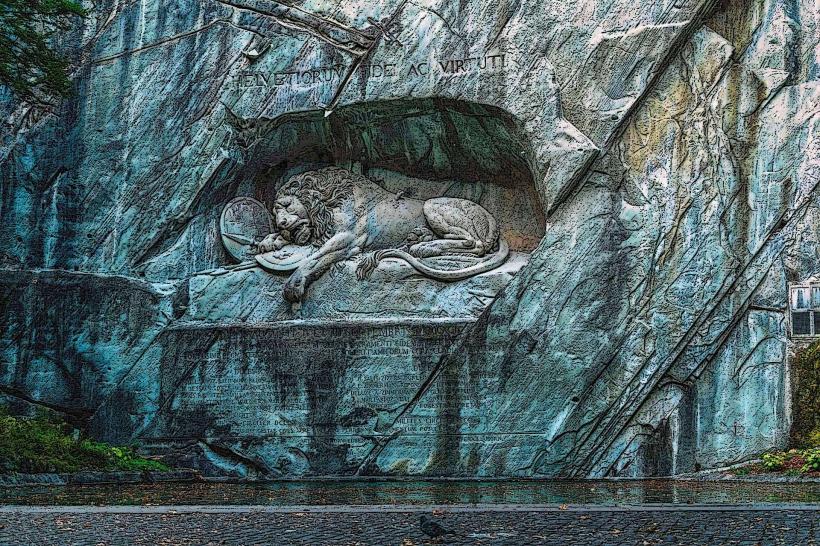
Lion Monument – 0.7km Northeast
Hofkirche St. Leodegar – 0.6km East