Information
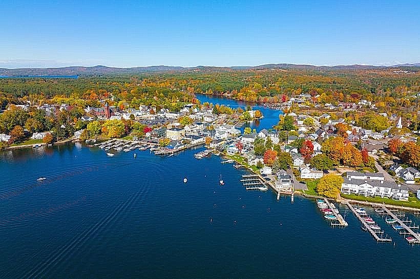
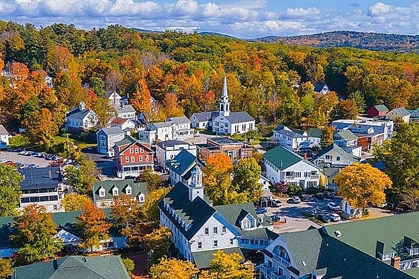
Landmark: Lake WinnipesaukeeCity: Wolfeboro
Country: USA New Hampshire
Continent: North America
Lake Winnipesaukee, Wolfeboro, USA New Hampshire, North America
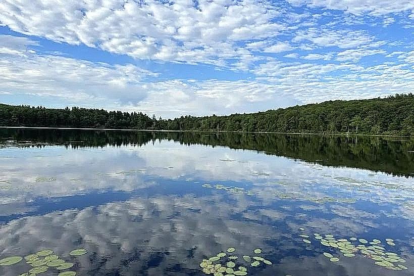
Lake Winnipesaukee is a large freshwater lake located in central New Hampshire, USA. It is the largest lake in the state by surface area.
Visual Characteristics
The lake's surface covers approximately 72 square miles. It features numerous islands, with over 250 named islands. The shoreline is irregular, with many coves and inlets. Water color varies from deep blue in open areas to greenish near shorelines with aquatic vegetation. The surrounding terrain is characterized by mixed deciduous and coniferous forests.
Location & Access Logistics
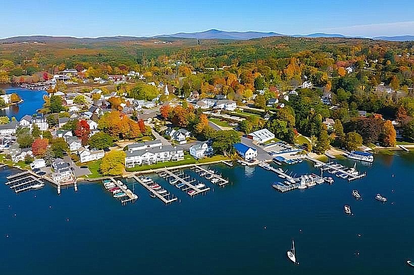
Lake Winnipesaukee is situated in the Lakes Region of New Hampshire. Wolfeboro is located on the eastern shore of the lake. Access to the lake from Wolfeboro is via local roads such as Route 109 and Route 28. Public boat launches are available at various points, including the town docks in Wolfeboro. Parking is available at designated boat launch sites and town beaches, though fees may apply during peak season. No specific bus lines directly serve the lake itself, but regional bus services connect to nearby towns.
Historical & Ecological Origin
Lake Winnipesaukee was formed by glacial activity during the last Ice Age. The receding glaciers carved out the basin, and meltwater filled it to create the lake. The lake has been a significant resource for indigenous peoples and early European settlers, serving as a source of water, food, and transportation.
Key Highlights & Activities
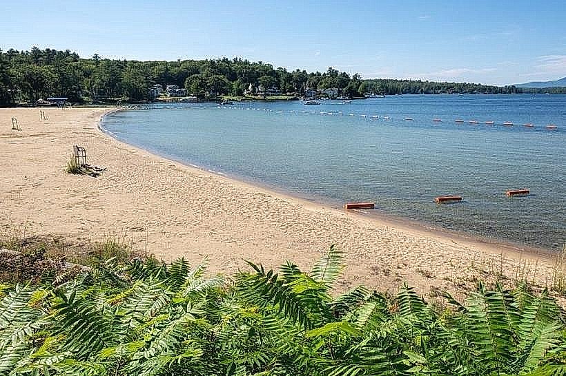
Boating, including sailing and motorboating, is a primary activity. Fishing for species such as lake trout, salmon, and bass is permitted with a New Hampshire fishing license. Swimming is possible at designated public beaches. Hiking trails are present on some of the larger islands and along sections of the mainland shoreline. Scenic boat tours operate from several towns around the lake.
Infrastructure & Amenities
Restrooms are available at public beaches and boat launch facilities. Shade is provided by trees along shorelines and in parks. Cell phone signal (4G/5G) is generally available in populated areas around the lake, but can be intermittent on remote islands or coves. Food vendors and restaurants are located in the towns bordering the lake, such as Wolfeboro.
Best Time to Visit
The best months for warm-weather activities like swimming and boating are July and August. For fishing, spring (April-May) and fall (September-October) are often productive. Sunrise and sunset offer specific lighting conditions for photography, particularly over the open water. High tide is not a relevant factor for this freshwater lake.
Facts & Legends
The name "Winnipesaukee" is derived from the Abenaki word meaning "smile of the Great Spirit" or "place of the high water." A local legend speaks of a mythical creature said to inhabit the lake's depths, though no scientific evidence supports its existence. The lake is known for its variable water levels, influenced by dam operations at its outlet.
Nearby Landmarks
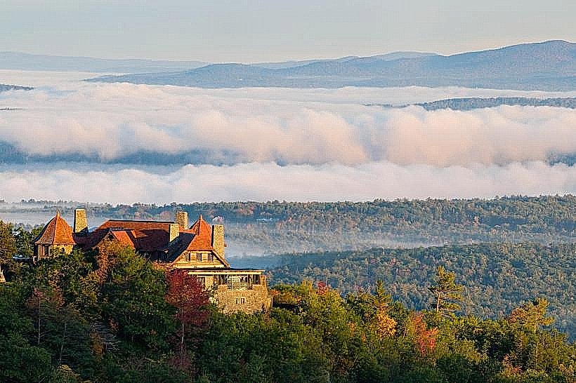
- Castle in the Clouds (3.5km Northwest)
- Mount Major (8km Southwest)
- Wolfeboro Historical Society Museum (0.8km West)
- Prescott Park (1km West)
- Alton Bay (12km Southwest)