Information
Landmark: Las Cañadas del TeideCity: Tenerife
Country: Canary Islands
Continent: Europe
Las Cañadas del Teide, Tenerife, Canary Islands, Europe
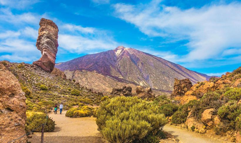
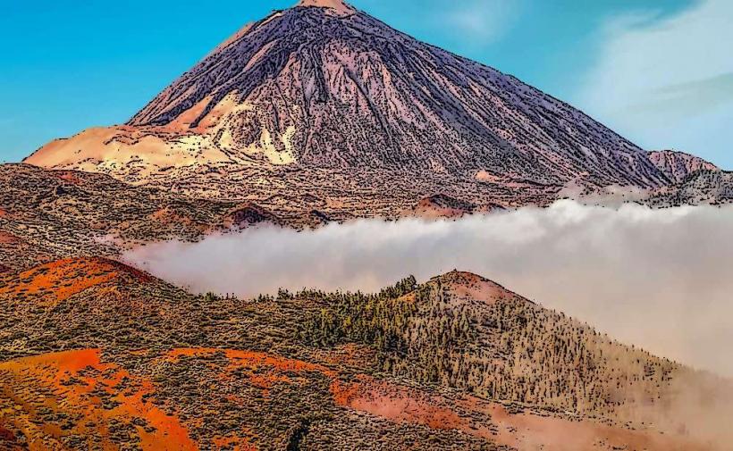
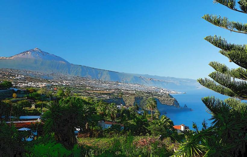
Las Cañadas del Teide is a large volcanic caldera situated in the central part of Tenerife, Canary Islands. It forms the base for Mount Teide, the highest peak in Spain.
Visual Characteristics
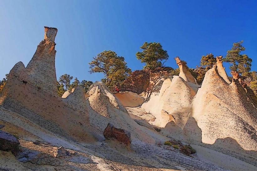
The landscape consists primarily of volcanic rock formations, displaying a spectrum of colors including reds, blacks, and ochres. The caldera floor is a vast, relatively flat expanse at an average altitude of 2,000 meters, surrounded by the steep walls of the ancient volcano. Sparse, high-altitude vegetation, such as the Teide broom and Teide violet, dots the rocky terrain. Mount Teide itself is a stratovolcano with a distinct conical shape, often capped with snow during winter months.
Location & Access Logistics
The caldera is centrally located on Tenerife. Access is primarily by road via the TF-21, TF-24, and TF-38 highways. From Santa Cruz de Tenerife, it is approximately 60km southwest via the TF-24. From Puerto de la Cruz, it is about 45km south via the TF-21. Numerous designated parking areas are available at viewpoints and trailheads throughout the national park. Public transport is limited; bus line 342 connects Playa de las Américas to Teide National Park, and line 348 connects Puerto de la Cruz to the park, both operating once daily in each direction.
Historical & Ecological Origin
Las Cañadas del Teide is a caldera formed by the collapse of a much larger ancient volcano approximately 170,000 years ago. Subsequent eruptions within this caldera led to the formation of Mount Teide and Pico Viejo. The area is a unique high-altitude desert ecosystem, characterized by extreme temperature fluctuations and specialized flora adapted to volcanic soils and arid conditions. It was declared a national park in 1954 and a UNESCO World Heritage Site in 2007.
Key Highlights & Activities
The Teide Cable Car provides access to an upper station at 3,555 meters, offering panoramic views. Hiking is a primary activity, with trails such as the Roques de García loop (3.5km, moderate) and the ascent to Pico Viejo crater. Stargazing is popular due to minimal light pollution; the area is a Starlight Reserve. The El Portillo Visitor Center offers exhibits on the park's geology and ecology.
Infrastructure & Amenities
Restrooms are available at the Parador de Las Cañadas del Teide, the El Portillo Visitor Center, and the Teide Cable Car base station. Limited shade is provided by specific rock formations or small visitor facilities. Cell phone signal (4G/5G) is intermittent and generally weak in many parts of the caldera. Food vendors are present at the Parador and the Teide Cable Car base station, offering basic meals and snacks.
Best Time to Visit
The best time for photography is during sunrise or sunset, when the low sun angle illuminates the volcanic rock formations with warm colors. The months of April to June are optimal for observing the endemic flora in bloom. For stargazing, clear, moonless nights between May and October offer the best visibility. Winter months (December to March) can bring snow, potentially closing roads and trails, but offer a unique snow-capped landscape.
Facts & Legends
The landscape of Las Cañadas del Teide has been used by NASA and other space agencies to test instruments and vehicles for Mars missions due to its geological similarities to the Martian surface. According to Guanche mythology, Guayota, the demon of evil, lived inside Teide and kidnapped the sun god Magec. The supreme god Achamán intervened, freeing Magec and trapping Guayota inside the volcano, sealing the crater with a sugar loaf, which is the peak of Teide.
Nearby Landmarks
- Roques de García: 0.5km West
- Parador de Las Cañadas del Teide: 1.2km Southwest
- Teide Cable Car Base Station: 3.5km North
- El Portillo Visitor Center: 10km Northeast
- Pico Viejo: 2.5km West (from Teide Cable Car upper station)