Information
Landmark: Laurisilva ForestCity: Madeira
Country: Portugal
Continent: Europe
Laurisilva Forest, Madeira, Portugal, Europe
Laurisilva of Madeira is a high-density subtropical rainforest and a UNESCO World Heritage site (designated 1999). It covers approximately 15,000 hectares (20% of the island), representing the largest surviving area of laurel forest in the world.
Visual Characteristics
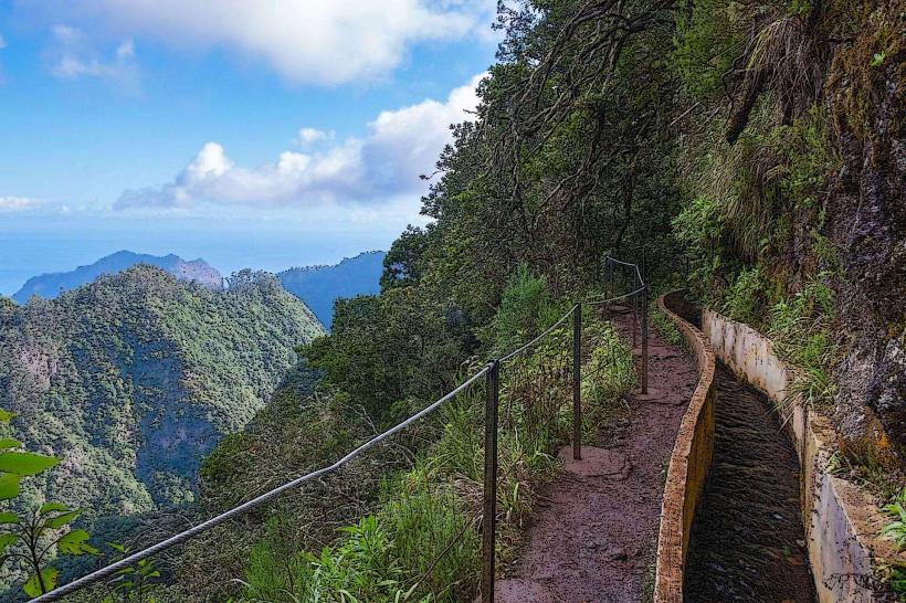
The forest is defined by a high-fidelity "evergreen" aesthetic, characterized by a closed canopy of large trees with glossy, laurel-like leaves. The interior is a high-humidity environment with a dense undergrowth of ferns, mosses, and liverworts. It is frequently shrouded in high-altitude fog, creating a stark, primeval visual profile.
Location & Access Logistics
The forest is primarily located within the Madeira Natural Park at elevations between 300 and 1,300 meters, mostly on the northern slopes.
Access Hubs: Major entry points include Ribeiro Frio, Fanal, Queimadas, and Posto de Santo António.
Navigation: The most efficient access is via the Levadas (irrigation channels) and Veredas (footpaths).
Public Transport: Limited. Buses (Horários do Funchal) serve Ribeiro Frio; however, high-elevation areas like Fanal require a private vehicle or tour.
Logistics: Hiking boots and waterproof gear are mandatory due to high-density mud and sudden precipitation.
Historical & Ecological Origin
The Laurisilva is a relict of a forest type that covered much of Southern Europe and North Africa 15–40 million years ago. It disappeared elsewhere during the Pliocene glaciations but survived in Madeira due to the moderating Atlantic climate. It is a high-fidelity ecosystem containing 76 endemic vascular plant species and unique fauna, such as the Trocaz Pigeon (Columba trocaz).
Key Highlights & Activities
Fanal Forest: A high-plateau area featuring ancient, twisted Ocotea foetens (Til) trees, often surrounded by thick mist.
PR9 Levada do Caldeirão Verde: A 13km high-fidelity hike through the heart of the forest, featuring tunnels and a 100-meter waterfall.
Levada dos Balcões: A short, low-intensity walk in Ribeiro Frio leading to a panoramic balcony over the forest canopy.
Biodiversity Observation: The forest is a high-density site for observing endemic flora like the Madeira Laurel (Laurus azorica) and Lily-of-the-Valley Tree (Clethra arborea).
Infrastructure & Amenities
Infrastructure is limited to designated forest stations (Postos Florestais) such as Ribeiro Frio and Queimadas, which provide basic restrooms and maps. 5G cellular coverage is intermittent and often blocked by dense canopy and deep valleys.
Best Time to Visit
Open 24/7. Spring (April–June) offers peak flowering. Fanal is best visited in the morning when the mist density is highest, providing the characteristic "ghostly" forest aesthetic.
Facts & Data
Hydrological Role: The forest acts as a high-capacity "water producer." Its leaves intercept horizontal precipitation (fog), which then drips into the soil and feeds the levada system.
Protection: It is strictly protected under Portuguese and EU law; the removal of any plant material or stones is prohibited.
Nearby Landmarks
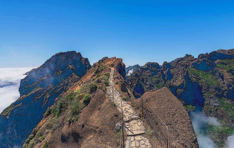
Pico Ruivo: Bordering the high-altitude forest limits.
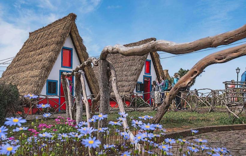
Santana: 10km North (known for traditional thatched houses).
Porto Moniz: 15km Northwest of the Fanal sector.