Information
Landmark: Malolo IslandCity: Mamanuca Islands
Country: Fiji
Continent: Australia
Malolo Island, Mamanuca Islands, Fiji, Australia
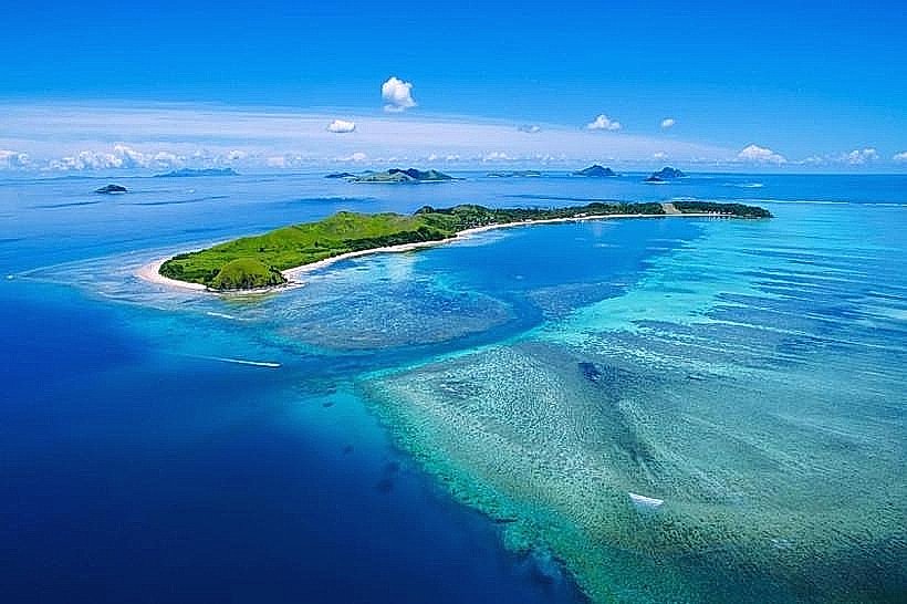
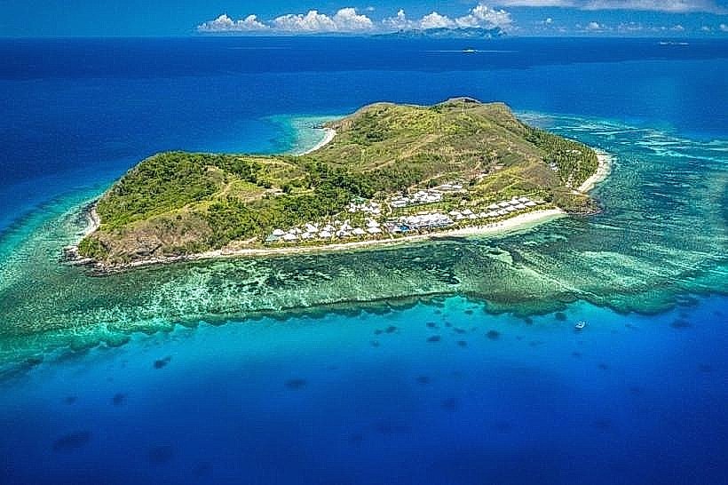
Malolo Island is the largest landmass in the Mamanuca Archipelago, covering approximately 9.3 square kilometers in the Pacific Ocean west of Viti Levu. It is a volcanic island characterized by significant elevation and the presence of two traditional indigenous villages, Yaro and Solevu.
Visual Characteristics
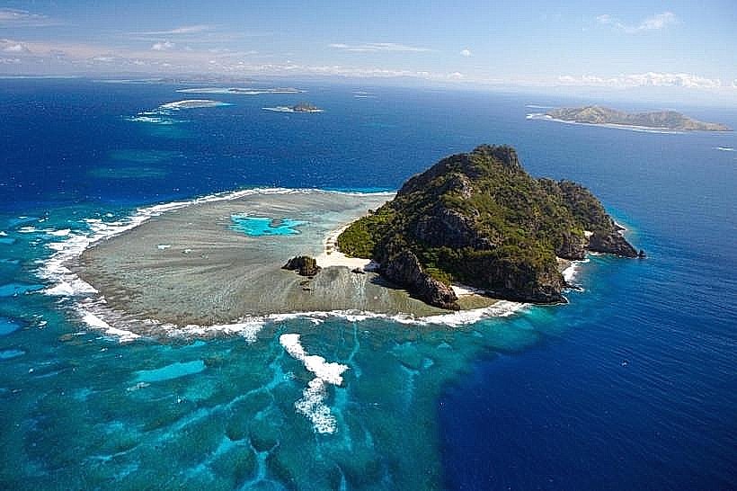
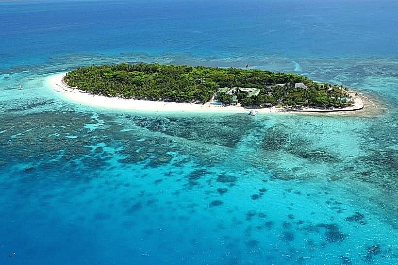
The island is a volcanic formation with a rugged interior reaching a peak of 210 meters at Mt. Uluisilo. The terrain consists of steep basaltic ridges covered in tropical dry forest remnants, savanna grasslands, and stands of indigenous trees such as Stinkwood, Coral Tree, and Ironwood. The coastline features a combination of white-sand beaches, rocky headlands, and protected mangrove systems. Fringing coral reefs encircle the island, creating shallow turquoise lagoons that transition into deep blue oceanic channels.
Location & Access Logistics
Malolo Island is located 25 kilometers west of Nadi International Airport. Access is via high-speed catamaran from Port Denarau, with services taking between 55 minutes and 2 hours depending on the route. Private water taxis and speedboats depart on demand from Denarau Marina. Aerial transfers include a 10-minute seaplane flight from Nadi or helicopter transfers to helipads at Likuliku Lagoon or Malolo Island resorts. There are no public roads or cars; transit is restricted to footpaths and boat transfers between coastal points.
Historical & Ecological Origin
Archaeological evidence indicates human occupation dating back to 2000–500 BCE. In July 1840, the island was surveyed by the United States Exploring Expedition under Charles Wilkes, leading to a significant conflict and the temporary destruction of local villages. Ecologically, the island is a vital refugium for the critically endangered Fiji Crested Iguana (Brachylophus vitiensis), which was long thought extinct on the island until its rediscovery in 2010. The surrounding waters are designated as a "Na Tabu" marine reserve to protect turtle breeding grounds and coral biodiversity.
Key Highlights & Activities
Hiking trails lead to the summit of Mt. Uluisilo, which houses the remains of a World War II American lookout fort. Snorkeling is conducted on the fringing reefs, while scuba diving excursions depart for 44 nearby sites, including the "Supermarket" shark encounter and a sunken B-26 bomber. Surfing tours access world-class breaks such as Cloudbreak and Wilkes Passage on the southern barrier reef. Cultural tours to Yaro Village allow for traditional kava ceremonies and participation in "lovo" earth-oven cooking.
Infrastructure & Amenities
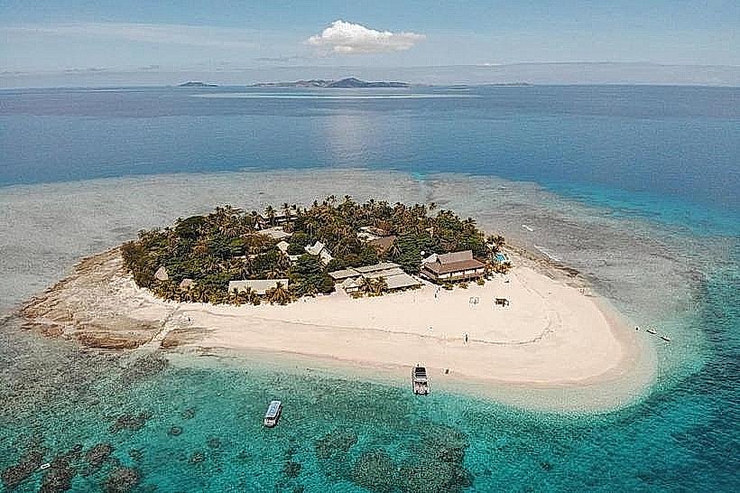
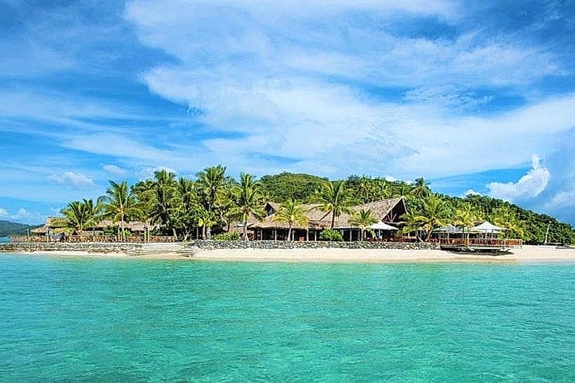
The island hosts five major resorts (Likuliku, Malolo, Tropica, Six Senses, and Funky Fish) which provide self-contained infrastructure, including desalination plants and solar-diesel hybrid power grids. Public restrooms and dining facilities are located within resort boundaries and village areas. 4G cell signal is stable across the windward side but intermittent in the deep interior valleys. There are no ATMs or public utility grids; all commercial services are concentrated at the resort properties.
Best Time to Visit
The dry season from May to October provides the most stable weather, with temperatures ranging from 23°C to 30°C and peak underwater visibility for diving. The wet season (November to April) is characterized by higher humidity and increased rainfall, though the island remains drier than the Viti Levu mainland. Photography at Mt. Uluisilo is optimal in the late afternoon to capture the sunset, which historically led to the island's name as the "place where the sun rests."
Facts & Legends
According to local mythology, the sun descends behind Malolo every evening to rest after its journey across the sky, giving rise to the Fijian expression "na siga e dromu i Malolo." Another legend concerns the "Box of Blessings" (Katonimana), which supposedly fell from a giant outrigger canoe into the Mamanuca seas; anyone attempting to retrieve it is said to be cursed, a myth used to explain the presence of sea snakes in the area.
Nearby Landmarks
Malolo Lailai Island – 1.5km Southeast
Castaway Island (Qalito) – 4.0km Northwest
Wadigi Island – 2.5km North
Mociu Island (Honeymoon Island) – 3.2km Northeast
Cloudbreak Surf Reef – 5.0km South