Information
Landmark: Monuriki IslandCity: Mamanuca Islands
Country: Fiji
Continent: Australia
Monuriki Island, Mamanuca Islands, Fiji, Australia
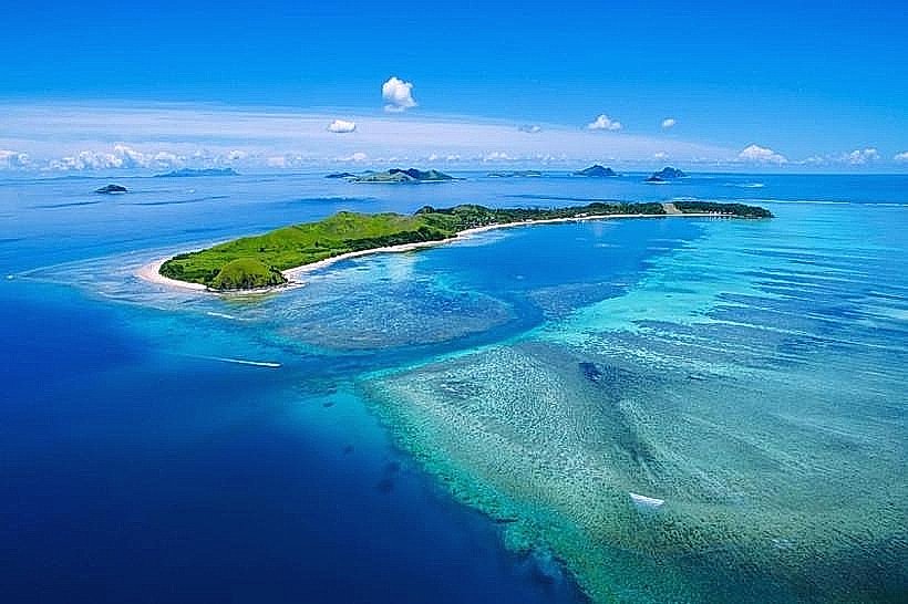
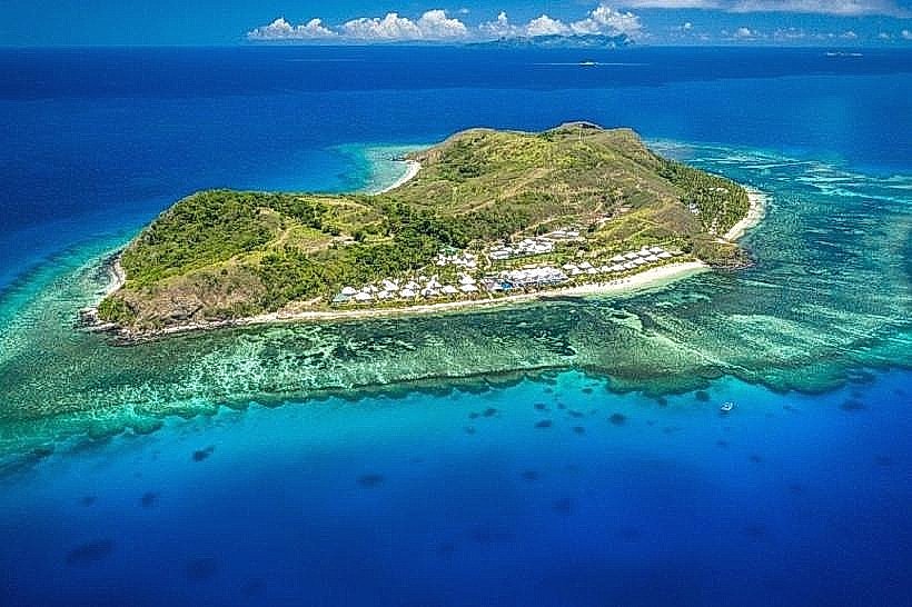
Monuriki Island is a 0.4-square-kilometer uninhabited volcanic island in the Mamanuca Archipelago, situated at 17.61° South and 177.03° East. It is part of a small subgroup of islands known as the Mamanuca-i-ra, located approximately 30 kilometers west of Viti Levu.
Visual Characteristics
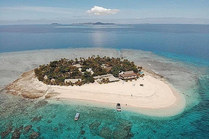
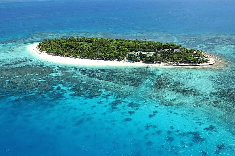
The island is defined by a central volcanic peak rising 178 meters, featuring sheer basaltic cliffs and jagged rock faces. The topography is exceptionally rugged, with steep slopes covered in tropical dry forest and savanna grasslands. Its coastline consists of a broad white-sand beach on the southern leeward side and rocky, wave-battered volcanic shores to the north. The island is encircled by a 1-kilometer-wide fringing reef with high coral density and a shallow turquoise lagoon.
Location & Access Logistics
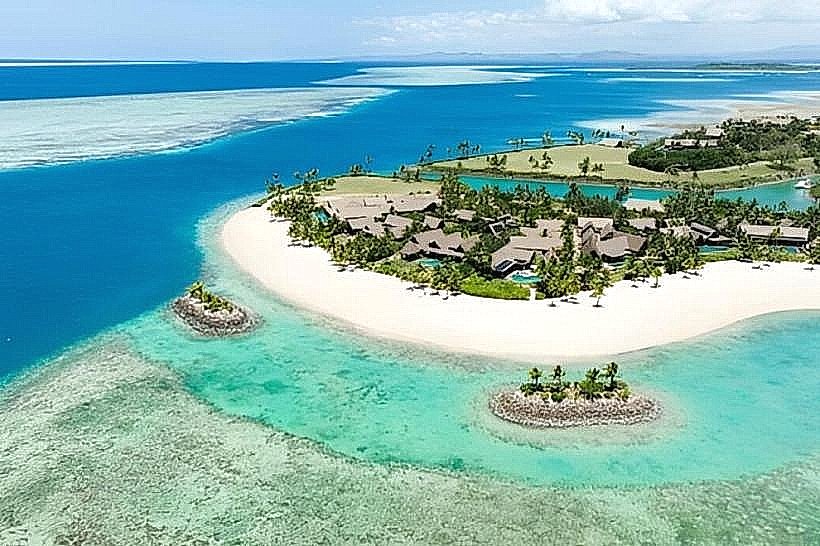
Access is restricted to boat transit, as there is no airstrip or jetty. Day-trip vessels and private charters depart daily from Port Denarau or nearby resort islands such as Mana, Castaway, and Tokoriki, with travel times ranging from 15 to 45 minutes. Visitors must swim or wade ashore from small tenders landing on the southern beach. As the island is part of a traditional marine reserve managed by the villagers of Yanuya, an entry fee is typically included in organized tour prices.
Historical & Ecological Origin
Monuriki is a volcanic remnant formed during the Pliocene epoch. It is an ecological stronghold for the critically endangered Fiji Crested Iguana (Brachylophus vitiensis), which was reintroduced following a successful goat and rat eradication program in 2011. The island also serves as a vital nesting ground for the wedge-tailed shearwater and hawksbill sea turtles. It is traditionally owned by the mataqali (clan) of Yanuya Island.
Key Highlights & Activities
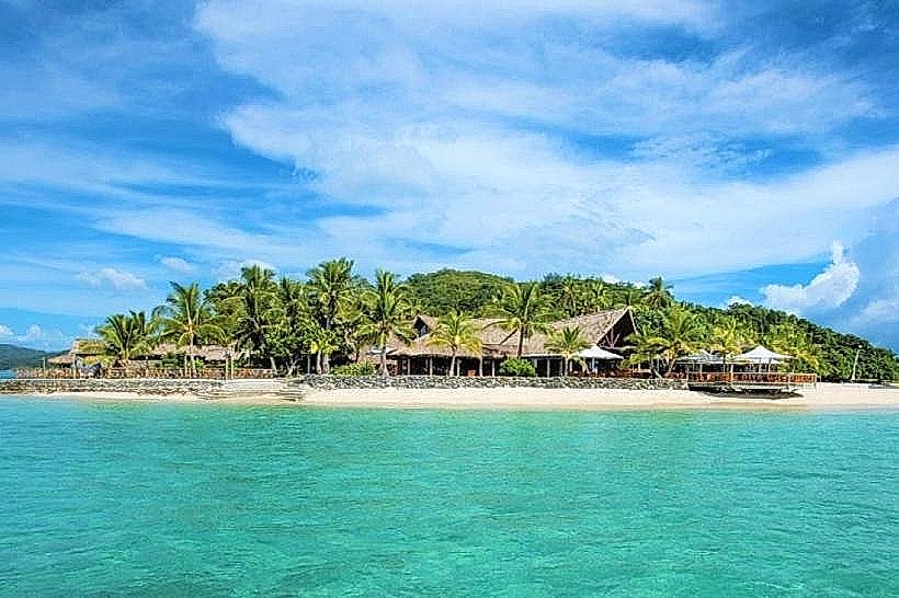
Snorkeling is the primary activity, concentrated on the reef edge directly off the southern beach where the "Drop Off" features soft corals and sea fans. Guided hikes to the 178-meter summit are possible via a steep, unmaintained trail through the scrub. Visitors can explore the beach locations used in film production, including the coconut grove and the "Help" sign area. Primitive rock climbing is possible on the lower basaltic crags, though no fixed anchors exist.
Infrastructure & Amenities
There is zero permanent infrastructure on Monuriki. There are no restrooms, buildings, potable water sources, or shade structures other than natural vegetation. Visitors must carry all supplies, including food and water, and remove all waste. 4G cell signal is available but weak, depending on line-of-sight to the Mana Island transmitter.
Best Time to Visit
The dry season from May to October is optimal for calm sea conditions and clear underwater visibility. Tours generally arrive between 09:00 and 11:00 to avoid the stronger afternoon trade winds that can make landing difficult. Mid-morning provides the best overhead lighting for photographing the lagoon and the "Cast Away" beach, while late afternoon offers dramatic shadows on the northern basaltic cliffs.
Facts & Legends
Monuriki gained global recognition as the primary filming location for the 2000 film Cast Away, starring Tom Hanks. A specific "secret" tip is to locate the cave on the southern end of the island, which was used for interior shots in the movie. Local legend from Yanuya suggests the island is protected by spirits, which led to its historical preservation as a "tabu" (restricted) site for hunting and fishing long before formal conservation efforts began.
Nearby Landmarks
Monu Island – 0.8km North
Yanuya Island – 2.5km Northeast
Tokoriki Island – 5.2km Northeast
Matamanoa Island – 6.0km Southeast
Mana Island – 11.5km Southeast
Would you like me to generate a logistical summary for another island in the Mamanuca chain, such as Tokoriki or Matamanoa?