Information
Landmark: Mana IslandCity: Mamanuca Islands
Country: Fiji
Continent: Australia
Mana Island, Mamanuca Islands, Fiji, Australia
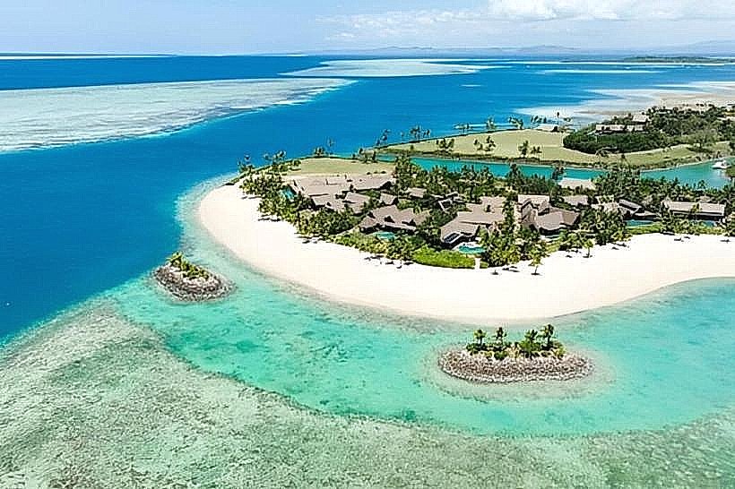
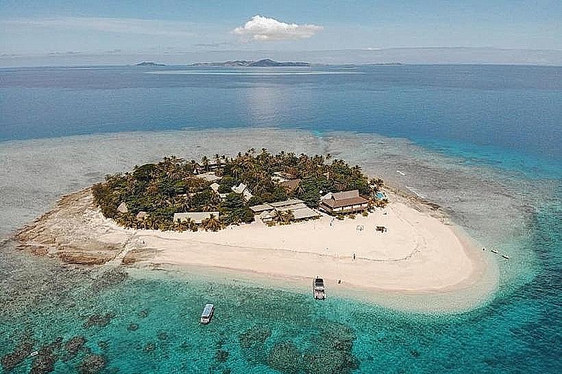
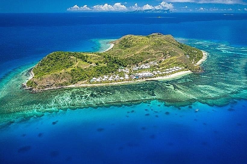
Mana Island is a 120-hectare crescent-shaped island located in the center of the Mamanuca Archipelago, 30 kilometers west of Nadi, Viti Levu. It is the largest resort landmass in the Mamanuca chain and serves as a major logistical hub for regional marine and aviation transfers.
Visual Characteristics
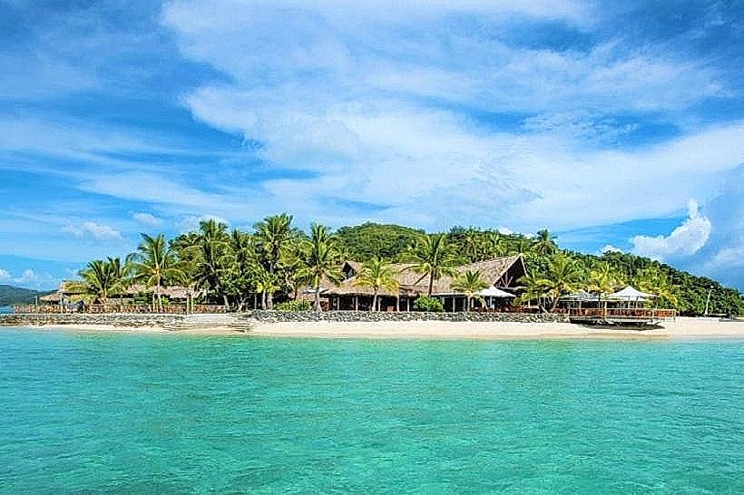
The island features a diverse topography with a central ridge of hills rising to approximately 50 meters, contrasting with flat coastal plains. It is bordered by four distinct white-sand beaches: North Beach, Sunset Beach, South Beach, and a secluded eastern cove. The surrounding marine environment consists of a shallow turquoise lagoon on the western side and deep vertical reef drop-offs to the south. Vegetation is primarily tropical dry forest, manicured gardens, and extensive coconut palm groves.
Location & Access Logistics
Mana Island is accessible via a 90-minute high-speed catamaran transfer from Port Denarau, with South Sea Cruises operating daily services. Air access is provided by Pacific Island Air and Turtle Airways, utilizing a private 800-meter grass airstrip for fixed-wing aircraft or amphibious seaplanes landing in the lagoon. Private water taxis from Vuda Point or Denarau take approximately 45 to 60 minutes. There are no public roads; transit is limited to sand footpaths and resort-operated electric carts.
Historical & Ecological Origin
Geologically, the island is part of the Mamanuca Volcanic Group, formed during the Pliocene epoch. Historically, Mana was a traditional burial site for Fijian chiefs and remains home to a local village on its eastern end. In 1973, it became one of the first islands in Fiji developed for large-scale tourism. Ecologically, it is a significant site for the Fiji Sea Turtle Restoration project, featuring protected nesting grounds for hawksbill and green sea turtles.
Key Highlights & Activities
Snorkeling is available directly from the shore at North Beach and Sunset Beach, targeting "cabbage coral" formations and resident reef sharks. The island hosts a PADI five-star dive center providing access to 44 regional sites, including "The Supermarket" and a downed WWII B-26 bomber. Land-based activities include hiking to the "Lookout" for 360-degree views and visiting the Mana Island Chapel. Motorized water sports, such as jet skiing and parasailing, are concentrated on the western lagoon side.
Infrastructure & Amenities
The island contains the Mana Island Resort & Spa and several smaller backpacker lodges. Amenities include a medical clinic, a boutique shop, five restaurants, and four bars. Electricity is generated by onsite diesel and solar hybrid systems, and water is produced via a large-scale desalination plant. 4G cell signal is stable across the island. Public restrooms and lockers are available for day-trippers at the main resort terminal.
Best Time to Visit
The dry season from May to October offers optimal underwater visibility and temperatures between 20°C and 26°C. High tide is required for swimming at South Beach to avoid exposed coral flats. For photography, the summit lookout is best visited at sunrise for views toward the Viti Levu mainland, while Sunset Beach is the primary location for low-angle evening lighting.
Facts & Legends
Local tradition dictates that the island is "blessed" or "magic" (the meaning of Mana in Fijian), and visitors are historically cautioned not to remove any stones or sand to avoid misfortune. A verified historical oddity is the presence of the 800-meter grass airstrip, which is one of the few active island runways in the Mamanucas capable of handling multi-passenger fixed-wing aircraft.
Nearby Landmarks
Monuriki Island (Castaway Island) – 5.5km Northwest
Matamanoa Island – 4.2km North
Castaway Island (Qalito) – 6.0km South
Tokoriki Island – 10.5km North
Cloud 9 (Floating Platform) – 14.5km Southeast