Information
Landmark: Tokoriki IslandCity: Mamanuca Islands
Country: Fiji
Continent: Australia
Tokoriki Island, Mamanuca Islands, Fiji, Australia
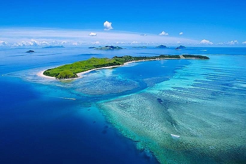
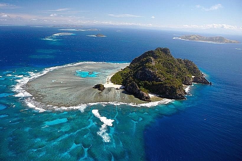
Tokoriki Island is a 40-hectare volcanic island located at the northernmost point of the Mamanuca Archipelago, situated approximately 35 kilometers west of Nadi. It is a private resort island characterized by its secluded location and high-relief topography.
Visual Characteristics
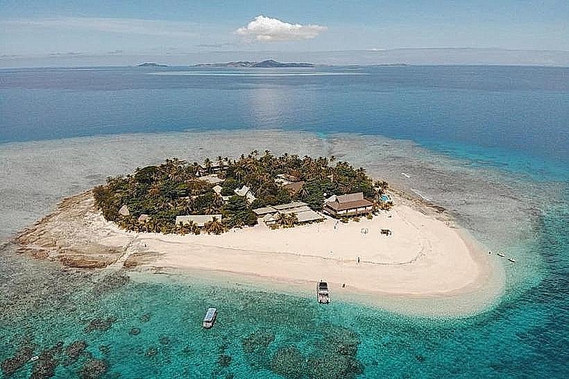
The island features a central mountain ridge that rises to an elevation of approximately 60 meters, providing a steep backdrop to its western-facing beaches. The terrain is composed of volcanic basalt and is covered in a mixture of tropical dry forest, pandanus trees, and coconut palms. The coastline is defined by a 1-kilometer stretch of white-sand beach on the leeward side and rugged, wave-cut volcanic rock on the windward side. Its surrounding fringing reef is extensive, featuring a distinct drop-off into the deep waters of the Bligh Water.
Location & Access Logistics
Access is primarily via the South Sea Cruises high-speed catamaran from Port Denarau, which takes approximately 60 to 90 minutes. Direct transfers are also available via private speedboat from Vuda Point or Denarau Marina, taking 40 to 60 minutes. Aerial access is provided by Pacific Island Air and Turtle Airways, utilizing seaplanes that land in the lagoon or helicopters that land on the island's two private helipads. There are no roads or vehicles; movement is restricted to walking paths along the beach and resort grounds.
Historical & Ecological Origin
Geologically, Tokoriki is a volcanic remnant formed during the Pliocene epoch. It remains under a long-term lease from the traditional landowners of the nearby Yanuya Village. Ecologically, the island is a participant in the Mamanuca Environment Society’s Giant Clam regeneration program and maintains a protected marine area. The island also serves as a nesting site for hawksbill sea turtles and the wedge-tailed shearwater.
Key Highlights & Activities
Snorkeling is concentrated on the house reef, which is accessible directly from the beach at mid-to-high tide. The island features two PADI five-star dive centers providing access to over 30 sites, including the "Sherwood Forest" gorgonian fan site and the "Monu Hole." Land-based activities include hiking the ridgeline trail for views toward the Yasawa Islands and visiting the traditional village on neighboring Yanuya. Glass-bottom boat tours operate daily for non-swimmers to view the giant clam nurseries.
Infrastructure & Amenities
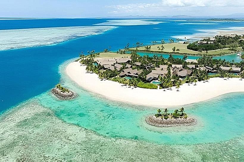
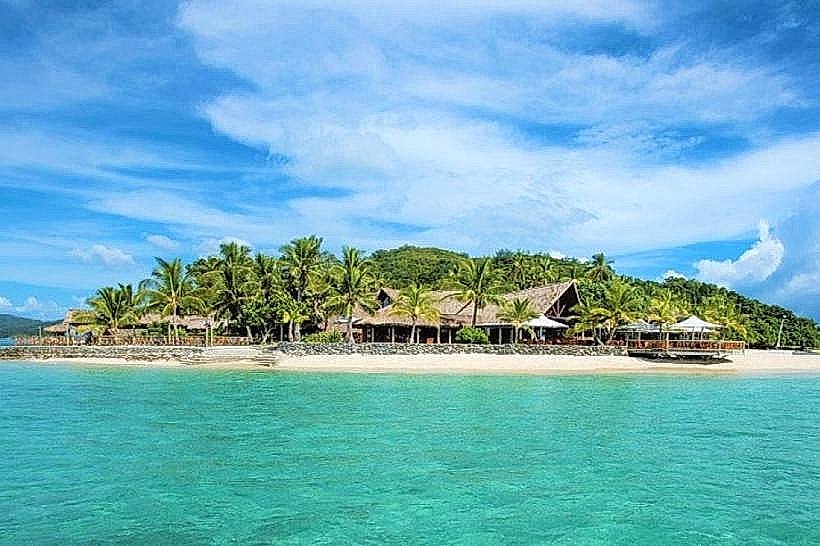
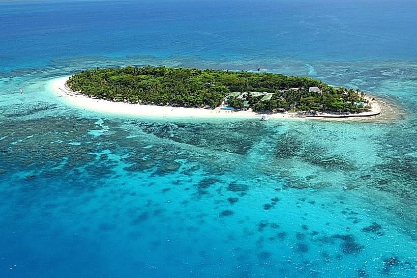
The island is occupied by two luxury resorts: Tokoriki Island Resort and Sheraton Fiji Resort & Spa, Tokoriki Island. Infrastructure is self-contained, including large-scale desalination plants for potable water and solar-diesel hybrid power stations. Amenities include multiple restaurants, bars, spas, a fitness center, and a boutique shop. 4G cell signal is generally stable across the island. There are no public ATMs; all transactions are typically charged to resort accounts or processed via credit card.
Best Time to Visit
The dry season from May to October offers the most consistent weather and underwater visibility exceeding 30 meters. The western orientation of the main beach makes it susceptible to afternoon trade winds, so morning hours are optimal for calm-water activities. For photography, the "golden hour" (17:30–18:30) is the primary time for capturing the sunset over the external reef edge.
Facts & Legends
A unique historical oddity is that the island was entirely uninhabited and lacked any fresh water source until the first resort development in the late 20th century necessitated the installation of desalination technology. Local legend from Yanuya suggests that the waters between Tokoriki and Monuriki are home to a guardian sea spirit, which sailors still acknowledge by maintaining silence when transiting the channel at night.
Nearby Landmarks
Yanuya Island – 1.8km West
Monuriki Island – 5.2km Southwest
Monu Island – 4.5km Southwest
Matamanoa Island – 6.5km South
Tavua Island – 7.2km East
Would you like me to detail the logistics for Matamanoa Island or the nearby Yanuya Village?