Information
Landmark: Pincushion Mountain TrailCity: Grand Marais
Country: USA Minnesota
Continent: North America
Pincushion Mountain Trail, Grand Marais, USA Minnesota, North America
Pincushion Mountain Trail – In Detail
The Pincushion Mountain Trail is a premier hiking destination located just outside Grand Marais, Minnesota. It offers a stunning combination of accessible wilderness, panoramic views, and a versatile trail network suitable for hikers, mountain bikers, cross-country skiers, and snowshoers. Named for the dome-like summit that resembles a pincushion, the trail is part of the larger Pincushion Mountain Trail System, which sits at the edge of the Sawtooth Mountains and forms a key connector to the Superior Hiking Trail.
Geographic Setting and Access
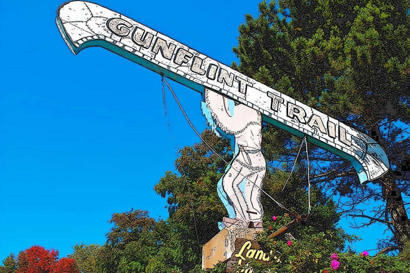
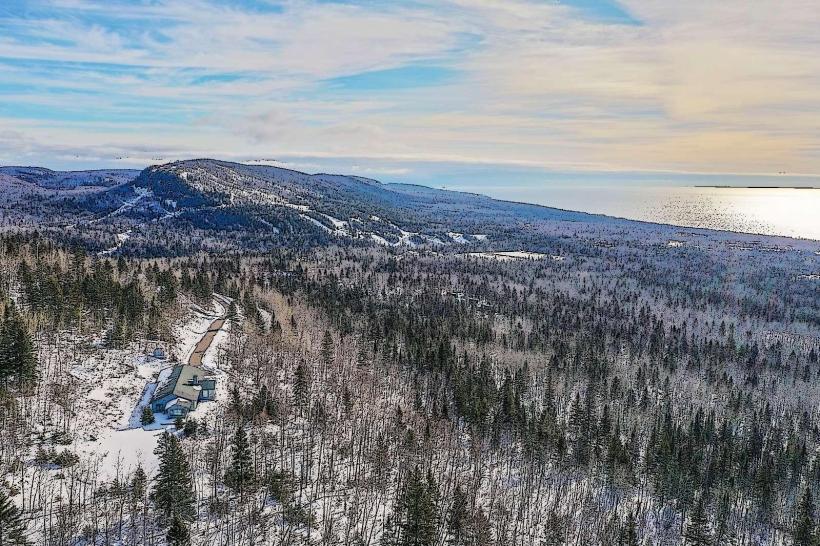
Pincushion Mountain rises just a few miles inland from the Lake Superior shoreline, accessible from County Road 12 (Gunflint Trail). Visitors follow a signposted turn onto Pincushion Drive, which leads to a dedicated parking area. The trailhead is part of a well-developed recreation complex that includes a warming hut (used in winter), interpretive signage, maps, and access to a wide network of multi-use trails.
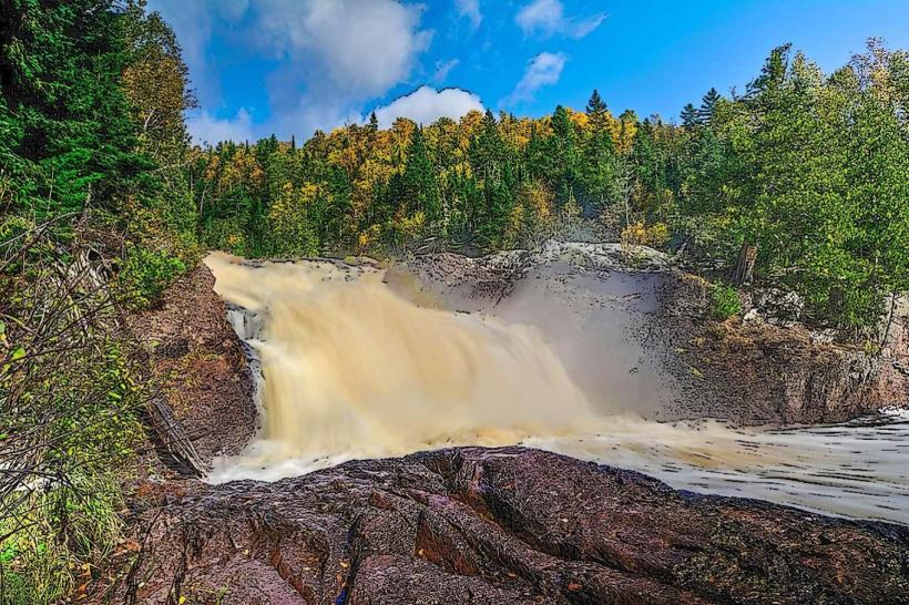
From the start, hikers are quickly immersed in the boreal forest that dominates Minnesota’s North Shore interior: balsam firs, white and black spruces, birches, and trembling aspens. The elevation increases gradually at first, with rocky outcrops and woodland ridges revealing themselves as the trail climbs.
Trail Characteristics
Length and Layout:
The most popular route is a 4.5 to 4.75-mile loop that includes a spur trail to the summit.
More ambitious hikers can connect to the Superior Hiking Trail for extended day hikes or backpacking.
The trail climbs approximately 700 feet, with most elevation gained steadily, though a few sections are steeper or rockier.
Surface and Terrain:
The path alternates between packed earth, boardwalks over marshy areas, gravel, and exposed bedrock.
In spring and after heavy rains, sections near the beginning can be wet, but the trail is generally well-drained.
Stone steps and short switchbacks are found on the approach to the summit.
Summit and Views
The reward at the summit is a dramatic overlook perched roughly 1,400 feet above sea level. From here, hikers can see:
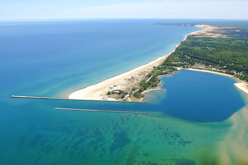
Grand Marais Harbor, including the lighthouse and Artist’s Point.
Lake Superior, stretching like an inland ocean toward the hazy horizon.
Isle Royale, visible on clear days as a blue-gray silhouette across the lake.
The vast inland forest of the Superior National Forest, with its glacial ridges, rivers, and low wetlands.
A lesser-known second overlook lies slightly beyond the summit and provides equally sweeping views with fewer crowds.
Ecology and Seasonal Changes
The Pincushion trail area supports diverse northern wildlife:
Moose and white-tailed deer browse in lowlands and along river valleys.
Black bears, pine martens, and red foxes are occasionally seen.
Songbirds, woodpeckers, hawks, and ravens add to the soundscape.
In summer, the undergrowth bursts with blueberries and wildflowers, including fireweed and lupines. In autumn, the trail becomes a corridor of color-birch and aspen turning gold and orange while conifers maintain their deep green backdrop.
During winter, the area transforms into a snowy playground. The Pincushion Trail System offers groomed cross-country ski trails with sweeping views from snow-covered overlooks. Snowshoeing is also allowed off the ski routes.
Trail System and Connectivity
Pincushion Mountain is part of a multi-use trail system maintained by the Pincushion Mountain Trails Association. The full network includes:
25+ km of cross-country ski trails.
Dedicated mountain biking loops.
Snowshoe routes and backcountry spur trails.
Access to the Superior Hiking Trail, which runs from Duluth to the Canadian border.
The trails are well-marked but require attention at junctions. Trail maps are posted near the trailhead and available online. In winter, trail grooming reports help users plan visits.
Practical Tips
Difficulty: Rated moderate. Beginners can manage the hike with good shoes and pacing.
Time: The loop hike with summit spur takes 2 to 3 hours, depending on pace and stops.
Footwear: Sturdy, waterproof boots recommended due to rocky sections and boardwalks.
Navigation: Bring a map or GPS; trail markers are present but can be confusing at ski trail crossings.
Dogs: Allowed on leash; bring water, especially on hot days.
Biking Etiquette: Hikers should yield to bikers on multi-use trails.
Facilities and Accessibility
Parking: Free parking at trailhead with space for about 20–30 vehicles.
Restrooms: Vault toilets available seasonally.
Shelter: A warming hut and picnic shelter are open during the winter season.
No cell service: Bring a printed map or download offline maps.
Sustainability and Conservation
Pincushion Mountain Trail is located on land managed by the Superior National Forest, which emphasizes low-impact recreation. Visitors are encouraged to:
Leave no trace: Pack out all trash.
Stay on trails: To prevent erosion and protect native plant life.
Avoid wildlife interaction: Especially in late summer when bears and moose are more active.
Respect ski grooming and bike trail maintenance in season.
Summary
Pincushion Mountain Trail offers a unique combination of proximity, beauty, and trail variety. It’s one of the best hikes in the Grand Marais area for those wanting spectacular views without venturing deep into the Boundary Waters. Whether hiking in summer sunshine or skiing through winter woods, it’s a landscape that captures the rugged spirit of Minnesota’s North Shore.