Information
Landmark: Upper Sûre ReservoirCity: Luxembourg City
Country: Luxembourg
Continent: Europe
Upper Sûre Reservoir, Luxembourg City, Luxembourg, Europe
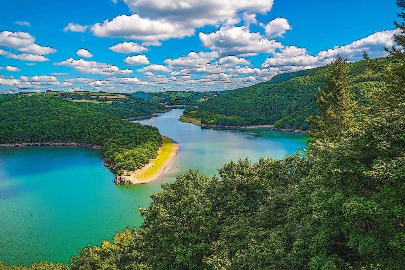
The Upper Sûre Reservoir is the largest body of water in Luxembourg, formed by a dam on the Sûre River in the northwest of the country. It serves as the primary drinking water source for approximately 70% of the national population and is the centerpiece of the Upper Sûre Natural Park.
Visual Characteristics
The reservoir covers 3.8 square kilometers and is characterized by a deep turquoise water color and a jagged shoreline spanning 42 kilometers. It is contained by the Esch-sur-Sûre Dam, a concrete arch structure 47 meters in height and 168 meters in length. The surrounding topography consists of steep, densely forested slate hills typical of the Luxembourgish Ardennes, with several "creeks" and narrow side-arms extending into the valleys.
Location & Access Logistics
The site is located approximately 50 kilometers north of Luxembourg City. Access by car is primarily via the N12 or E421/N15 roads, with a travel time of roughly 50 minutes. Public transport involves taking a train from Luxembourg City to Ettelbruck, followed by bus line 131 to the villages of Insenborn or Lultzhausen. Designated parking lots are situated at the Burfelt Forest Center and at the beaches of Insenborn, though these frequently reach capacity during summer weekends.
Historical & Ecological Origin
The reservoir was created between 1955 and 1961 to provide hydroelectric power and a stable water supply. The project required the flooding of portions of the Sûre valley, submerging several old mills and farm structures that remain underwater. Ecologically, it is a protected Ramsar wetland and a Natura 2000 site, supporting diverse fish populations including pike, zander, and large catfish.
Key Highlights & Activities
Non-motorized water sports are permitted, including swimming at designated beaches in Insenborn, Lultzhausen, and Burfelt. Scuba diving is available at specialized zones with a maximum depth of 43 meters, where divers can observe submerged historical remains. A solar-powered excursion boat operates from the Insenborn pier, offering guided ecological tours of the dammed area.
Infrastructure & Amenities
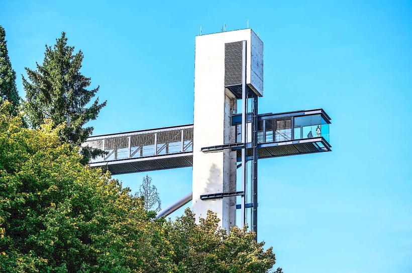
The villages of Insenborn and Lultzhausen provide public restrooms and seasonal food vendors. The Burfelt Forest Discovery Center (Centre de découverte de la forêt) includes educational facilities and a panoramic viewing platform. 4G and 5G cellular coverage is consistent across the lake surface, though signal strength may drop in the deepest wooded ravines. Most beach areas have grass lawns but limited natural shade.
Best Time to Visit
The peak season for swimming and water sports is July and August when surface water temperatures reach 25°C. For landscape photography, the "Belvédère Burfelt" platform offers the best perspective during the morning hours. Autumn (October) is preferred for hiking as the surrounding deciduous forests change color, while water clarity for divers is generally highest in late spring.
Facts & Legends
Underwater explorers have identified the remains of a bridge and several small stone buildings from the pre-dam era that are still visible during periods of low water levels or via diving. A local technical oddity is that the reservoir is part of a complex "cascading" system, with smaller compensation basins located downstream to regulate water flow for the hydroelectric plant at Esch-sur-Sûre.
Nearby Landmarks
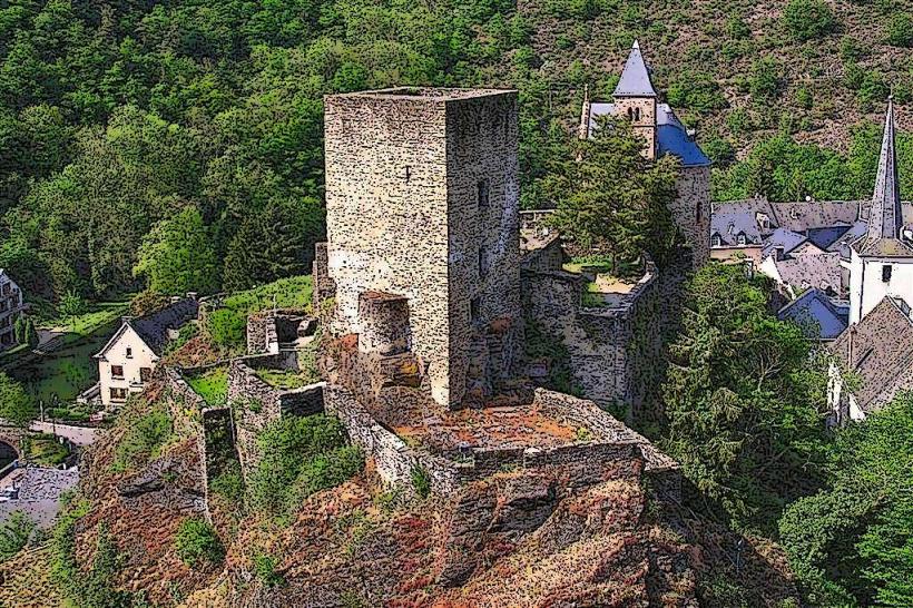
Esch-sur-Sûre Castle – 1.0km East
Belvédère Burfelt (Viewing Platform) – 0.5km South (from Burfelt beach)
National Museum of Military History (Diekirch) – 4.5km East
Lultzhausen Youth Hostel – 0.2km West (lakefront)
Schumann's Eck Memorial – 4.2km Southwest